)
Past Projects
UNAVCO's past projects include many collaborations with other institutions. The projects listed below cover some of the more significant ones, listed alphabetically.
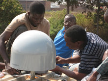
Africa Array
Africa Array — Pan-African Network of Observatories.
BARGEN
Basin and Range Geodetic Network (BARGEN) — permanent GPS network in the western US co-developed and installed by UNAVCO.
COCONet
COCONet - Caribbean Network — (Continuously Operating Caribbean GPS/GNSS Observational Network) is an international geoscience community project to develop Caribbean-wide GPS/GNSS observations for geophysical and atmospheric hazard studies in the Caribbean region.
Dataworks for GNSS
Dataworks for GNSS — a project to design and make available a turn-key archiving system for regional GNSS data management, initially for COCONet regional data centers.
EarthScope
EarthScope — a collaboration with the other components of this major US science initiative, e.g. USArray at IRIS and SAFOD at Texas A&M University.
Plate Boundary Observatory
EarthScope - Plate Boundary Observatory (PBO) — a component of the EarthScope project that precisely measures Earth deformation resulting from the constant motion of the Pacific and North American tectonic plates in the western United States.
GeoEarthScope
GeoEarthScope — SAR, ALS, and geochronology datasets for EarthScope.
GEON
GEON — Cyberinfrastructure for the Geosciences.
GSAC
GSAC (Geodesy Seamless Archive Center) — a free, open-source software package that provided web services at geoscience data repositories for discovery, sharing, and access to geodetic data and metadata associated with site-located instruments.
GSRM - GEM
GSRM - GEM — a second Global Strain Rate Model sponsored by the Global Earthquake Model (GEM) international forum.
GSRM - ILP
GSRM - ILP — the original Global Strain Rate Model sponsored by the International Lithosphere Project.
INTERFACE
INTERFACE — data processing and visualization software for TLS data.
L1 Project
L1 Project — the development of a L1-only receiver & radio modem system for geo-hazardous sites.
NLAS
NLAS — NASA LiDAR Access System — a NASA ROSES funded project to integrate NASA IceSAT satellite and altitude airborne LiDAR into the OpenTopography system and lay the groundwork for data flow from the NASA DESDynI mission.
PBO Nucleus
PBO Nucleus — incorporation of existing various western US arrays into PBO GPS Network.
PBO GPS Campaigns
PBO GPS Campaigns — established GPS Campaign sites to augment the permanent PBO GPS Network.
SNARF
SNARF — hosting for the Stable North America Reference Frame working group and its web publications.
SSARA
SSARA — Seamless SAR Archive — a NASA ROSES funded project to provide users with GUI and web service API to view and retrieve SAR data from multiple archives.
SuomiNet
SuomiNet — a world-wide GPS and meteorological array.
TEQC
TEQC — Translate, Edit, and Quality Check. A Collaboration with GPS/GNSS equipment manufacturers and other institutions to make a general GNSS/GPS preprocessing tool available.
TLALOCNet
TLALOCNet - Mexico Network — an international geoscience community project to develop Mexico-wide GPS observations for geophysical and atmospheric hazard studies in Mexico— Mexico Network.
Last modified: 2026-05-28 09:22:23 America/Denver