

GNSS Data
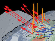
The NGF Data Center handles data management tasks for GNSS data and products from thousands of globally distributed permanent stations and ten thousand globally distributed campaign sites. A large fraction of the data are contributed by NGF community investigators. An GNSS Data Management Overview illustrates the legacy NGF GNSS data flow from stations and campaigns to users.
The NGF archives and distributes GNSS data in a variety of product levels, formats and access methods. Product levels distinguish between raw data (Level 0), pre-processed data (Level 1), and post-processed/derived (Level 2) data products. In addition to direct file server access, web based graphical user interfaces, command line clients, and web services are available.
| GNSS Data Products | Access Method / Product Format | |||||
|---|---|---|---|---|---|---|
| Data Product Level | Description | Generation Frequency | Creator | File Server | Web Graphical Interface | Web Service |
| Level 1 | Standard rate data (15-sec) | Daily, varies | NGF | RINEX | RINEX | n/a |
| High rate data (1-, 2-, 5-sps) | Varies | NGF | RINEX | RINEX | n/a | |
| Survey-mode (campaign) data | Daily, varies | NGF | n/a | RINEX | n/a | |
| Level 2 | Position solution time series | Daily | MIT | ASCII, CSV | ASCII, CSV | ASCII, CSV |
| Velocity solutions | Monthly | MIT | ASCII | ASCII | ASCII, CSV | |
| Position offsets (e.g. coseismic) | Varies | MIT | ASCII | n/a | n/a | |
| Events (e.g. coseismic) | Varies | MIT | ASCII | n/a | n/a | |
| Tropospheric parameter estimates | Daily | CWU | ASCII | n/a | n/a | |
| Position solution QA parameters | Daily, varies | UNR | ASCII | ASCII | n/a | |
| Position solutions (loose) | Daily | CWU | SINEX | SINEX | n/a | |
| Position solutions (constrained) | Daily | MIT | SINEX | SINEX | n/a |
NOTE: We provide Seafloor Geodesy data collections as assembled data sets that include GNSS and other data.
Data Access Methods
Data Access Methods include GUI and command line tools for site search and data access, direct HTTPS File Server access for browsing and command line scripts, REST web services, real-time data access streams, derived products access, and custom data requests. Please review the Data policy for data archived at the NGF.
Data Formats
Community Data Formats have been developed and are hosted at the GAGE Data Center. GAGE (formerly UNAVCO) has helped develop GNSS data and metadata standards, like BINEX, in collaboration with the NGF geosciences community. NGF hosts documentation about the BINEX data and metadata standard developed by the NGF community and GNSS receiver manfacturers.
Data Operations
A collection of Data Operations pages for monitoring of archiving and QC.
Seafloor Geodesy
Seafloor geodesy monitors the precise movements and deformations of the Earth's crust beneath the oceans. Using acoustic signals, GNSS, and specialized seafloor instruments, measurements of shifts in tectonic plates, underwater volcanic activity, and seafloor spreading are possible.
We provide Previously collected seafloor geodesy data as assembled data sets that include GNSS and other data.
Last modified: 2026-08-16 17:25:07 America/Denver