
Imaging Data
Imaging Data
GAGE works with partner organizations to acquire and distribute satellite synthetic aperture radar (SAR) and light detection and ranging (LiDAR) geodetic data, acquired both via both terrestrial laser scanning (TLS) and airborne laser scanning (ALS), covering select areas and field sites of geophyisical interest to the GAGE community.
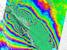
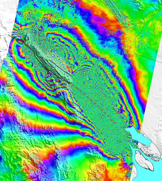
Synthetic Aperture Radar (SAR)
Get SAR data
Through GAGE's operational support role to the WInSAR consortium and the Supersites Initiative, GAGE acquires and distributes satellite SAR geodetic imaging data covering actively deforming faults and volcanic regions associated with the North American plate boundary and other geologically active regions. The satellite SAR collection includes more than 40 TB of data from the ERS-1, ERS-2, ENVISAT, ERS, RADARSAT, TerraSAR-X and other SAR missions. Interferometric SAR (InSAR) analysis can be used to model millimeter-to-centimeter level displacements in the Earth's surface over scales of tens to hundreds of kilometers.
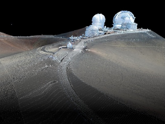
Terrestrial Laser Scanning (TLS)
Get TLS Data
TLS data are obtained from ground-based LiDAR instruments that provide 3-D point measurements with millimeter-to-centimeter precision over scales of tens of meters to kilometers. LiDAR "point clouds" from TLS data can be used to generate digital elevation models and to quantify erosion and other active geologic processes such as landslide deformation, earthquake faulting, and glacial retreat.
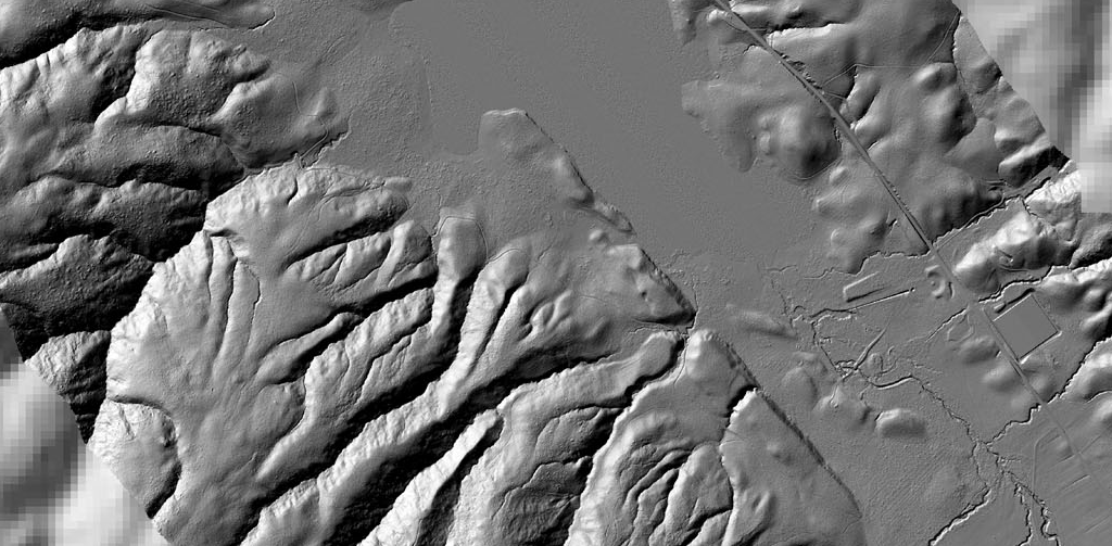
Airborne Laser Scanning (ALS)
Get ALS Data
ALS data are obtained from airborne LiDAR instruments that provide 3-D point measurements with centimeter precision over scales of tens to hundreds of kilometers. Much like LiDAR "point clouds" from TLS, ALS data are used to generate digital elevation models and to quantify erosion and other active geologic processes such as landslide deformation, earthquake faulting, and glacial retreat. As part of the EarthScope project, GAGE worked with partners such as the National Center for Airborne Laser Mapping (NCALM) to collect approximately 5800 square kilometers of lidar topography along active faults in the North American plate boundary. The ALS data are hosted at OpenTopography. Airborne LiDAR Hillshades as .kmz files from this project are also available.
Last modified: 2026-06-18 17:19:48 America/Denver