
Polar Services - Antarctic - Meta-Data Summaries (1999/00 Season) - G-081 Kyle
| G-081 Kyle |
|---|
 |
Data Set Name: G-081 1999/00 Investigator: PI: Philip Kyle POC: PI Institution: New Mexico Institute of Mining and Technology Email: kyle |
|
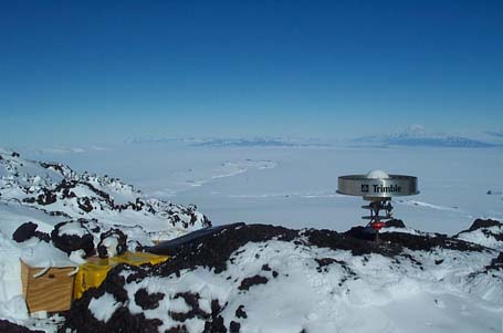
Summary: Philip Kyle requested UNAVCO support to install and survey a GPS deformation network on Mount Erebus. A nine monument geodetic GPS network was established to measure short and long term deformation. Four monuments (ABBZ, BOMZ, HOOZ, and SISZ) surround the crater on mid-level outcrops at the 1800-meter elevation level, and are collocated with permanent short-period continuous monitoring seismic stations. Five more monuments (CONZ, EAST, ELHT, HELZ, and NAUS) circle the crater on outcrops in the old caldera at the 3200-meter level. All nine monuments were surveyed in December 1999, and each monument was occupied for a minimum of three full (UTC) days per episodic visit. The monument ELHT, at the Erebus lower hut, serves as a local reference station and was run for the duration of the entire survey. |
Last modified: 2019-12-24 02:12:30 America/Denver