
Polar Services - Antarctic - Meta-Data Summaries (1999/00 Season) - G-052 Mullins
| G-052 Mullins |
|---|
 |
Data Set Name: G-052 1999/00 Investigator: PI: Jerry Mullins POC: Larry Hothem Institution: United States Geological Survey Email: lhothem |
|
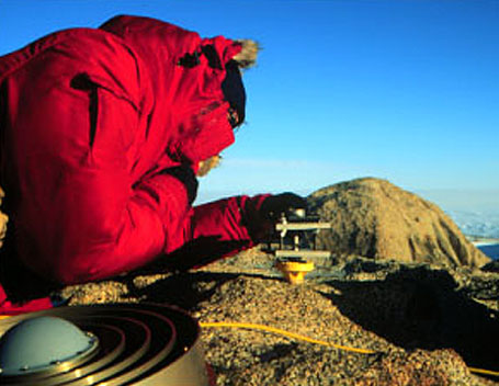
Summary: Five Trimble 4000 SSi geodetic receivers, choke ring antennas, and solar panels were provided to Larry Hothem for the OSU/USGS Transantarctic Mountain Deformation Monitoring (TAMDEF) GPS project. This project measures fault motion and post-glacial of the Transantarctic mountains with campaign-style GPS data collection. |
Last modified: 2019-12-24 02:12:30 America/Denver