
Polar Services - Antarctic - Meta-Data Summaries (1998/99 Season) - UPD Site Mapping
| UPD Site Mapping |
|---|
 |
Data Set Name: UPD 1998/99 Investigator: PI: Steve Dunbar POC: Bjorn Johns Institution: UNAVCO Email: bjorn |
|
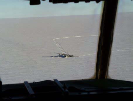
Summary: After the LC-130 Hercules was stuck in a crevasse at UPD, a crevasse-free skiway and camp area was needed to allow additional Hercules landings to bring in salvage personnel and parts. ASA Field Safety supervisor Steve Dunbar requested differential GPS support from UNAVCO for mapping the area. CRREL provided a ground penetrating radar unit to detect hidden crevasses, and UNAVCO provided differential GPS control for position-tagging radar data and site mapping. |
Last modified: 2019-12-24 02:12:31 America/Denver