
Polar Services - Antarctic - Meta-Data Summaries (2002/03 Season) - G-081 Kyle
| G-081 Kyle |
|---|
|
Data Set Name: G-081 2002/03 Investigator: PI: Philip Kyle Institution: New Mexico Institute of Mining and Technology POC: Beth Bartel Email: bebartel |
| Summary:
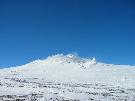
Dr. Kyle requested UNAVCO support for both campaign and permanent station GPS activities on Mt. Erebus to measure the deformation of the volcano caused by the migration of magma. Six receivers, training, and data archiving support were provided to field assistant Beth Bartel to re-survey the nine monument GPS deformation network that was installed on Mount Erebus during the 1999/2000 season, and GPS data collected since 1999 are showing displacements on the order of millimeters per year. Velocity stakes on the Barne Glacier were also re-surveyed this season. In addition, four permanent GPS/seismic MRI sites were installed this season. UNAVCO provided support to this effort prior to the field season with GPS receiver selection and purchasing, GPS-specific development support, and planning GPS data management and archiving. Three of the MRI sites were located at previous L1 GPS sites at Hooper Shoulder (HOOZ), Nausea Knob (NAUS), and E1 (E1GP). The L1 systems were re-installed at Abbot Peak (ABBZ), McIntosh (MAC) and Bomb Peak (BOMZ). Data from all of the Erebus permanent stations are downloaded daily to McMurdo Station, and transferred to the UNAVCO data archive where they are on-line and publicly available. Early in the season, a continuously operating Trimble 5700 receiver was retrieved from the deformation network monument ELHT at the Erebus Lower Hut. The receiver was powered by the wind and solar electric system at Lower Erebus Hut, and ran for the entire 2002 winter. |
Last modified: 2019-12-24 02:12:40 America/Denver