
Polar Services - Antarctic - Meta-Data Summaries (2001/02 Season) - G-081 Kyle
| G-081 Kyle |
|---|
|
Data Set Name: G-081 2001/02 Investigator: PI: Philip Kyle Institution: New Mexico Institute of Mining and Technology POC: PI Email: http://www.ees.nmt.edu/Geop/erebus.html (kyle |
| Summary:
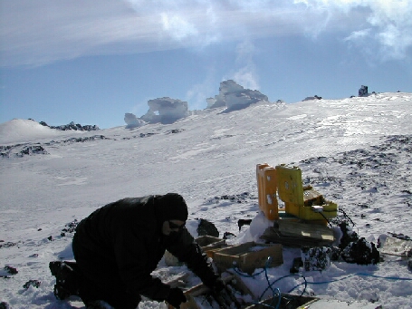
Dr. Kyle requested UNAVCO support to re-survey the nine monument GPS deformation network that was installed on Mount Erebus during the 1999/2000 season (Figure 5). UNAVCO personnel deployed four geodetic receivers early in the field season, and the G-081 team finished the survey. The network is used to monitor deformation of the volcano caused by the migration of magma. UNAVCO also provided two receivers, data processing software, field support and training to research assistant Emily Desmarias to position and map fumaroles. Data processing support and data archiving were provided after the season. In addition to the episodic campaign survey, maintenance was performed on the dual-frequency permanent GPS station at Truncated Cones (CONZ) and the L1 network stations at the side crater (E1GP), Hooper's Shoulder (HOOZ), and Nausea Knob (NAUS). Data from these permanent stations are downloaded daily to McMurdo Station, and transferred to the UNAVCO archive where they are on-line and publicly available. A second continuously operating dual-frequency receiver was installed on the deformation network monument (ELHT) at the Erebus Lower Hut. This receiver is one of the new low power/high memory Trimble 5700 receivers with capacity to log data throughout the winter. The receiver is powered by the wind and solar electric system at Lower Erebus Hut, and it will be downloaded at the beginning of the 2002-03 season. UNAVCO is also working with Dr. Kyle on the broadband seismometer and geodetic GPS Major Research Infrastructure project slated for installation in November 2002. UNAVCO's participation in this includes GPS receiver selection nd purchasing, GPS specific development support, and GPS data management and archiving. |
Last modified: 2019-12-24 02:12:41 America/Denver