
Polar Services - Antarctic - Meta-Data Summaries (2000/01 Season) - I-175 Stone
| I-175 Stone |
|---|
|
Data Set Name: I-175 2000/01 Investigator: PI: John Stone POC: John Stone Institution: University of Washington Email: stone |
| Summary:
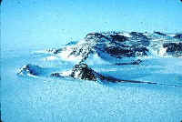
John Stone requested a geodetic receiver to obtain accurate elevations at his sampling locations in Marie Byrd Land, where he is studying the history of the West Antarctic Ice Sheet using cosmogenic and isotope dating of moraine boulders and ice-abraded bedrock. After the season UNAVCO processed the data using precise satellite orbits and provided both geoid and ellipsoid referenced elevations. The data are archived at UNAVCO. |
Last modified: 2019-12-24 02:12:42 America/Denver