)
Other Projects
The NSF GAGE Facility (herafter simply GAGE) collaborates with other institutions on a variety of projects. Some of the projects fund staff at the GAGE Facility and have their own Web pages within the GAGE Web site. Others are mainly external to the GAGE Web site and are only referenced here.
BINEX
BINEX — BINary EXchange, is a now operational binary format standard for GPS/GNSS data and metadata exchange.
COOPEUS
COOPEUS — is a project funded under the Research Infrastructures action of the 7th Framework Programme for Research and Innovation of the EU, shall bring together scientists and users being involved in Europe's major environmental related research infrastructure projects.
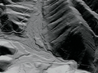
GeoCode
GeoCode Visualizing Geohazards and Risk with Code. The primary goal of this project is to develop a pedagogical model for integrating science practices with computational thinking practices germane to geoscientists’ inquiry into geohazards
High-rate GPS
High-rate GPS — downloading or streaming of 1-, 2-, 5-, and 10-Hz GPS data from select sites in the PBO GPS network, POLENET, COCONet, and other networks and archiving this high-rate GPS data at GAGE and making it available via FTP pickup.
LARISSA - Larsen Ice Shelf
LARISSA - Larsen Ice Shelf — is an NSF-funded initiative that brings an international, interdisciplinary team together to study the environmental change in Antarctica's Larsen Ice Shelf System and its global change implications.
OpenTopography
OpenTopography — is an NSF EAR project that facilitates community access to high-resolution, Earth science-oriented, topography data, and related tools and resources; based at the San Diego Supercomputer Center at UCSD, with GAGE and Arizona State University as partners.
Plug & Play GPS
Plug & Play GPS is a NASA ROSES ACCESS funded project to provide no-cost services for generating high precision GPS position timeseries products from continuously operating GPS/GNSS stations from around the globe.
Real-time GPS
Real-time GPS — real-time streaming of 1-Hz GPS data in BINEX format from a subset of the PBO GPS network and of COCONet and then re-distributed in BINEX, RTCM 2.3 and RTCM 3.1 formats via the Networked Transport of RTCM via Internet Protocol (NTRIP).
Supersites
Supersites — is an initiative under the auspices of the Group on Earth Observations (GEO) and provides access to space borne and in-situ geophysical data of selected sites prone to earthquake, volcano, or other hazards through a web site hosted at GAGE.
WInSAR
WInSAR — Western North America Interferometric Synthetic Aperture Radar, is a consortium of universities and research laboratories established by a group of practicing scientists and engineers to facilitate collaboration in, and advancement of, Earth science research using radar remote sensing
Last modified: 2026-05-28 09:22:23 America/Denver