)
2014 Short Courses Archive
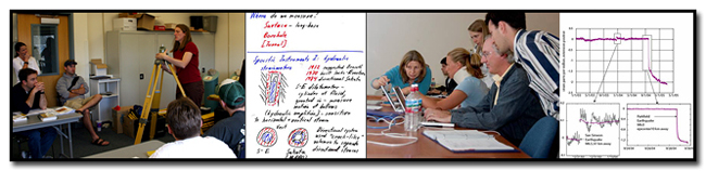
In response to community requests and interest, UNAVCO provides an annual series of short courses focussed on UNAVCO tools and data streams. These courses are for current researchers who want to refresh their skills or explore the use of new tools, and for early career scientists such as post doctoral fellows, graduate students, and upper level undergraduates who want to learn the latest geodetic techniques.
Short Course Materials
Course Materials from previous short courses.
2014 Short Courses
Faculty Development
Using Real Geodesy Data in Undergraduate Structural Geology and Geophysics courses
In conjunction with the 3rd Structural Geology and Tectonics Forum, an On the Cutting Edge - Professional Development for Geoscience Faculty event.
June 19, 2014.
Room TBD, Colorado School of Mines, Golden, Colorado
Undergraduate Research: Explore natural hazards in seismically active regions using geodetic, earthquake, and societal data
In conjunction with the On the Cutting Edge workshop Undergraduate Research in Earth Science Classes: Engaging Students in the First Two Years
Montana State University, Bozeman MT
August 11, 2014
Field Education and Support by the UNAVCO GAGE Facility
November 17 - 19, 2014
UNAVCO, 6350 Nautilus Drive, Boulder, Colorado
Course will begin at 9am on November 17 and end at 3pm on November 19.
GPS
Introduction to GPS Geodesy and High Precision Observations
July 14-18, 2014.
Institute and Observatory of Geophysics at Antananarivo (IOGA), University of Antananarivo, Madagascar
Course will begin at 9:00am on 14 July and end at 4:00pm on 18 July, 2014
Contact D. Sarah Stamps for any additional questions at dstamps![]() mit.edu
mit.edu
Hydrogeodesy
Hydrogeodesy Short Course
March 5, 2014 from 1:00pm to 4:30pm
Omni Interlocken Hotel in Broomfield, Colorado. This short course is being held in conjunction with the UNAVCO Science Workshop.
Short Course Materials
Imaging
The Next Generation of LiDAR Analysis for Critical Zone Research
May 12-14, 2014.
Guggenheim (Geography building), University of Colorado Boulder Campus, Boulder, CO
Course begins 8 am Monday May 12th. Ends 4 pm Wednesday May 14th.
This course is being taught through the Critical Zone Exploration Network (CZEN).
Introduction to Terrestrial Laser Scanning (Ground-based LiDAR) for Earth Science Research
June 20, 2014.
UNAVCO, 6350 Nautilus Drive, Boulder, Colorado
This course was taught in conjunction with the 3rd Structural Geology and Tectonics Forum, an On the Cutting Edge - Professional Development for Geoscience Faculty event.
Introduction to Terrestrial Laser Scanning (Ground-Based LiDAR) for Earth Science Research (GSA course 507.)
Sat., October 18, 8 a.m.–5 p.m
Centre for Dialogue, ICBC Concourse Level Salon 10, Vancouver, BC, Canada
Taught in conjunction with Geological Society of America (GSA) short courses.
InSAR
InSAR Processing and Theory with GMTSAR
July 21 - 23, 2014.
UNAVCO, 6350 Nautilus Drive, Boulder, Colorado
Course will begin at 9 AM on July 21 and end an 12 PM on July 23.
An introduction to Processing and Applications using ISCE and GIAnT
August 4 - 6, 2014
UNAVCO, 6350 Nautilus Drive, Boulder, Colorado
Course will begin at 9am on August 4 and end at 5pm on August 6.
Strainmeter
Working with Strainmeter Data
March 3, 2014 from 8:00am - 5:00pm.
Optional data viewing on Friday, March 7 from 8am - 12pm.
Omni Interlocken Hotel in Broomfield, Colorado. This short course is being held in conjunction with the UNAVCO Science Workshop.
Short Course Materials
Teacher (Grades 6 - 12), Park Ranger & Museum Interpreter Development
- the movie
- Beauty and the Beast: Plate Tectonics and Geological Hazards of the Pacific Northwest
- Basics of Earthquake and Tsunami Science and Hazards and Related Teaching Activities[pdf]
- Cascadia Earthquakes and Tsunami and Related Teaching Activities [pdf]
- World Map of Plate Boundaries and Activity[pdf]
- Pacific Northwest Tectonic Block Model[pdf]
- Activity—Cascadia GPS (gumdrop GPS)[pdf]
- Advanced GPS Activity—Locked & Loading [pdf]: Using Plate Boundary Observatory (PBO) data to determine elastic compression of the Pacific Northwest Active Continental Margin.[pdf]
- Activity—ETS (Episodic Tremor & Slip) [pdf]
- Local GPS cards illustrating the change of position over time for Quillayut , WA and Aberdeen, Washington, Goldendale, Washington, Astoria, Oregon , Newport, Oregon, Cape Meares, Oregon , Corvallis, Oregon [pdf]
- Relevant Next Generation Science Standards[pdf]
- Geology Share-a-Thon 9:30 am, , Friday, April 4th, BCEC, 052A/B.
- Earth System Science Share-a-Thon, 12:30 pm, Friday, April 4th, BCEC, 052A/B
- Workshop: EarthScope: A Hubble Space Telescope for Earth's Interior That's in Your Neighborhood!
Saturday, April 5, 3:30–4:30 PM, BCEC, 261 - Workshop: Yellowstone’s Dynamic Landscape as a Jigsaw Investigation
-
Sunday, April 6, 2014, 8:00-9:00 AM,
Room 104C, Boston Convention and Exhibition Center, Boston, MA
Discover volcanism through this Problem-Based Learning activity using data and Google Earth. Explore Yellowstone’s fascinating landscape through video, demonstrations, and seismic, hydrothermal, and GPS data. - Agenda [pdf], EarthScope Field Trip Schedule [pdf], Workshop details [pdf]
- UNAVCO presentation: Getting to know UNAVCO and the Plate Boundary Observatory [pptx]
- UNAVCO presentation: Science discoveries using GPS [pptx]
- UNAVCO presentation: Resources at UNAVCO & the Plate Boundary Observatory [pptx]
- Interpreter Workshop Group Presentations [youtube]
- Agenda [pdf]
- UNAVCO presentation: Getting to know UNAVCO and the Plate Boundary Observatory [pptx]
- Activitiy Presentation: Alaska: Visualizing Relationships Between Earthquakes, Volcanoes, and Plate Tectonics [pptx]
- Student Worksheet Alaska [pdf] [docx]
- Alaska blank map [pdf]
- New Insights into North America’s Midcontinent Rift
- Using the Midcontinent Rift as a Unifying Theme for Park Interpreters and Educators [pdf]
- Superior Province Rifting EarthScope Experiment [youtube]
- North America's Midcontinent Rift [pdf]
- Overview of UNAVCO and the Plate Boundary Observatory [pdf]
- How to create clear and concise messages that are targeted to your audience;
- How to stay on-message during a media interview;
- Best practices in social media communications;
- How to identify opportunities for interacting with the lay public in your community; and
- How to approach policy makers on scientific issues.
Using Data in Earth Science, Teacher Professional Development Workshop
February 18, 2014
Prairie Middle School, Cherry Creek School District, Aurora, Colorado
Agenda
Cascadia Earthscope Earthquake and Tsunami Education Program (CEETEP) Workshop series
CEETEP Year 1 Share-a-thon
Newport, OR
March 8, 2014
Aberdeen, WA Workshop
Aberdeen Museum of History
August 11-14, 2014
Detailed agenda
Forks, WA Workshop
Olympic Natural Resources Center
October 10-13, 2014
Through a grant from the EarthScope Program of the National Science Foundation (NSF), CEETEP offers four-day workshops to foster community engagement of earthquake science and preparedness, and to encourage collaboration and exchange between formal and informal coastal educators and includes Pacific Northwest tectonics, earthquake and tsunami hazards, and community preparedness.
Each workshop will include K-12 teachers, park and museum interpreters, and emergency management educators from coastal areas. Through a problem-solving approach to subduction zone geology, participants will learn how: 1) geoscientists developed our current understanding of Pacific Northwest plate tectonics, earthquakes, and tsunamis; 2) EarthScope is advancing knowledge about the active Earth in Washington, Oregon, and California; and 3) collaboration on education, interpretation, and preparedness makes coastal communities more resilient to earthquake and tsunami hazards. Three days of classroom and interpretive activities on Pacific Northwest geology and EarthScope science will be complemented by a field day investigating Cascadia earthquakes and tsunamis, and visits to seismic and GPS installations.
Relevant workshop resources with geodetic content:
UNAVCO events @ National Science Teacher Association (NSTA) National Conference
Boston Convention & Exhibition Center (BCEC) Boston, MA
EarthScope Alaska-Yukon Regional Workshop for Interpretor Professionals
USGS Alaska Science Center
Anchorage, AK
April 28-30 2014
This three-day workshop features presentations by prominent geoscientists and interpretive professionals to help convey the story of the magnificent landscapes, geology, and natural hazards of the Alaska-Yukon region. Participants will learn how to use basic geology, EarthScope data, and scientific results. Participants will develop and present interpretive programs and exhibits during the workshop. The Alaska Science Center, USGS, in Anchorage is the host for this workshop sponsored by EarthScope and the the National Science Foundation.
More information about the workshop at EarthScope’s website
Workshop Resources
Teacher Professional Development Workshop: Incorporating GPS, seismology, and EarthScope Data into Earth Science Courses
Sponsor: Seismological Society of America
USGS Alaska Science Center
Anchorage, AK
Saturday May 3, 2014 8:00 am - 12:00 pm
UNAVCO contributed resources
![Alaska blank map [pdf]](/education/resources/modules-and-activities/visualizing-relationships-with-data/module-materials/Alaska-map.png.pdf)
Mid-Continent Rift System Educator Program
Michigan Technological University
Houghton, Michigan
August 10-15, 2014
Workshop information
This workshop will show how geophysics is used to map the rift so that educators can better use the Midcontinent Rift System in teaching about the geologic history of the midcontinent and about plate tectonics in general. The workshop will be held in Houghton, Michigan, in the beautiful upper peninsula where rift geology is visible at the surface for comparison with the geophysical data. In addition to examining outcrops from both land and Lake Superior, participants will learn to use seismology, microgravity, and electromagnetics to explore the Earth and teach about plate tectonics.
Join us to...
- Create community based informal + formal educator “partnerships”
- Experience inquiry-based science as you observe geologic history of the Midcontinent Rift System while touring the Keweenaw Peninsula by both land and water.
- Engage in activities while collecting geophysical data within the Keweenaw Peninsula and the Midcontinent Rift System.
- Become empowered to teach about plate-tectonics in your backyard.
Agenda and workshop information
Related workshop resources:
Science Communication Workshop: Hone Your Skills
GSA Short Course #528 (Sign up on your registration form)
Sat., 18 Oct., 8 a.m.–noon.
Hyatt Regency Vancouver
Professionals: US$35; students US$25. Includes continental breakfast.
Instructors: Christa Stratton, Justin Samuel, and Kasey White of The Geological Society of America, and Beth Bartel of UNAVCO.
CEU: 0.4; Limit: 30.
Scientist-communicators who can present messages clearly and foster respect between science and the lay public are essential for true public engagement with critical scientific issue, but traditional scientific training typically does not prepare scientists to be effective communicators. This workshop will give you guidance on how to hone your public communication and outreach skills as well as the opportunity to practice in a safe and comfortable setting.
- You’ll Learn:
The Crunching of Cascadia: Discovering Deformation with Data
GSA Short Course 518B. (Sign up on your registration form)
Sat., 18 Oct., 8 a.m.–noon
Harbour Centre, Boardroom 2260
US$35 for one course — or get two-for-one! — pay the same amount when combined with an afternoon course (add 518D, 518E, or 518F)
Instructors: Shelley Olds, UNAVCO; Nancy West, Quarter Dome Consulting; Vince Cronin, Baylor Univ.
Cosponsors: UNAVCO
CEU: 0.4 | Max. class size: 30
This course provides the resources to teach about convergent plate margins with GPS data. Subduction of the Juan de Fuca plate is distorting the western margin of the Pacific Northwest with strain building toward another great earthquake. More than 40 have occurred over the last 10,000 years. Participants will explore Cascadian deformation and strain intuitively with models, qualitatively with vectors from GPS time series data, and quantitatively in a graphical analysis. Middle and high school teachers will experience activities within UNAVCO’S investigation, “The Crunching of Crust: Deformation, Distortion, and Destruction.” Seismic data, LiDAR, and seismic tomography will also be included.
Yellowstone National Park as a Hotbed for Inquiry
GSA Short Course 518E. (Sign up on your registration form)
Sat., 18 Oct., 1–5 p.m.
Harbour Centre, Boardroom 2260
US$35 for one course — or get two-for-one! — pay the same amount when combined with a morning course (add 518A, 518B, or 518C)
Instructors: Shelley Olds, UNAVCO; Nancy West, Quarter Dome Consulting; Vince Cronin, Baylor Univ.
Cosponsor: UNAVCO
CEU: 0.4 | Max. class size: 30
Course Description
This course will provide teachers with lessons and activities regarding Yellowstone’s dynamic landscape. Middle- and high-school teachers will experience UNAVCO’S data-rich investigation, “Taking the Pulse of Yellowstone’s ‘Breathing’ Volcano: Problem-Based Learning in America’s First National Park.” Data includes the region’s eruption history, hydrothermal activity, seismicity, GPS, LiDAR, INSAR, and seismic tomography. The module focuses on Yellowstone; however, the park’s deformation connects to investigating tectonic activity, natural hazards, crustal deformation and strain throughout the West. Instruction will include models, demonstrations, analyzing data, and discussing how to use these materials in teaching. All course materials are free to the public.
Yellowstone National Park as a Hotbed for Inquiry
Teacher professional development session at Geophysical Information for Teachers (GIFT) Workshops
December 15 - 16, 2014
7:30 AM – 4:00 PM each day
Franciscan Ballroom
Westin Hotel
Market St.
San Francisco, CA
Presenters: Shelley Olds, Dave Mencin (UNAVCO)
Learn with AGU video: UNAVCO Lecture & Activity Presentation
Module Materials
GIFT Agenda [pdf]
About the GIFT
Last modified: 2019-12-24 01:25:51 America/Denver