
Short Courses
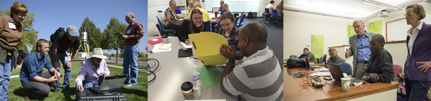
In response to community requests and interest, UNAVCO provides an annual series of short courses focused on UNAVCO tools and data streams. These courses are for current researchers who want to refresh their skills or explore the use of new tools, and for early career scientists such as post doctoral fellows, graduate students, and upper level undergraduates who want to learn the latest geodetic techniques.
For a complete listing of past short courses, see Previous Courses.
For a complete listing of all course materials, see our Course Materials page.
Upcoming Courses
-
2021 The Generic Mapping Tools (GMT) for Geodesy
Dates: June – July 2021, multiple days
-
2021 InSAR Processing and Theory with GMTSAR
Dates: June – July 2021, multiple days
-
2021 InSAR Processing and Time-Series Analysis for Geophysical Applications: ISCE, ARIA-Tools, and MintPy
Dates: August 23-27, 2021 and pre-course work
-
(POSTPONED) 2020 Change Detection with SfM and GPS: Teaching Undergraduates in the Field
Date: TBD
Previous Courses
-
2020 GAGE/SAGE Plenary Session Webinars
The in-person 2020 GAGE/SAGE workshop was postponed to 2021. In the meantime, several of the planned speakers presented in this webinar series so the community can learn more about these subjects before next year.
Dates:
Location: Online
-
2020 GNSS Data Processing and Analysis with GAMIT/GLOBK and TRACK
This workshop was designed for intermediate- to advanced-level users of the GNSS processing software suite GAMIT/GLOBK and kinematic module TRACK.
Dates:
Location: Online
-
2020 GAGE/SAGE Virtual Special Interest Group (SIG) meetings
The virtual Special Interest Group (SIG) meetings were held the same week as the originally-scheduled 2020 GAGE/SAGE workshop.
Dates:
Location: Online
-
2020 InSAR Processing and Time-Series Analysis for Geophysical Applications: InSAR Scientific Computing Environment (ISCE), ARIA Tools, and MintPy
This 5-day course covered basic & advanced InSAR theories, InSAR processing with JPL/Caltech InSAR Scientific Computing Environment (ISCE), and time-series InSAR processing with interferometric products generated by different processing centers.
Dates:
Location: Online
-
2020 Seafloor Geodesy Community Building Events
Join the emergent seafloor geodesy community through this series of engagement activities. The goal of these activities are to build the seafloor geodesy community, including scientists from academic institutions, government agencies, and international partners.
Dates:
Location: Online
-
2020 InSAR Processing and Theory with GMTSAR
This course covered the theory and application of InSAR processing with GMTSAR.
Dates:
Location: Online
-
2020 The Generic Mapping Tools (GMT) for Geodesy
This course covered the use of GMT 6 in geodesy using UNIX shell scripting.
Dates:
Location: Online
-
2020 Teaching for a Changing World: Water Resources and Melting Ice - Earth Educators' Rendezvous
Integrating cutting edge data and quantitative skills into introductory courses can be challenging. The GEodesy Tools for Societal Issues (GETSI) project has developed a suite of undergraduate teaching modules to make this easier and more engaging. The workshop featured two of the modules in greater depth, as well as overview additional resources, and gave participants time to work on implementation planning.
Dates:
Location: Online
-
2020 Science Communication - Earth Educators' Rendezvous
Participants in this workshop worked to improve their science communication skills through interactive activities that could in turn be incorporated into geoscience curriculum.
Dates:
Location: Online
-
2020 Communicating Science for Impact - UT Austin
This workshop took a hands-on approach to learning the tricks of science communication, focusing on science communication as a conversation.
Date:
Location: UT-Austin, Austin, TX, USA
-
2020 Communicating Science for Impact - New Mexico State University
This workshop took a hands-on approach to learning the tricks of science communication, focusing on science communication as a conversation.
Date:
Location: New Mexico State University, Las Cruces, NM, USA
-
2020 Communicating Science for Impact - University of South Florida
This workshop took a hands-on approach to learning the tricks of science communication, focusing on science communication as a conversation.
Date:
Location: University of South Florida, Tampa, FL, USA
-
2019 Tell me a story: Storytelling in SciComm - AGU 2019
Participants practiced techniques for identifying stories in their science and telling them.
Date:
Location: 2019 American Geophysical Union (AGU) Fall Meeting, San Francisco, CA, USA
-
2019 Social Media 201 - AGU 2019
Social Media for Scientists: Participants learned how to use or improve their game on various platforms to communicate science with different demographics using different types of media.
Date:
Location: 2019 American Geophysical Union (AGU) Fall Meeting, San Francisco, CA, USA
-
2019 Social Media for Scientists - AGU 2019
This workshop discussed the current social media landscape as well as best practices, tips, guidelines, and inspirations for multiple social media platforms.
Date:
Location: 2019 American Geophysical Union (AGU) Fall Meeting, San Francisco, CA, USA
-
2019 Using Geophysics Data to Teach About Flooding, Landslides, and Climate Change in Undergraduate Majors' Courses - AGU 2019
This workshop gave instructors hands-on time with several GETSI modules, in particular those that revolve around water and earth system science.
Date:
Location: 2019 American Geophysical Union (AGU) fall meeting, San Francisco, CA, USA
-
2019 COMET InSAR Training Workshop
This 3-day workshop aimed at early postgraduate students and postdoctoral researchers included a combination of informal lectures and practical exercises covering InSAR theory, SAR data access and preprocessing, differential interferometry, and more.
Date:
Location: School of Earth and Environment, University of Leeds, UK
-
2019 Early Career Networking Event - SAGE/GAGE Workshop 2019
Participants learned networking strategies, developed and practiced elevator speeches, and met their meeting peers.
Date:
Location: 2019 SAGE/GAGE Workshop, Portland, OR, USA
-
2019 InSAR Data Interpretation and Analysis for Nonspecialists
This short course, focused on the interpretation of processed InSAR data and how these data can be analyzed and modeled. Topics covered: background theory and processing methodology, data errors and common issues, satellite missions and processed data repositories, time series analysis, data interpretation and ingesting data into modeling efforts.
Date:
Location: 2019 SAGE/GAGE Workshop, Portland, OR, USA
-
2019 Communicating Geohazards: Delivering Information in Crisis and Calm
Communicating hazards is critical for public safety and understanding. This two-day short course with three remote follow-on sessions covered responsible communication of geohazards, with a focus on earthquakes and volcanoes of the Pacific Northwest.
Date:
Location: 2019 SAGE/GAGE Workshop, Portland, OR, USA
-
2019 Preparing Undergraduates - Data-Rich Introductory Teaching Modules and Connecting Content to Geoscience Careers
This short course was intended for instructors of introductory Earth science courses interested in integrating data-rich teaching into their courses. Participants also learned more about mentoring students on geodetic research methods and careers in geoscience.
Date:
Location: Geological Society of America's Annual Meeting, Phoenix, AZ, USA
-
2019 High Resolution Topography and 3D Imaging II: Introduction to Structure from Motion (SfM) Photogrammetry
This one-day course provided faculty, students, and professionals with an introduction to SfM technology, data collection and processing, and examples of science and educational applications.
Date:
Location: Geological Society of America's Annual Meeting, Phoenix, AZ, USA
-
2019 High Resolution Topography and 3D Imaging I: Introduction to Terrestrial Laser Scanning
This one-day course provided faculty, students, and professionals with an introduction to terrestrial laser scanning (TLS a.k.a., ground-based lidar) for research and education. TLS provides high-resolution three-dimensional images of geologic features and is a powerful tool for applications ranging from outcrop mapping to analysis of earth-surface processes. The course focused on TLS technology, data collection, processing and analysis, and examples of science and educational applications.
Date:
Location: Geological Society of America's Annual Meeting, Phoenix, AZ, USA
-
2019 ARIA Standard Products, ARIA-Tools, & Time-series InSAR
This 1-day course covered the ARIA standard InSAR product, the ARIA-tools, and time-series InSAR processing with interferometric products generated by different processing centers.
Date:
Location: Jet Propulsion Laboratory, Pasadena, CA, USA
-
2019 InSAR Theory and Processing
This 4.5-day course covered basic & advanced InSAR theories, InSAR processing with JPL/Caltech InSAR Scientific Computing Environment (ISCE), and time-series InSAR processing with interferometric products generated by different processing centers.
Date:
Location: UNAVCO, Boulder, CO, USA
-
2019 InSAR Processing and Theory with GMTSAR
This 2.5 day course covered the theory and application of InSAR processing with GMTSAR.
Date:
Location: Scripps Institution of Oceanography, La Jolla, CA, USA
-
2019 The Generic Mapping Tools (GMT) for Geodesy
This 2-day course covered the use of Generic Mapping Tools (GMT) in geodesy using UNIX shell scripting.
Date:
Location: Scripps Institution of Oceanography, La Jolla, CA, USA
-
2019 Teaching Introductory Geoscience with Data and Math in a Societal Context Using GETSI Modules (at EER)
This workshop featured three GEodesy Tools for Societal Issues (GETSI) modules in greater depth and provided resources including coaching on teaching with data and math.
Date:
Location: Earth Educators' Rendezvous (EER), Nashville, TN, USA
-
2019 Whole Student Mentoring and STEM Resource Workshop
This six-hour workshop introduced the evidence-based concept of intentionally mentoring students in STEM [e.g. Pope, 2002; Huntoon and Lane, 2007; Crisp, 2010], and included components specifically provided for faculty mentoring of STEM students from underrepresented groups.
Date:
Location: Fort Lewis College, Durango, CO, USA
-
2019 Communicating Science for Impact - UT Austin 2019
This workshop paired participants with experts from improvisational theatre and Informal Science Education so that participants could gain the tools and insight needed to better communicate their own research with a public of all ages and backgrounds.
Date:
Location: Jackson School of Geoscience, University of Texas, Austin, TX, USA
-
2018 Tell Me a Story: Storytelling in Science Communication
One of the most compelling means of captivating an audience is to tell them a story. In this fast-paced, interactive workshop, participants learned and practiced some techniques for identifying the stories in their science and telling them.
Date:
Location: American Geophysical Union (AGU) Fall Meeting, Washington DC, USA
-
2018 Measuring Water Resources with GPS, Gravity, and Traditional Methods: Undergraduate Teaching Module
This short course gave instructors hands-on experience with a curricular module that features GPS/GNSS and gravity data alongside more traditional water measurement methods such a snow pillow stations and ground water wells.
Date:
Location: American Geophysical Union Fall Meeting, Washington DC, USA
-
2018 Social Media 101 & 201
This short course discussed best practices, tips, guidelines, and inspirations for multiple social media platforms as well as sharing the power of what social media can do for your science.
Date:
Location: American Geophysical Union Fall Meeting, Washington DC, USA
-
2018 COMET InSAR Training Workshop
The Centre for Observation and Modeling of Earthquakes Volcanoes and Tectonics (COMET) held a 3-day InSAR training workshop. The workshop was aimed at early postgraduate students and postdoctoral researchers and included a combination of informal lectures and practical exercises.
Date:
Location: School of Earth and Environment (SEE), University of Leeds, United Kingdom
-
2018 Social Media for Scientists - Lecture & Lab - GSA
The goal is this workshop was to give geoscientists of all levels the skills and confidence to build a social media presence for effective professional and public communication.
Date:
Location: Geological Society of America Annual Meeting, Indianapolis, IN, USA
-
2018 InSAR Data Interpretation and Analysis for Nonspecialists
This short course focused on the interpretation of processed InSAR data and how these data can be analyzed and modeled. Topics include: background theory and processing methodology, data errors and common issues, satellite missions and processed data repositories, time series analysis, data interpretation and ingesting data into modeling efforts.
Date:
Location: Geological Society of America Annual Meeting, Indianapolis, IN, USA
-
2018 High Resolution Topography and 3D Imaging I: Introduction to Structure from Motion (SfM) Photogrammetry short course
This course provided faculty, students, and professionals with an introduction to SfM technology, data collection and processing, and examples of science and educational applications.
Date:
Location: Geological Society of America Annual Meeting, Indianapolis, IN, USA
-
2018 How to Network Successfully - GSA
This short workshop gave students and early career attendees from backgrounds underrepresented in the geosciences the skills and confidence to effectively network during the GSA Annual Meeting.
Date:
Location: Geological Society of America Annual Meeting, Indianapolis, IN, USA
-
2018 Ready to Engage: Selling Yourself at GSA 2018 and Beyond, for Students.
This short workshop for students covered how to promote your work at GSA 2018 and beyond.
Date:
Location: Geological Society of America Annual Meeting, Indianapolis, IN, USA
-
2018 High Resolution Topography and 3D Imaging I: Introduction to Terrestrial Laser Scanning
This course provided faculty, students, and professionals with an introduction to Terrestrial Laser Scanning (TLS—a.k.a., ground-based lidar) for research and education.
Date:
Location: Geological Society of America Annual Meeting, Indianapolis, IN, USA
-
2018 Synthetic Aperture Radar Literacy and Training Workshop
This workshop brought together leaders in SAR fields to develop recommendations for the next generation of SAR/InSAR literacy training.
Date:
Location: Denver, CO, USA
-
2018 EarthCube Research Coordination Network Workshop: Advancing the Analysis of High Resolution Topography
This A2 HRT Workshop was organized through an NSF-funded EarthCube Research Coordination Network (RCN) to bring together the Earth science community to discuss technical challenges and cyberinfrastructure requirements to answer scientific questions, coordinate research activities, and share best practices and resources.
Date:
Location: Broomfield, CO, USA
-
2018 Using kinematic and static GPS in undergraduate field courses
The goal of this workshop was to equip instructors of geoscience courses with field components with the knowledge and skills needed to integrate high precision positioning with GPS/GNSS into their courses. The teaching resources being featured are part of the GEodesy Tools for Societal Issues (GETSI) project’s field collection.
Date:
Location: Idaho State University, Pocatello, ID USA
-
2018 InSAR Theory and Processing
This course covered basic and advanced InSAR theories, InSAR processing with JPL/Caltech/Stanford InSAR Scientific Computing Environment (ISCE), and time-series InSAR processing with interferometric products generated by different processing centers.
Date:
Location: UNAVCO, Boulder, CO, USA
-
2018 InSAR Processing and Theory with GMTSAR: Sentinel-1A Time Series
This course covered the theory and application of InSAR processing with GMTSAR.
Date:
Location: Scripps Institution of Oceanography, La Jolla, CA, USA
-
2018 Communicating Science to the General Public - EER
This workshop took a hands-on approach to learning the tricks of science communication, focusing on science communication as a conversation.
Date:
Location: Earth Educators' Rendezvous (EER), Lawrence, KS, USA
-
2018 Teaching with the GETSI module "GPS, Strain, and Earthquakes”
Participants attended to improve their instruction in geoscience and geodesy, as well as meet other like-minded educators and develop networks within the geoscience education community.
Date:
Location: Earth Educators' Rendezvous, Lawrence, KS, USA
-
2018 Connecting with Different Audiences: From the Podium to the Pub
The goal of this workshop was to introduce geoscientists of all levels to effective storytelling as a science communication tool.
Date:
Location: IRIS Workshop, Albuquerque, NM, USA
-
2018 Networking Skills for Early Career Scientists
This workshop style short course took a hands-on approach to learning the tricks of science communication, focusing on effective networking.
Date:
Location: IRIS Workshop, Albuquerque, NM, USA
-
2018 Communicating Science to a Broad Audience: Social Media for You and Your Students
This webinar discussed the power of social media for science, best practices, how you can support students in effective social media use, and tips for contentious communication that can be applied in all forms of communication.
Date:
Location: InTeGrate webinar
-
2018 Communicating Science for Impact - UNAVCO Science Workshop
This short course took a hands-on approach to learning the tools of science communication, focusing on communication as a conversation. It was held in conjunction with the 2018 UNAVCO Science Workshop.
Date:
Location: UNAVCO Science Workshop, Broomfield, CO, USA
-
2018 InSAR Data Interpretation and Analysis for Nonspecialists
This short course focused on the interpretation of processed InSAR data and how these data can be analyzed and modeled. It was held in conjunction with the 2018 UNAVCO Science Workshop.
Date:
Location: UNAVCO Science Workshop, Broomfield, CO, USA
-
2018 Strainmeter Short Course
Students learned how strainmeters work, studied examples where the data were used to model strain transients, basic processing steps and how to access the strainmeter data. It was held in conjunction with the 2018 UNAVCO Science Workshop.
Date:
Location: UNAVCO Science Workshop, Broomfield, CO, USA
-
2017 Using GPS data in undergraduate courses: from tectonic motions to water resources and climate change issues
This short course gave instructors hands-on experience with curricular modules that feature GPS/GNSS data and other geodetic time series applied to water resources and climate change topics, as well as the more known use of measuring tectonic motions.
Date:
Location: American Geophysical Union (AGU) Annual Meeting, New Orleans, LA USA
-
2017 Social Media 101 & 201
This two-hour workshop discussed best practices, tips, guidelines, and inspirations for multiple social media platforms as well as sharing the power of what social media can do for your science.
Date:
Location: American Geophysical Union (AGU) Annual Meeting, New Orleans, LA USA
-
2017 COMET InSAR Training Workshop
Three-day workshop aimed at early postgraduate and postdoctoral researchers that included a combination of lectures and practical exercises covering topics including but not limited to InSAR theory, SAR data preparation and processing, and displacement field modelling.
Date:
Location: School of Earth and Environment (SEE), University of Leeds, United Kingdom
-
2017 Introduction to Structure from Motion (SfM) Photogrammetry for Earth Science Research and Education
This short course provided faculty, students, and professionals with an introduction to SfM technology, data collection and processing, and examples of science and educational applications.
Date:
Location: Geological Society of America Annual Meeting, Seattle, WA, USA
-
2017 High Resolution Topography and 3D Imaging I: Introduction to Terrestrial Laser Scanning
This short course provided faculty, students, and professionals with an introduction to terrestrial laser scanning (TLS, also known as ground-based LiDAR).
Date:
Location: Geological Society of America Annual Meeting, Seattle, WA, USA
-
2017 Processing and Analysis of Terrestrial Laser Scanning (TLS) Data
This short course provided participants with instruction and hands-on experience with various tools and methods for Terrestrial Laser Scanning (TLS) data processing and analysis.
Date:
Location: UNAVCO, Boulder, CO, USA
-
2017 Networking for Scientists
This mini-workshop focused on networking tips and tricks and also practice, for scientists of all backgrounds.
Date:
Location: ComSciCon - Rocky Mountain West, Boulder, CO, USA
-
2017 InSAR Processing and Theory with GMTSAR: Sentinel-1A Time Series
This course covered the theory and application of InSAR processing with GMTSAR.
Date:
Location: Scripps Institution of Oceanography, La Jolla, CA, USA
-
2017 Using high resolution topography, UAVs, and GPS in undergraduate field education
The goal of this workshop was to equip instructors of geoscience field courses with the knowledge and skills needed to integrate analysis of high-resolution topography into their courses. The teaching resources that were featured can be found at the GEodesy Tools for Societal Issues (GETSI) website.
Date:
Location: UNAVCO and nearby field sites, Boulder, CO, USA
-
2017 Communicating for the Public - IAVCEI
This short workshop exposed participants to lessons learned from experienced volcano hazards communicators in attendance; provided practice on messaging using a Single Overriding Communications Objective (SOCO) worksheet with the assitance of Jeffery Rubin, Tualatin Valley Fire & Rescue; and provided a venue for discussion about the challenges of and best practices for communicating volcano-related science and hazards.
Date:
Location: International Association of Volcanology and Chemistry of the Earth's Interior (IAVCEI) 2017 Meeting, Portland, OR, USA
-
2017 Communicating Science for Impact - IAVCEI
This workshop took a hands-on approach to learning the tricks of science communication, focusing on science communication as a conversation.
Date:
Location: International Association of Volcanology and Chemistry of the Earth's Interior (IAVCEI) 2017 Meeting, Portland, OR, USA
-
2017 Drones in STEM (Science, Technology, Engineering, and Mathematics)
This course was part of the ESIP Education workshop "Drones, Data, and the Great American Eclipse"
Date:
Location: Earth Science Information Partners Summer Meeting, Bloomington, IN, USA
-
2017 Using Recreational Drones for STEM (Science, Technology, Engineering, and Mathematics) Explorations
Participants learned about drone safety and teamwork, and then tested their drones' capabilities, decided how to monitor the environment with onboard cameras and/or attached sensors, set up systems to organize data from drones, and developed STEM explorations appropriate for their situations.
Date:
Location: Earth Educators' Rendezvous, Albuquerque, NM, USA
-
2017 Communicating Science to the Public - EER
This workshop took a hands-on approach to learning the tricks of science communication, focusing on science communication as a conversation.
Date:
Location: Earth Educators' Rendezvous (EER), Albuquerque, NM, USA
-
2017 GPS Data Processing and Analysis with GAMIT/GLOBK/TRACK
The workshop included a review of GAMIT and GLOBK commands and file structures, and useful Unix command-line sequences not incorporated into scripts, as well as lectures on reference frame realization, error analysis, and efficient processing of both continuous and survey-model observations. This workshop also included kinematic measurements and GPS seismology, including real-time processing.
Date:
Location: UNAVCO, Boulder, CO, USA
-
2017 Communicating Science for Impact - EarthScope National Meeting
This workshop took a hands-on approach to learning the tricks of science communication, focusing on science communication as a conversation.
Date:
Location: EarthScope National Meeting, Anchorage, AK, USA
-
2017 Working with Strainmeter Data
This hands-on workshop covered the main topics involved in processing strainmeter data with the purpose to help make strainmeter data useful to a broad scientific audience.
Date:
Location: Deutsches GeoForschungsZentrum (GFZ), Helmholtz-Zentrum Potsdam, Germany
-
2016 Geophysical Information for Teachers (GIFT) Workshop
Geophysical Information for Teachers (GIFT) Workshops allow science teachers to hear about the latest geoscience research from the scientists making the discoveries, explore new classroom resources for their students, and visit exhibits and technical sessions of the AGU meeting for free.
Date:
Location: American Geophysical Union Fall Meeting, San Francisco, CA, USA
-
2016 Hooking undergraduates into geophysics data and methods (GPS, Lidar, InSAR, SfM photogrammetry) through societally important issues
This short course provided instructors hands-on experience with curricular modules that feature LiDAR, InSAR, GPS, and structure from motion (SfM) photogrammetry data and methods for both classroom and field courses.
Date:
Location: American Geophysical Union Fall Meeting, San Francisco, CA, USA
-
2016 Tectonic Motions of the Western United States
Education workshop that taught education professionals about Tectonic Motions of the Western United States and Alaska.
Date:
Location: Colorado Science Conference, Denver, CO, USA
-
2016 Workshop series: UAVs in STEM Education: Using drones for science, technology, engineering, and math (STEM) investigations
A collaboration between education professionals at UNAVCO, NASA, NOAA, CIMMS, and other organization has resulted in the the Drones in STEM education initiative with the Earth Science Information Partners (ESIP) to promote Science, Technology, Engineering, and Math (STEM) through data-focused activities and modules.
Dates:
Locations: Multiple
-
2016 COMET InSAR Training Workshop
This workshop was aimed at early postgraduate and postdoctoral researchers that included a combination of lectures and practical exercises covering topics including but not limited to InSAR theory, SAR data preparation and processing, and displacement field modelling.
Date:
Location: School of Earth and Environment, University of Leeds, United Kingdom
-
2016 Introduction to Structure from Motion (SfM) Photogrammetry for Earth Science Research and Education
This course provided faculty, students, and professionals with an introduction to SfM technology, data collection and processing, and examples of science and educational applications.
Date:
Location: Geological Society of America Annual Meeting, Denver, CO, USA
-
2016 Introduction to Terrestrial Laser Scanning (Ground-Based LiDAR) for Earth Science Research and Education
This course provided faculty, students, and professionals with an introduction to terrestrial laser scanning (TLS, also known as ground-based LiDAR).
Date:
Location: UNAVCO, Boulder, CO, during the Geological Society of America Annual Meeting, Denver, CO, USA
-
2016 Navigating and Maximizing a Digital, Social World
The Southern California Earthquake Center (SCEC) Communication, Education, and Outreach hosted an afternoon of social media discussions and media training at the SCEC Annual Meeting on Sunday, September 11th, featuring award-winning earthquake journalist for the LA Times, Ron Lin, and communications experts and scientists from IRIS, UNAVCO, and SCEC.
Date:
Location: SCEC Annual Meeting, Palm Springs, CA, USA
-
2016 Using TLS and Structure from Motion (SfM) Photogrammetry in Undergraduate Field Education
The goal of this workshop was to equip instructors of geoscience courses with field components with the knowledge and skills needed to integrate terrestrial laser scanning (TLS) and structure from motion (SfM) photogrammetry methods and applications into their courses.
Date:
Location: Indiana University Geologic Field Station, Cardwell, MT, USA
-
2016 InSAR Processing and Theory with GMTSAR: Sentinel-1A Time Series
This course covered the theory and application of InSAR processing with GMTSAR.
Date:
Location: Scripps Institution of Oceanography, La Jolla, CA, USA
-
2016 InSAR Theory & Processing with ISCE, GIAnT, and StaMPS
This course covered basic & advanced InSAR theories, InSAR processing with JPL/Caltech/Stanford InSAR Scientific Computing Environment (ISCE), time-series InSAR processing with Generic InSAR Analysis Toolbox (GIAnT), and StaMPS (Stanford Method for Persistent Scatterers) processing.
Date:
Location: UNAVCO, Boulder, CO, USA
-
2016 Imaging and Analyzing Active Faults with High Resolution Topography
This short course provided beginner to intermediate training on airborne and terrestrial lidar, and Structure from Motion technology, point cloud and raster-based data processing, and active fault-oriented analysis.
Date:
Location: UNAVCO, Boulder, CO, USA
-
2016 Open Source ALS and MLS Processing Tools Short Course
This workshop introduced the airborne and mobile laser scanning (ALS and MLS) open source tools, and provided a detailed overview of the open source workflow to process raw LiDAR observations and perform advanced analysis without the requirements for high-cost hardware specific software packages.
Date:
Location: UNAVCO Science Workshop, Broomfield, CO, USA
-
2016 Geodesy Data Teaching Modules: GETSI Short Course
This workshop used resources from four GETSI modules, provided advice from instructors who have developed and used the materials, and facilitated a discussion with colleagues on how best to adapt/adopt materials into your educational setting.
Date:
Location: UNAVCO Science Workshop, Broomfield, CO, USA
-
2016 Working with Strainmeter Data
Students learned how strainmeters work, studied examples where the data were used to model strain transients, basic processing steps and how to access the strainmeter data.
Date:
Location: UNAVCO Science Workshop, Broomfield, CO, USA
-
2016 "UNAVCO Early Career Geo-Resources for you & Your Teaching", presented at A Career Development Workshop for NSF Geosciences Postdoctoral Researchers
This meeting brought together many postdoctoral researchers who work in the geosciences, including the atmospheric, Earth, ocean, and polar sciences.
Date:
Location: Boulder, CO, USA
-
2016 Earthquake Science, Engineering & Preparedness Workshop
Workshop for middle-level science teachers from Seattle-Tacoma area.
Date:
Location: CWU Des Moines Center on the Highline Community College campus, WA, USA
-
2016 Imaging and Analyzing Southern California's Active Faults with High Resolution Topography
This course featured recent research results and provided beginner to intermediate training on airborne and terrestrial lidar, and Structure from Motion technology, point cloud and raster-based data processing, and active fault-oriented analysis.
Date:
Location: Arizona State University, Tempe, AZ, USA
-
2015 Geophysical Information for Teachers (GIFT) Workshop
Geophysical Information for Teachers (GIFT) Workshops allow science teachers to hear about the latest geoscience research from the scientists making the discoveries, explore new classroom resources for their students, and visit exhibits and technical sessions of the AGU meeting for free.
Course Information & Materials: Exploring Tectonic Motions & Velocity Map Posters
Date:
Location: American Geophysical Union Fall Meeting, San Francisco, CA, USA
-
2015 Tectonic Motions of the Western United States
Education workshop that taught education professionals about Tectonic Motions of the Western United States and Alaska.
Date:
Location: Colorado Science Conference, Denver, CO, USA
-
2015 Cascadia Earthscope Earthquake and Tsunami Education Program (CEETEP) Workshop series
Through a grant from the EarthScope Program of the National Science Foundation (NSF), CEETEP offers four-day workshops to foster community engagement of earthquake science and preparedness, and to encourage collaboration and exchange between formal and informal coastal educators and includes Pacific Northwest tectonics, earthquake and tsunami hazards, and community preparedness.
Coos Bay, OR Workshop August 10-13, 2015
Arcata, CA Workshop October 9-12, 2015
Dates:
Location: Multiple
-
2015 How to Talk to Strangers, Selling Yourself and Your Science, For Students
This short workshop for students covered communicating at the 2015 GSA meeting and beyond.
Date:
Location: Geological Society of America Annual Meeting, Baltimore, MD, USA
-
2015 GPS Data Processing and Analysis with GAMIT/GLOBK/TRACK
The workshop included a review of GAMIT and GLOBK commands and file structures, and useful Unix command-line sequences not incorporated into scripts, as well as lectures on reference frame realization, error analysis, and efficient processing of both continuous and survey-model observations. This workshop also included kinematic measurements and GPS seismology, including real-time processing.
Date:
Location: UNAVCO, Boulder, CO, USA
-
2015 InSAR Processing and Theory with GMTSAR
This short course covered the theory and application of InSAR processing with GMTSAR.
Date:
Location: Scripps Institution of Oceanography, La Jolla, CA, USA
-
2015 Midwest Native Science Educators Workshop
For the benefit of teachers working in predominantly Native American schools in Minnesota and the Midwest, the EarthScope Program offered a 2 ½-day professional-development workshop in Midwest-based, cross-cultural Earth science.
Date:
Location: Cass Lake, MN, USA
-
2015 Earth Science Information Partners Educator Workshop
Workshop sessions focused on using Earth Science data to inform instruction, linking real-word scientific data to science curriculum in grades 9-14.
Date:
Location: Asilomar, CA, USA
-
2015 Advanced InSAR Processing
This short course covered advanced InSAR theory, InSAR processing with JPL/Caltech/Stanford InSAR Scientific Computing Environment (ISCE), time-series InSAR processing with Generic InSAR Analysis Toolbox (GIAnT), and StaMPS (Stanford Method for Persistent Scatterers) processing.
Date:
Location: UNAVCO, Boulder, CO, USA
-
2015 Working with Strainmeter Data
Students learned how strainmeters work, study examples where the data were used to model strain transients, and gain knowledge of the basic steps involved in processing strainmeter data.
Date:
Location: Stowe, VT, USA
-
2014 Yellowstone National Park as a Hotbed for Inquiry - AGU
Teacher professional development session at Geophysical Information for Teachers (GIFT) Workshops.
Date:
Location: American Geophysical Union Fall Meeting, San Francisco, CA, USA
-
2014 Field Education and Support by the UNAVCO GAGE Facility
This workshop brought together educators who are interested in, or are already actively using, geodesy in a field education context.
Date:
Location: UNAVCO, Boulder, CO, USA
-
2014 Yellowstone National Park as a Hotbed for Inquiry - GSA
This short course at GSA provided teachers with lessons and activities regarding Yellowstone’s dynamic landscape.
Date:
Location: Geological Society of America's Annual Meeting, Vancouver, BC, Canada
-
2014 The Crunching of Cascadia: Discovering Deformation with Data
This short course at GSA provided the resources to teach about convergent plate margins with GPS data.
Date:
Location: Geological Society of America's Annual Meeting, Vancouver, BC, Canada
-
2014 Hone Your Skills: Be Heard and Be Interesting
This short course at GSA was on developing a social media campaign, based on the course materials below.
Date:
Location: Geological Society of America's Annual Meeting, Vancouver, BC, Canada
-
2014 Introduction to Terrestrial Laser Scanning (Ground-Based LiDAR) for Earth Science Research
This GSA short course provided faculty, students, and professionals with an introduction to Terrestrial Laser Scanning (TLS—aka ground-based LiDAR) and focused on TLS technology, data collection, processing and analysis, and examples of science applications.
Date:
Location: Geological Society of America's Annual Meeting, Vancouver, BC, Canada
-
2014 Cascadia Earthscope Earthquake and Tsunami Education Program (CEETEP) Workshop series
Through a grant from the EarthScope Program of the National Science Foundation (NSF), CEETEP offers four-day workshops to foster community engagement of earthquake science and preparedness, and to encourage collaboration and exchange between formal and informal coastal educators and includes Pacific Northwest tectonics, earthquake and tsunami hazards, and community preparedness.
Year 1 Share-a-thon, Newport, OR March 8, 2014
Aberdeen, WA Workshop August 11-14, 2014
Forks, WA Workshop October 10-13, 2014
Dates:
Location: Multiple
-
2014 Mid-Continent Rift System Educator Program
This workshop showed how geophysics is used to map the rift so that educators can better use the Midcontinent Rift System in teaching about the geologic history of the midcontinent and about plate tectonics in general.
Date:
Location: Michigan Technological University, Houghton, MI, USA
-
2014 Undergraduate Research: Explore natural hazards in seismically active regions using geodetic, earthquake, and societal data
This workshop explored the many ways that authentic research experiences can be embedded in introductory Earth Science courses. Held in conjunction with the "On the Cutting Edge workshop Undergraduate Research in Earth Science Classes: Engaging Students in the First Two Years".
Date:
Location: Montana State University, Bozeman, MT, USA
-
2014 InSAR: An introduction to Processing and Applications using ISCE and GIAnT
This short course trained scientists in the methods and practices of InSAR (Interferometric Synthetic Aperture Radar), a powerful tool for measuring Earth surface deformation due to earthquakes, volcanic unrest, ground water migration, and anthropogenic activity.
Date:
Location: UNAVCO, Boulder, CO, USA
-
2014 InSAR Processing and Theory with GMTSAR
This course covered the theory and application of InSAR processing with GMTSAR.
Date:
Location: UNAVCO, Boulder, CO, USA
-
2014 Introduction to GPS Geodesy and High Precision Observations
This course covered (1) the underlying principles of Global Positioning System (GPS) applications in geodesy, (2) techniques for high-precision observations, and (3) data processing with GAMIT-GLOBK.
Date:
Location: Institute and Observatory of Geophysics at Antananarivo (IOGA), University of Antananarivo, Madagascar, Africa
-
2014 Introduction to Terrestrial Laser Scanning (Ground-based LiDAR) for Earth Science Research
This course provided faculty, students and professionals with an introduction to Terrestrial Laser Scanning (TLS - a.k.a., ground-based lidar) and focused on TLS technology, data collection, processing and analysis, and examples of science applications.
Date:
Location: UNAVCO, Boulder, CO, USA
-
2014 Using Real Geodesy Data in Undergraduate Structural Geology and Geophysics Courses
The goals of this short course were (1) to teach folks how to use the velocity data from three non-colinear GPS sites to compute average crustal strain, (2) to present the associated curricular resources that we have developed, and (3) to discuss how these curricular resources might be adapted for use in structural geology, geophysics or tectonics courses and was held in conjunction with the 3rd Structural Geology and Tectonics Forum, an On the Cutting Edge - Professional Development for Geoscience Faculty event.
Date:
Location: Colorado School of Mines, Golden, CO, USA
-
2014 The Next Generation of LiDAR Analysis for Critical Zone (CZ) Research
This course was taught through the Critical Zone Exploration Network (CZEN). The goal of this workshop was to expose early career CZ scientists to new LiDAR processing techniques to develop a vision for advancing their own research and the broader CZ science using LiDAR datasets.
Date:
Location: University of Colorado Boulder Campus, Boulder, CO, USA
-
2014 Teacher Professional Development Workshop: Incorporating GPS, seismology, and EarthScope Data into Earth Science Courses
Course materials:
Date:
Location: USGS Alaska Science Center, Anchorage, AK, USA
-
2014 EarthScope Alaska-Yukon Regional Workshop for Interpretor Professionals
This workshop featured presentations by prominent geoscientists and interpretative professionals to help convey the story of the magnificent landscapes, geology, and natural hazards of the Alaska-Yukon region. Course information on the EarthScope website.
Course materials:
UNAVCO Presentation: Getting to know UNAVCO and the Plate Boundary Observatory [pptx]
UNAVCO Presentation: Science discoveries using GPS [pptx]
UNAVCO Presentation: Resources at UNAVCO & the Plate Boundary Observatory [pptx]
Date:
Location: USGS Alaska Science Center, Anchorage, AK, USA
-
2014 UNAVCO events at National Science Teacher Association (NSTA) National Conference
Geology Share-a-Thon
Earth System Science Share-a-Thon
Workshop: EarthScope: A Hubble Space Telescope for Earth's Interior That's in Your Neighborhood!
Workshop: Yellowstone’s Dynamic Landscape as a Jigsaw Investigation
Date:
Location: Boston Convention & Exhibition Center (BCEC) Boston, MA, USA
-
2014 Hydrogeodesy Short Course
The course covered the basic principles of InSAR, data type, data processing, InSAR time series, and the various hydrological applications. The course also included a tutorial on using InSAR observations for studying wetland and aquifer hydrology.
Date:
Location: UNAVCO Science Workshop, Broomfield, CO, USA
-
2014 Working with Strainmeter Data
Students learned how strainmeters work, studied examples where the data were used to model strain transients, basic processing steps and how to access the strainmeter data.
Date:
Location: UNAVCO Science Workshop, Broomfield, CO, USA
-
2014 Using Data in Earth Science, Teacher Professional Development Workshop
Date:
Location: Prairie Middle School, Cherry Creek School District, Aurora, CO, USA
-
2013 Imaging and Analyzing Southern California’s Active Faults with Lidar
This course highlighted recent research results and provided beginner to intermediate training on airborne and terrestrial lidar technology, point cloud and raster-based data processing, and active fault-oriented analysis.
Date:
Location: San Diego Supercomputer Center (SDSC), UCSD, La Jolla, CA, USA
-
2013 Yellowstone National Park as a Hotbed for Inquiry - GSA
This course for teachers focused on data-rich classroom-ready lessons and activities exploring Yellowstone’s dynamic landscape.
Date:
Location: Geological Society of America's Annual Meeting, Denver, CO, USA
-
2013 Integrating GPS, LiDAR, InSAR, and Other Geodesy Data into Undergraduate Courses
In this short course participants learned about a suite of activities that feature geodetic data investigations.
Date:
Location: Geological Society of America's Annual Meeting, Denver, CO, USA
-
2013 Introduction to Terrestrial Laser Scanning (Ground-Based LiDAR) for Earth Science Research
This short course provided earth science faculty, students and professionals with an introduction to the principles of Terrestrial Laser Scanning (TLS - a.k.a., ground-based lidar). Held in conjunction with the 2013 Geological Society of America's Annual Meeting.
Date:
Location: UNAVCO, Boulder, CO, USA
-
2013 Cascadia Earthscope Earthquake and Tsunami Education Program (CEETEP) Workshop series
Through a grant from the EarthScope Program of the National Science Foundation (NSF), CEETEP offers four-day workshops to foster community engagement of earthquake science and preparedness, and to encourage collaboration and exchange between formal and informal coastal educators and includes Pacific Northwest tectonics, earthquake and tsunami hazards, and community preparedness.
Newport, OR Workshop August 12-15, 2013
Astoria, OR Workshop October 11-14, 2013
Dates:
Location: Multiple
-
2013 InSAR: An introduction to Processing and Applications using ROI_pac and GIAnT
The goal of this short course was to train scientists in the methods and practices of InSAR (Interferometric Synthetic Aperture Radar), a powerful tool for measuring Earth surface deformation due to earthquakes, volcanic unrest, ground water migration, and anthropogenic activity.
Date:
Location: UNAVCO, Boulder, CO, USA
-
2013 GPS Data Processing and Analysis with GAMIT/GLOBK/TRACK
The workshop included a review of GAMIT and GLOBK commands and file structures, and useful Unix command-line sequences not incorporated into scripts, as well as lectures on reference frame realization, error analysis, and efficient processing of both continuous and survey-model observations. This workshop also included kinematic measurements and GPS seismology, including real-time processing.
Date:
Location: UNAVCO, Boulder, CO, USA
-
2013 InSAR Processing and Theory with GMTSAR
This course covered the theory and application of InSAR processing with GMTSAR.
Date:
Location: UNAVCO, Boulder, CO, USA
-
2013 Finite Element Modeling of Deformation at Volcanoes
This short course describeed how to design and construct models to describe deformation observed using geodetic methods (Global Positioning System — GPS — and Interferometric Synthetic Aperture Radar — InSAR) at volcanic systems using the finite element method (FEM).
Date:
Location: UNAVCO, Boulder, CO, USA
-
2013 Teacher Workshop at the National Science Teacher Association Annual Conference
This course explored the world beneath the Pacific Northwest and discovered how new science has detected "slow earthquakes" using high-precision GPS and seismic data.
Date:
Location: National Science Teacher Association Annual Conference, San Antonio, TX, USA
-
2013 EarthScope Central Appalachians Interpretative Workshop
This workshop, seventh in a series of workshops for park rangers, museum educators, and other interpretative professionals sponsored by the EarthScope National Office (ESNO), was motivated by the progress of EarthScope instrumentation into the Eastern United States and by the M5.8 central Virginia (Mineral) earthquake in the summer of 2011.
Date:
Location: College of Charleston, Charleston, SC, USA
-
2012 Laser Scanning (Ground-Based LiDAR) Methods and Applications in Geologic Research & Education
This workshop consisted of lectures and hands-on application of TLS equipment and data processing. Held in conjunction with the 2012 Geological Society of America's Annual Meeting.
Date:
Location: Geological Society of America's Annual Meeting, Charlotte, NC, USA
-
2012 InSAR: An introduction to Processing and Applications for Geoscientists
The goal of this short course was to train scientists in the methods and practices of InSAR (Interferometric Synthetic Aperture Radar), a powerful tool for measuring Earth surface deformation due to earthquakes, volcanic unrest, ground water migration, and anthropogenic activity.
Date:
Location: UNAVCO, Boulder, CO, USA
-
2012 PIRE Teacher Workshop - The Dynamics of Intraplate and Other Earthquakes
A professional development opportunity for high school and community-college science teachers from states around the New Madrid Seismic Zone (Arkansas, Illinois, Indiana, Kentucky, Mississippi, Missouri, and Tennessee).
Date:
Location: University of Missouri, Columbus, OH, USA
-
2012 Static and Kinematic GPS-based Positioning Using GIPSY/OASIS
This course covered the fundamentals of using the Jet Propulsion Laboratory's (JPL's) GIPSY/OASIS software package to perform static and kinematic precise point positioning from GPS data.
Date:
Location: UNAVCO, Boulder, CO, USA
-
2012 Teacher Workshop at the National Science Teacher Association Annual Conference
This short course provided hands-on experience with place-based, data-rich activities and science content to teach plate tectonics and earthquakes.
Date:
Location: National Science Teacher Association Annual Conference, Indianapolis, IN, USA
-
2012 EarthScope Workshop for Interpretative Professionals in the Central Appalachian Region
EarthScope presented a workshop that featured presentations by prominent geoscientists and interpretative professionals to help convey the story of the magnificent landscapes, geological stories, and natural hazards of the Central Appalachian Region.
Date:
Location: James Madison University, Harrisonburg, VA, USA
-
2012 GPS Data Processing Using GAMIT/GLOBK and TRACK
This workshop included both static and kinematic processing of GPS data with an emphasis on regional tectonics and volcano monitoring.
Date:
Location: Montserrat Volcano Observatory, Montserrat, West Indies
-
2012 GPS Data Processing Using GAMIT/GLOBK and TRACK
This workshop included both static and kinematic processing of GPS data with an emphasis on regional tectonics and volcano monitoring.
Date:
Location: Montserrat Volcano Observatory, Montserrat, West Indies
-
2011 GPS Data Analysis and Modeling Using GAMIT/GLOBK and TDEFNODE at University of the Philippines, Diliman
This workshop combined static GPS data processing and analysis with modeling of secular and time-dependent motion of GPS stations.
Date:
Location: University of the Philippines, Diliman
-
2011 GPS Data Processing Using GAMIT/GLOBK and TRACK at University of Witwatersrand, Johannesburg, South Africa
This course covered intermediate and advanced issues in GPS analysis for crustal motion studies and meteorolical studies.
Date:
Location: University of Witwatersrand, Johannesburg, South Africa
-
2011 Terrestrial Laser Scanning (Ground based LiDAR) Methods and Applications in Geologic Research & Education
This workshop provided faculty, students and professionals with the basic principles of Terrestrial Laser Scanning (TLS), a.k.a. ground‐based LiDAR, workflows and best practices for the acquisition and processing of TLS data, an overview of various TLS platforms, and examples of science and education applications. Held in conjunction with the 2011 Geological Society of America's Annual Meeting.
Date:
Location: Geological Society of America's Annual Meeting, Minneapolis, MN, USA
-
2011 GPS Data Processing Using GAMIT/GLOBK and TRACK at Dokuz Eylul University, Izmir, Turkey
This short course was organized by Dokuz Eylul University and led by Prof Tom Herring of MIT. It included lectures and one-on-one tutoring in static processing of both continuous and survey-mode measurements; defining, global, regional, and local reference frames; temporal and spatial filtering of time series; modeling tropospheric, antenna, and loading effects in height estimates; combining solutions to esimate post-seismic and long-term crustal deformation; handling step-displacements due to earthquakes and instrument changes; and developing an error model for velocity estimates.
Date:
Location: Dokuz Eylul University, Izmir, Turkey
-
2011 InSAR: An introduction to Processing and Applications for Geoscientists
The goal of this short course was to train scientists in the methods and practices of InSAR (Interferometric Synthetic Aperture Radar), a powerful tool for measuring Earth surface deformation due to earthquakes, volcanic unrest, ground water migration, and anthropogenic activity. This short course also helped prepare scientists for the upcoming NASA InSAR mission, now called DESDynI (Deformation, Ecosystem Structure and Dynamics of Ice).
Date:
Location: UNAVCO, Boulder, CO, USA
-
2011 PIRE Teacher Workshop - The Dynamics of Intraplate and Other Earthquakes
A professional development opportunity for high school and community-college science teachers from states around the New Madrid Seismic Zone (Arkansas, Illinois, Indiana, Kentucky, Mississippi, Missouri, and Tennessee).
Date:
Location: University of Missouri, Columbus, OH, USA
-
2011 Exploring Geology and Geophysics through EarthScope
Date:
Location: University of Texas Institute of Geophysics, Austin, TX, USA
-
2011 Post-processing and Real Time Kinematic GPS data analysis with track and trackRT
This workshop featured kinematic processing using TRACK and it's real-time counterpart TrackRT.
Date:
Location: UNAVCO, Boulder, CO, USA
-
2011 EarthScope New Madrid-Central US Interpretative Workshop
Workshop for park rangers and museum educators sponsored by the EarthScope National Office. Participants learned how to use EarthScope data and science results, and developed and presented interpretative programs on the evolving landscape and its connections to aspects of the natural and cultural history of theNew Madrid region.
Date:
Location: Fogelman Executive Conference Center, Memphis, TN, USA
-
2011 GPS Data Processing Using GAMIT/GLOBK and TRACK at Lima, Peru
This workshop was organized by Instituto Geofisico del Peru (IGP) and Universidad Nacional Mayor de San Marcos (UNMSM) and covered static processing of both continuous and survey-mode measurements: defining global, regional, and local reference frames; temporal and spatial filtering of time series; modeling tropospheric, antenna, and loading effects in height estimates; combining solutions; handling step-displacements due to earthquakes and instrument changes; and developing an error model for velocity estimates.
Date:
Location: Lima, Peru
-
2010 GPS Data Processing Using GAMIT/GLOBK and TRACK
This workshop combined GPS data processing and analysis using the GAMIT/GLOBK software with modeling of secular and time-dependent motion of GPS stations using DEFNODE.
Date:
Location: University of Miama, FL, USA
-
2010 Terrestrial Laser Scanning (Ground based LiDAR) Methods and Applications in Geologic Research & Education
This workshop provided faculty, students, and professionals with the basic principles of Terrestrial Laser Scanning (TLS), aka ground-based LiDAR, workflows and best practices for the acquisition and processing of TLS data, an overview of various TLS platforms, and examples of science and education applications. Held in conjunction with the 2010 Geological Society of America's Annual Meeting.
Date:
Location: Geological Society of America's Annual Meeting, Denver, CO, USA
-
2010 EarthScope Yellowstone Interpretative Workshop
Workshops for park rangers and museum educators sponsored by the EarthScope National Office. Participants learned how to use EarthScope data and science results, and developed and presented interpretative programs on the evolving landscape and its connections to aspects of the natural and cultural history of the Yellowstone region.
Date:
Location: Teton Science School, Jackson, WY, USA
-
2010 Getting Started with PBO Strainmeter Data
This workshop covered the basic concepts of strain and gave a background in instrumentation for monitoring crustal deformation.
Date:
Location: UNAVCO, Boulder, CO, USA
-
2010 InSAR: An introduction to Processing and Applications for Geoscientists
This workshop introduced InSAR processing and applications to new users.
Date:
Location: UNAVCO, Boulder, CO, USA
-
2010 Teachers on the Leading Edge (TOTLE) 2010 Summer Workshop for Washington State Middle Level Earth Science Teachers (5-9th grade)
Teachers on the Leading Edge (TOTLE) is a professional development program for Earth Science teachers in the Pacific Northwest. Through a problem-solving approach to active continental margin geology, teachers learned how geoscientists developed our current understanding of Pacific Northwest plate tectonics, earthquakes, and volcanoes and how EarthScope research is advancing frontiers of knowledge.
Date:
Location: Pacific Lutheran University, Tacoma, WA, USA
-
2010 Teaching Geodesy in the 21st Century – an ‘On the Cutting Edge’ Follow-on Workshop
The Follow-On Workshop Program was designed to bring Cutting Edge workshop results and resources to new audiences, while providing opportunities to develop new Cutting Edge workshop leaders. Held in conjunction with the 2010 UNAVCO Science Workshop.
Date:
Location: UNAVCO Science Workshop, Boulder, CO USA
-
2010 Central Texas Earth Science Teacher Workshop
GPS Geodesy as Windows on Earth: New Discoveries using GPS and other Geodetic Techniques.
This course was taught remotely via WebEx.
Date:
Location: Waco, TX, USA
-
2010 Planning for the Future of Geo-cybereducation Workshop
The purpose of the Geo-Cyberlearning Workshop was to examine the components in existence in terms of NSF programs, datasets, and users.
Date:
Location: Arlington, VA, USA
-
2009 EarthScope Colorado Plateau-Rio Grande Rift Workshop Interpretative Workshop
Fourth in a series of workshops for park rangers and museum educators sponsored by the EarthScope National Office. Participants learned how to use EarthScope data and science results, and developed and presented interpretive programs on the evolving landscape and its connections to aspects of the natural and cultural history of the Colorado Plateau-Rio Grande Rift region.
Date:
Location: New Mexico Museum of Natural History and Science, Albuquerque, NM, USA
-
2009 Which Way Are We Going? A Short Presentation on Online Mapping Tools to Help Students Visualize Plate Motions with GPS Data
This presentation provided an overview of UNAVCO's visualization tools and how they are used in our learning modules. Held in conjunction with the 2009 Geological Society of America's Annual Meeting.
Date:
Location: Geological Society of America's Annual Meeting, Porland, OR, USA
-
2009 INTERFACE Workshop: Recent Developments in the Methods and Applications of Terrestrial Laser Scanning (Ground-based LiDAR) in Geologic Research and Education
This workshop provided faculty, students, and professionals with the basic principles of Terrestrial Laser Scanning (TLS), aka ground-based LiDAR, workflows and best practices for the acquisition and processing of TLS data, an overview of various TLS platforms, and examples of science and education applications. Held in conjunction with the 2009 Geological Society of America's Annual Meeting.
Date:
Location: Geological Society of America's Annual Meeting, Porland, OR, USA
-
2009 Exploring Southwest Geology and Geophysics through the EarthScope Program
Through an exploration of EarthScope learning activities as they relate to the geology and geophysics of the American Southwest, participants will: (1) be able to describe why EarthScope is investigating the geophysics of the Southwest, how understanding the past can help us understand the present and future & how present day geologic phenomena can help us understand the past, (2) improve their foundation in geophysics, and (3) be able to implement selected EarthScope activities in their classrooms.
This workshop was a collaboration between UNAVCO, Arizona State University, and Incorporated Research Institutions for Seismology, and is funded by the National Science Foundation through EarthScope.
Date:
Location: Flagstaff, AZ, USA
-
2009 Workshop & Science Planning for the Evaluation, Monitoring and Communication of Volcanic and Seismic Hazards in East Africa
A workshop and business meeting that convened for US, African, and European scientists to develop and enhance plans for investigations of processes leading to volcanic eruptions and large earthquakes in continental rift zones, with emphasis on the evaluation, monitoring and communication of volcanic and seismic hazards in East Africa.
Date:
Location: ICTP - Adriatico Guest House - Kastler Lecture Hall, Trieste, Italy
-
2009 InSAR: An introduction to Processing and Applications for Geoscientists
A three day workshop that introduced InSAR processing and applications to new users.
Date:
Location: UNAVCO, Boulder, CO, USA
-
2009 Teachers on the Leading Edge (TOTLE) 2009 Summer Workshop for Washington State Teachers
Teachers on the Leading Edge (TOTLE) is a professional development program for Earth Science teachers in the Pacific Northwest. Through a problem-solving approach to active continental margin geology, teachers learned how geoscientists developed our current understanding of Pacific Northwest plate tectonics, earthquakes, and volcanoes and how EarthScope research is advancing frontiers of knowledge.
Date:
Location: Pacific Lutheran University, Tacoma, WA, USA
-
2009 Exploring the Yellowstone Hotspot Using EarthScope Data: A One-day Workshop for Teachers
This workshop was designed to provide information, activities, and materials that teachers can use in their classrooms to teach Earth and physical sciences. Held in conjunction with the 2009 EarthScope National Meeting.
Date:
Location: EarthScope National Meeting, Boise, ID, USA
-
2009 Getting Started with PBO Strainmeter Data
This workshop described how the strainmeters work, presented examples of tectonic strain transients recorded by PBO strainmeters, and outlined how to access and work with the data. Held in conjunction with the 2009 EarthScope National Meeting.
Date:
Location: EarthScope National Meeting, Boise, ID, USA
-
2009 New Data and Data Tools for EarthScope Data at UNAVCO and Other EarthScope
EarthScope witnessed an explosion of new data and data access tools in 2008. The focus of this workshop was a hands-on introduction to these data and tools.
Date:
Location: EarthScope National Meeting, Boise, ID, USA
-
2009 Methods for Estimating Western US GPS Velocity Field
The purpose of this workshop was to present and discuss methods for determining a GPS velocity field that unifies all available campaign and continuous GPS into a single solution with a common reference frame. Held in conjunction with the 2009 EarthScope National Meeting.
Date:
Location: EarthScope National Meeting, Boise, ID, USA
-
2009 EarthScope San Andreas Interpretative Workshop
Third in a series of workshops for park rangers and museum educators sponsored by the EarthScope National Office. Participants learned how to use Southern California Earthquake Center (SCEC) and EarthScope data and science results, and developed and presented interpretative programs on the evolving landscape and its connections to aspects of the natural and cultural history of the San Andreas region.
Date:
Location: San Bernardino County Museum, Redlands, CA, USA
-
2009 Explore Plate Tectonics Using GPS Data
TeXas Earth and Space Science (TXESS) Revolution workshop.
Date:
Location: Austin, TX, USA
-
2008 The Use of GPS, LiDAR, and InSAR Data to Learn about Plate Tectonics, Crustal Deformation, Isostasy, and Ice Flow: A Short Course for Faculty at Two- and Four-Year Institutions
This course was geared toward faculty at two- and four-year colleges who teach earth science or a science course in which plate tectonics is a topic. Participants were introduced to place-based, data-rich educational materials about GPS and plate tectonics to use in their classrooms, received an introduction to high-precision GPS, and had the opportunity to discuss pedagogical strategies for classroom implementation. Held in conjunction with the 2008 Geological Society of America's Annual Meeting.
Date:
Location: Geological Society of America's Annual Meeting, Houston, TX, USA
-
2008 Introducing GPS and its Applications in Earth Science to Students and Educators of Puerto Rico
An exploration of UNAVCO learning activities as they relate to the Caribbean geology and geophysics.
Date:
Location: Mayagüez, Puerto Rico
-
2008 Processing and Analysis of GPS Data with GAMIT/GLOBK/TRACK
This course provided group and (some) individual instruction in GPS data analysis.
Date:
Location: UNAVCO, Boulder, CO, USA
-
2008 Explore New Mexico Geology and Geophysics through the EarthScope Program
EarthScope was a national, decade-long geoscience program to understand the North American continent. Geophysical instruments moved across the continent, acquiring new information about continental evolution and structure; and laboratories were set up in regions of special interest, including our own Rio Grande rift. In 2008, instruments were fully operational throughout New Mexico, allowing us to better understand our state’s volcanoes, mountains, seismic activity, and the development of the rift.This workshop was offered by EarthScope, IRIS, and UNAVCO and hosted by the New Mexico Museum of Natural History and Science (NMMNHS) and was a great opportunity to learn about new and ongoing geological research that directly relates to New Mexico.
Date:
Location: New Mexico Museum of Natural History and Science, Albequerque, NM, USA
-
2008 Teachers on the Leading Edge (TOTLE) 2008 Summer Workshop
Teachers on the Leading Edge (TOTLE) is a professional development program for Earth Science teachers in the Pacific Northwest. Through a problem-solving approach to active continental margin geology, teachers learned how geoscientists developed our current understanding of Pacific Northwest plate tectonics, earthquakes, and volcanoes and how EarthScope research is advancing frontiers of knowledge.
Date:
Location: Portland, OR, USA
-
2008 InSAR: An introduction to Processing and Applications for Geoscientists
This workshop included an overview of the technology and its application to Earth Science, an introduction to a common processing package, and an overview of different processing packages.
Date:
Location: UNAVCO, Boulder, CO, USA
-
2008 Explore Central Great Plains Geology and Geophysics through the EarthScope Program
Through an exploration of EarthScope learning activities as they relate to the Central Great Plains geology and geophysics, participants were able to describe why EarthScope is investigating the geophysics of the Great Plains, how understanding the past can help us understand the present and future & how present day geologic phenomena can help us understand the past. They were also able to improve their foundation in geophysics and able to implement selected EarthScope activities in their classrooms.
Date:
Location: University of Nebraska, Lincoln, NE, USA
-
2008 Working with Strainmeter and Tiltmeter Data: A Short Course for New Users
This workshop covered the main topics involved in processing strainmeter data with the purpose to help make EarthScope data useful to a broad scientific audience. The target audience was graduate students and practicing scientists interested in studying plate boundary, earthquake, and volcano deformation.
Date:
Location: UNAVCO, Boulder, CO, USA
-
2008 Processing and Analysis of GeoEarthscope and Other Community LiDAR Topography Datasets
Participants in this course learned about LiDAR technology, access to publicly available datasets, software and hardware considerations for working with the data, data processing (raw or classified point clouds, digital elevation models, other derived products), and approaches for analyzing the data to answer their research questions.
Date:
Location: Arizona State University, Tempe, AZ, USA
-
2008 EarthScope Cascadia Interpretative Workshop
This workshop combined presentations by EarthScope scientists with interpretive methods to convey the story of the ongoing deformation of the edge of the North American continent. Participants learned how to use EarthScope data and science results, and developed and presented actual programs and exhibits during the workshop. The goal was to help interpreters create opportunities for the public to form their own intellectual and emotional connections to the dynamic landscape of the Pacific Northwest.
Date:
Location: Mount Rainier National Park Education Center, Tahoma Woods, WA, USA
-
2008 Explore Plate Tectonics Using GPS Data
TeXas Earth and Space Science (TXESS) Revolution workshop.
Date:
Location: Austin, TX, USA
-
2008 Explore Plate Tectonics Using GPS Data
National Science Teachers Association (NSTA) National Conference workshop.
Date:
Location: Boston, MA, USA
-
2008 Using GPS Data to Study Crustal Deformation, Earthquakes, and Volcanism: A Workshop for College Faculty
This course was geared toward faculty at two- and four-year institutions who teach general science education and introductory or lower level geoscience courses in which plate tectonics is a topic.
Date:
Location: Geological Society of America Cordilleran / Rocky Mountain Section Meeting, Las Vegas, NV, USA
-
2007 Using EarthScope Data in the Classroom - Conference for the Advancement of Science Teaching
Teachers learned how their students can access GPS and seismic data over the Internet from the largest ever Earth science experiment. The data can be used in the classroom to discover the processes underlying tectonic plate motions and to understand Earth structure.
Date:
Location: Conference for the Advancement of Science Teaching, Austin, TX, USA
-
2007 Explore Plate Tectonics Using GPS Data - NSTA Western Area
Teachers explored techniques to study plate tectonics and plate movement and discuss strategies for integrating modern research into their teaching.
Date:
Location: National Science Teachers Association (NSTA) Western Area Conference, Denver, CO, USA
-
2007 Using GPS Data to Learn about Tectonic Plate Movement, Earthquakes, Volcanoes, and other Applications: A Workshop for Educators in Secondary Education
This course was geared toward educators in middle and high schools who teach earth science or a science course in which plate tectonics is a topic. Held in conjunction with the 2007 Geological Society of America's Annual Meeting.
Date:
Location: Geological Society of America Annual Meeting, Denver, CO, USA
-
2007 Processing and Analysis of GeoEarthscope and Other Community LiDAR Topography Datasets
Participants in this course learned about LiDAR technology, access to publicly available datasets, software and hardware considerations for working with the data, data processing (raw or classified point clouds, digital elevation models, other derived products), and approaches for analyzing the data to answer their research questions. Held in conjunction with the 2007 Geological Society of America's Annual Meeting.
Date:
Location: Geological Society of America Annual Meeting, Denver, CO, USA
-
2007 Explore Plate Tectonics Using GPS Data - TIE
Workshop for secondary education teachers: Through computer-based, hands-on, and kinesthetic exercises, teachers joined in exploring how to make plate tectonics come alive for students.
Date:
Location: 21st Annual Technology in Education (TIE) Conference, Copper Mountain, CO, USA
-
2007 Exploring Plate Tectonics Using the Global Positioning System (GPS) - NSTA
Short course for secondary education teachers who learned how earth scientists use Global Positioning System (GPS) to measure deformation.
Date:
Location: National Science Teachers Association National Conference, St. Louis, MO, USA
-
2007 Using EarthScope Data in the Classroom - EarthScope National Meeting
Workshop (Middle and high school teachers): This professional development session focused on the use of EarthScope data in the classroom for middle and high school teachers. The session included the presentation of EarthScope science content and modeling of classroom activities by UNAVCO and IRIS staff and consortium members.
Date:
Location: EarthScope National Meeting, Monterey, CA, USA
-
2006 Geophysical Information for Teachers (GIFT) Workshop: Earthquakes And Tsunamis
This workshop targeted K-12 teachers in conjunction with the GIFT (Geophysical Information for Teachers) program. Held in conjunction with the 2006 American Geophysical Union Fall Meeting.
Date:
Location: Fall AGU Meeting, San Francisco, CA, USA
-
2006 Using Data-Rich Activities to Teach About Plate Tectonics, Earth Structure, and Earthquakes
This workshop was held at the Society for Advancement of Chicanos and Native Americans in Science (SACNAS) National Meeting (K-12 teachers).
Date:
Location: Tampa, FL, USA
-
2006 Using GPS Data to Study Crustal Deformation, Earthquakes, and Volcanism: A Workshop for College Faculty
A half-day workshop for college faculty who teach introductory/general education Earth science courses. Held in conjunction with the Geological Society of America Annual Meeting.
Date:
Location: Philadelphia, PA, USA
-
2006 Working with Strainmeter and Tiltmeter Data: A Short Course for New Users
This workshop covered the main topics involved in processing strainmeter data with the purpose to help make EarthScope data useful to a broad scientific audience.
Date:
Location: UNAVCO, Boulder, CO, USA
-
2006 GPS Data Analysis (GAMIT/GLOBK): A Short Course for Intermediate and Experienced Users
An intermediate-level short course in GPS analysis using the GAMIT/GLOBK software for crustal motion studies.
Date:
Location: UNAVCO, Boulder, CO, USA
-
2005 Working with Strainmeter and Tiltmeter Data: A Short Course for New Users
This workshop covered the main topics involved in processing strainmeter data with the purpose to help make EarthScope data useful to a broad scientific audience.
Date:
Location: UNAVCO, Boulder, CO, USA
Last modified: 2021-04-15 14:58:03 America/Denver