
This summer we’re introducing interns in the RESESS, Geo-Launchpad, and USIP programs to shine a spotlight on the research projects they are completing throughout these 11-week internships and on their interests in geoscience.
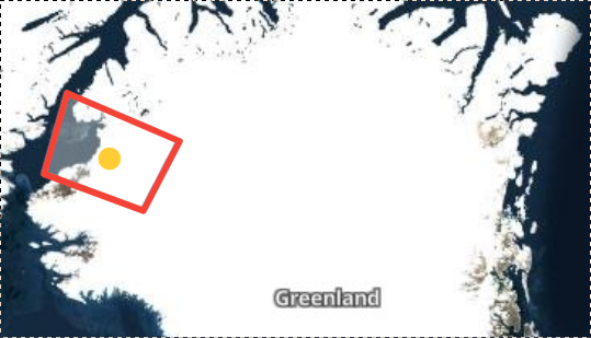
Phillip Choi is a rising senior at the University of Pennsylvania, where he studies physics with a minor in geology—and a returning RESESS intern. Phillip enjoyed physics, but wanted to combine his theoretical knowledge with laboratory work. At the University of Pennsylvania, Phillip works in a sediment dynamics and geomorphology laboratory to investigate Earth surface processes with granular physics. In his RESESS project last year, he was able to catalog natural hazards from a much broader perspective for the first time by characterizing crustal displacement in Greenland with InSAR. He is excited to expand upon this project throughout this summer.
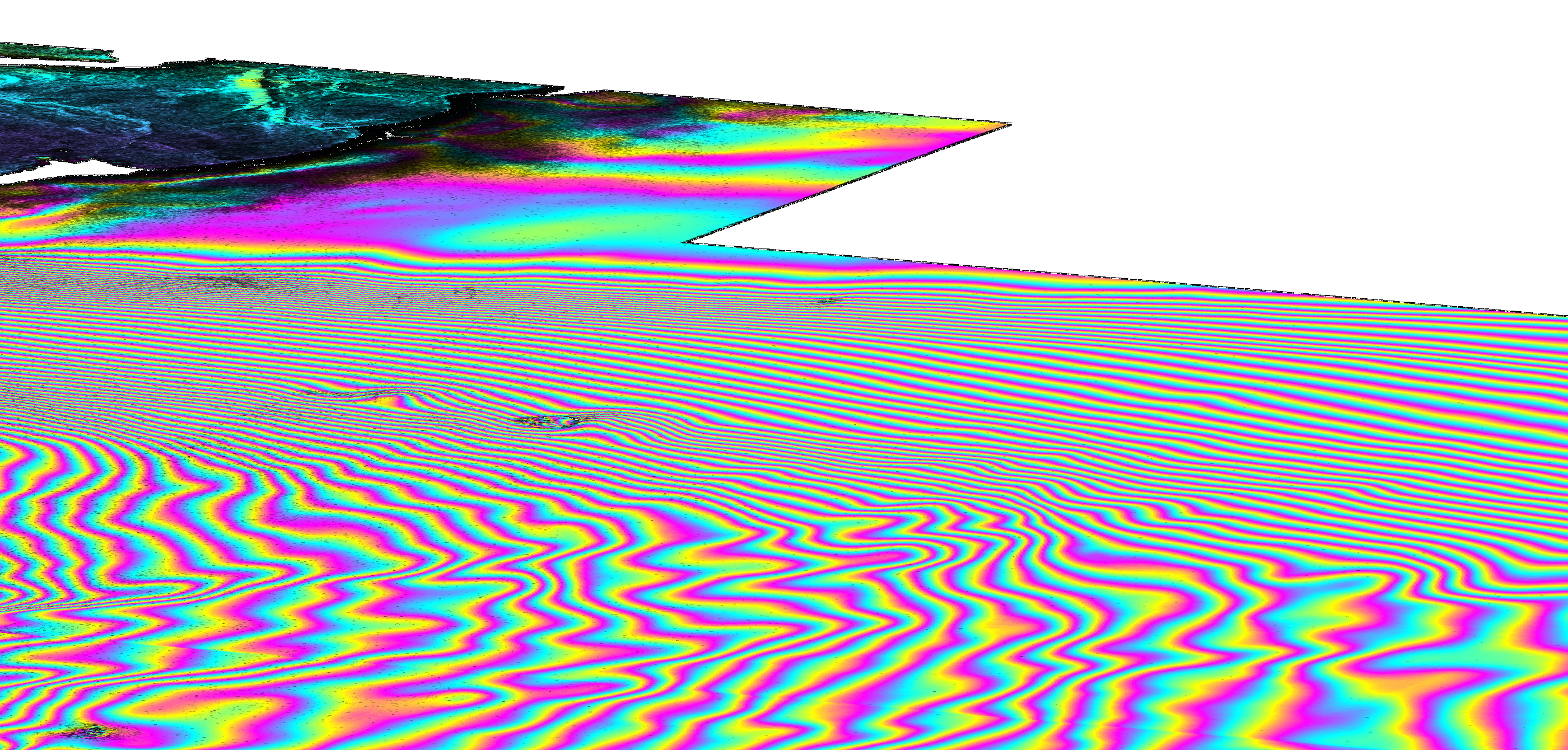
Dr. Kristy Tiampo and Dr. Michael Willis of the Cooperative Institute for Research in Environmental Sciences (CIRES), which is a partnership of NOAA and University of Colorado Boulder, are mentoring Phillip again this summer. Phillip is utilizing a Digital Elevation Model and synthetic aperture radar (InSAR) maps to determine how Earth’s crust is uplifting in Greenland in response to changing ice mass from melting. Last summer, he processed enough images to create a local, 100-square-kilometer map of an area of bedrock. This year, with the help of his mentors and graduate students in the laboratory, the process has become more streamlined and Phillip is able to process many more regions of Greenland. Additionally, InSAR can be used to create velocity maps that show how quickly deformation is occurring in certain areas. This data can be compared to GPS data from permanent stations in Greenland. While these GPS stations provide continuous time series of displacement, there are only 46 GPS stations in Greenland. InSAR and GPS can thus be used together to combine the high spatial resolution of InSAR and the continuous measurements of GPS. These deformation maps can then be used to map and catalog natural hazards, like landslides, and protect the communities that will be impacted.
Q&A:
- Why did you decide to return for a second year of the RESESS program?
I think it made sense for my goals, and also because of how invested I was in the first year… For a lot of [interns], I understand that it’s sort of a way to dip their toes into maybe a field of geoscience research as the first time they do it. For me, I was lucky enough to find [mentors] that embarked on a more drastic direction. There’s an entire initiative that the NSF is funding and promoting, which is natural hazards in the Arctic. Part of it is creating a comprehensive InSAR map of Greenland. So my first year was… sort of a pilot study of the sorts of things we could do on the coast of Greenland. This year, I really want to expand our areas of coverage, streamline the workflow, and hopefully write a paper to be submitted to some remote sensing journal… For my goals this year and preceding my senior year, I thought it made sense to reapply for RESESS and get the funding to continue with this. There’s a lot of work to do and I really love it.
- What have you gained from your mentorship with Dr. Tiampo and Dr. Willis?
The most valuable thing I think I’ve gained from this mentorship is that Kristy and Mike are both really good at making you feel comfortable and in control of your path. They give you just enough leeway, but also encouragement and direction to guide you. I think their mentorship style is what gives me the most confidence to go work autonomously and work on problems, and not be so dependent on a mentor for every little thing. A lot of things you have to do on your own and I think [their] giving me that degree of responsibility even as an intern is something I really value and it’s worth taking away from their [mentorship] style.
- Have you learned about any new topics/research techniques that have really piqued your interest?
One thing that I’ve really started to dive into is the modeling and applications of modeling [for] glacial isostatic adjustment (GIA), which is the response of the solid Earth to past ice unloading. This Last Glacial Maximum was 21,000 years ago. Since then and since ice retreated, there’s been a long-term, sort of linear uplift all across… the world and especially in Arctic regions where the land is rising, it breathes elastically because of seasonal changes in weather and snow unloading. If you manage to subtract the elastic components, you see the glacial isostatic adjustment that is this rebound of the Earth. One thing I’m interested in is how we can use InSAR, what I’m doing now, to [improve] the constraints on GIA modeling. GIA modeling in the past has been constrained using GPS and all that. That’s a… well worn trail, but I think the geodetic techniques I’m using now can provide good insights into modeling that.
After graduating in the spring, Phillip hopes to earn a master’s degree in geoscience, potentially cryospheric science or glaciology. He also hopes to apply for the National Science Foundation’s graduate research fellowship this fall.
Read Phillip’s interview from last year here.

