Formerly known as the UNAVCO student internship program (USIP)

Applications for 2023 are closed

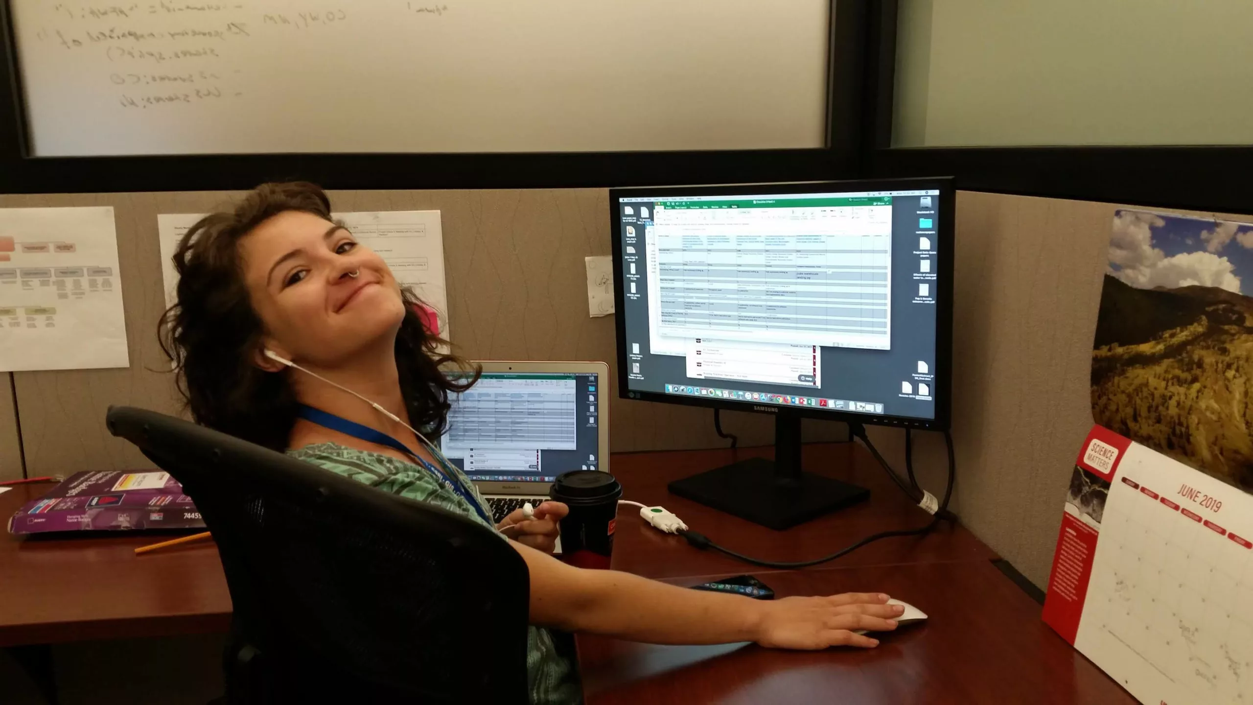
The EarthScope Student Career Internship Program, formerly known as USIP, offers unique real-world work experience for undergraduate and graduate students relative to the interns’ academic and career goals. Each intern is an integral member of the team and plays an important role by contributing their knowledge, skills, and abilities to specific projects.

Project managers teach interns what it is like to work in a non-profit organization that facilitates geoscience research and education. In doing so, we anticipate that we are able to share expertise, leverage best practices and forge lasting relationships.

Timing

Student Career internships are full-time (32 to 40 hrs/wk) for 11 weeks and typically offer remote options (depending on position duties). The 2023 program will begin on May 22, 2023

If you have questions regarding the application process, please visit or contact Internships@EarthScope.org.

What to expect

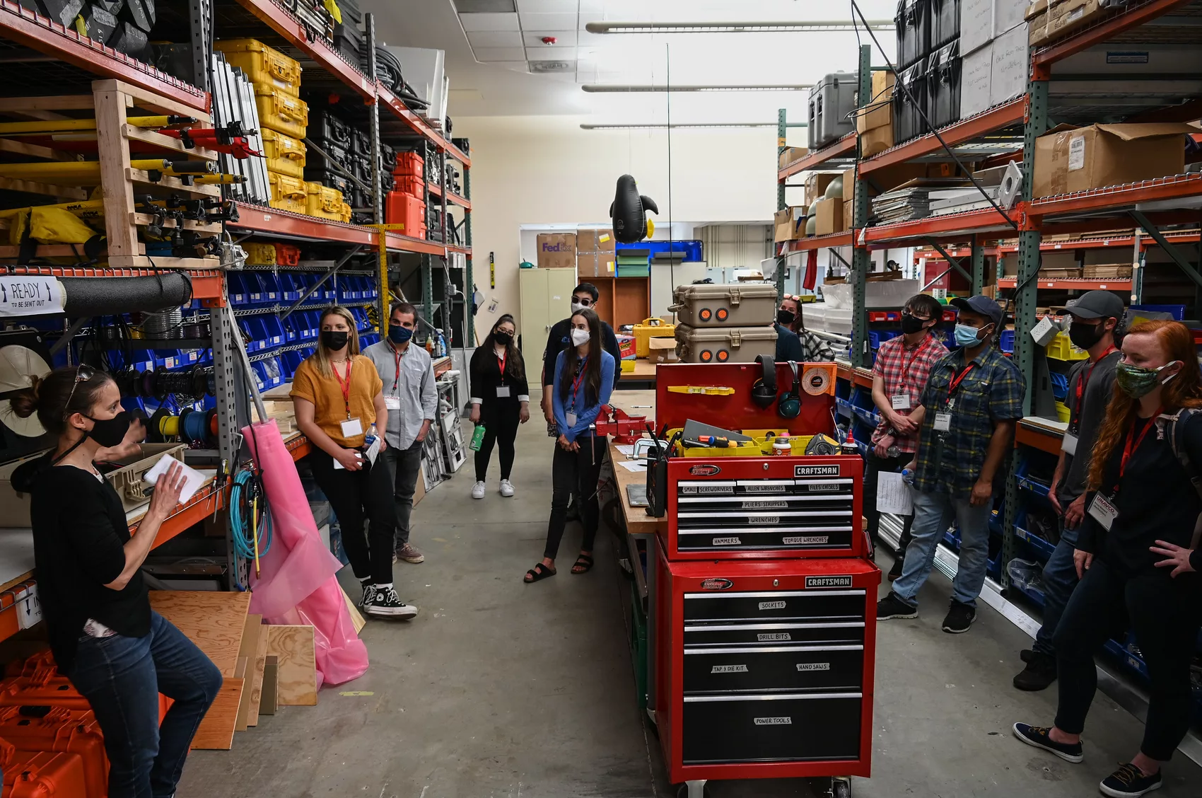
Internship assignments vary each year based on business needs. Managers identify a specific scope of work, designate a role, and create a statement of work for the intern. The intern will be assigned real-world work, with an impact on our organization and the community we serve. The manager will be the intern’s supervisor and mentor.

The intern will receive a company orientation and then collaborate with their manager to develop a work and learning plan that aligns with the statement of work. Before beginning work, interns will receive appropriate training, including compliance and safety training. Interns will meet with their managers weekly at the beginning of their assignment and have informal performance feedback throughout their assignment.
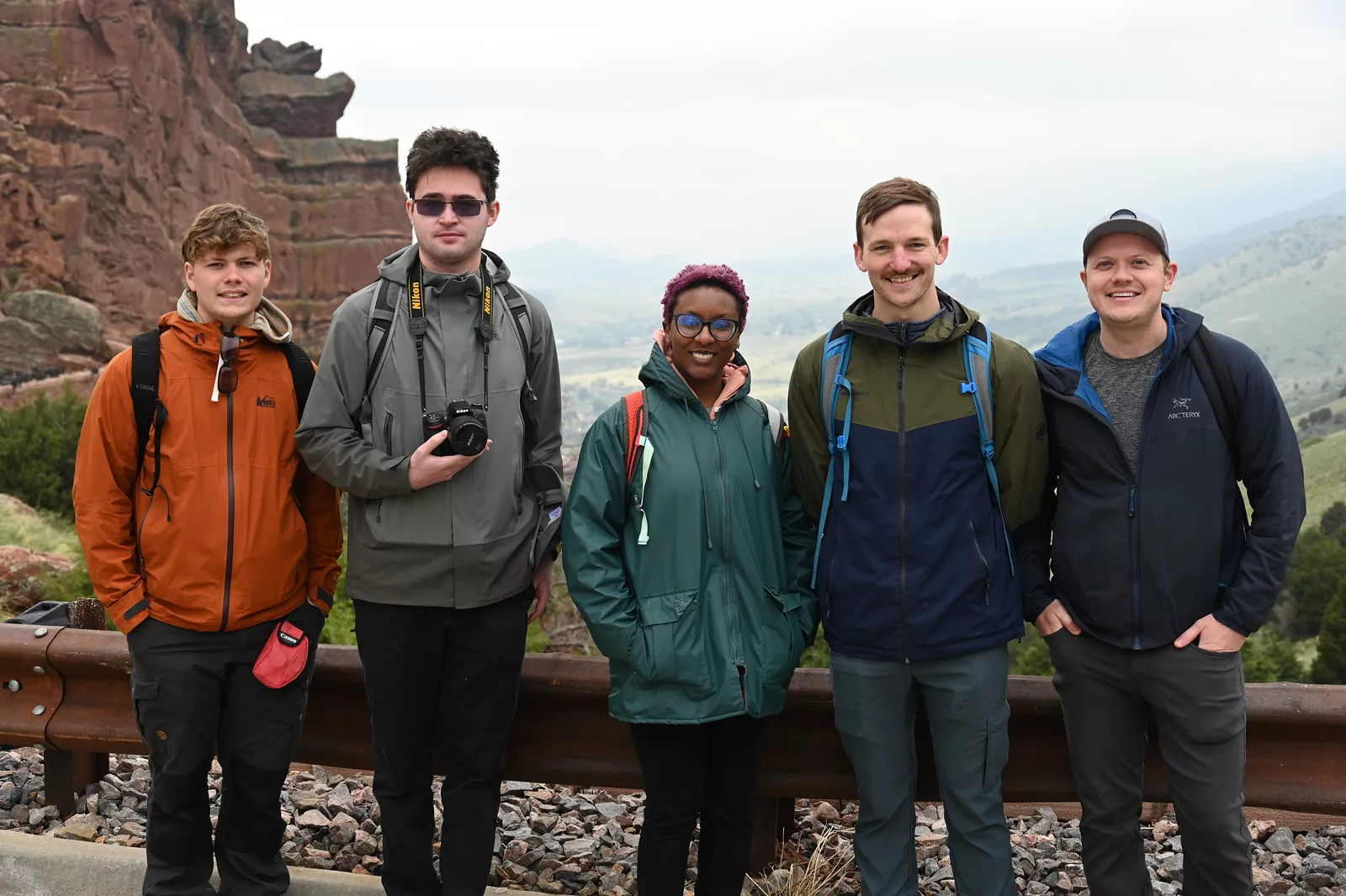
In addition to a weekly stipend, EarthScope provides many formal and informal learning opportunities; these include team meetings and various company meetings. Interns will be invited to participate in these events as well as other EarthScope business and social events.

Student Career Internship Program Alumni

Get to know our past Student Career Internship participants and their projects.

School: Rutgers University

UNAVCO Supervisor: Scott Johnson

ECE Communications Intern

About Lucia (she/her/hers)

Lucia Bellino is an incoming PhD student at the Jackson School of Geosciences, where she plans to study mineralogical surface processes on Mars to better understand the early climate of the planet. Lucia graduated from Rutgers University – New Brunswick in May 2021, with a bachelor of science in Geology and a minor in Business and Technical Writing. She is excited to continue learning about geodesy and explore graphic design and video production this summer as a science communications intern!

Recorded presentation

School: University of Oregon

UNAVCO Supervisor: Chris Crosby

Data Technician Intern – WInSAR

About Rebecca (she/her/hers)

Becca Bussard is a PhD candidate of Earth Sciences at the University of Oregon. She previously graduated from Penn State in 2019 with a BS in Physics and Honors in Earth Science. Last year her USIP internship involved organizing and updating the SAR resources for UNAVCO as well as helping run educational SAR courses. Returning to USIP again this year, she worked on updating and expanding the utility of the InSAR Product Archive and producing several pages of web content that focused on the applications of InSAR.

Recorded presentation

profile photo

School: University of Michigan

UNAVCO Supervisor: Sarah Doelger

Field Engineer Intern

About Kayla (she/her/hers)

Kayla Byrd recently graduated from the University of Michigan with a major in Materials Science and Engineering and a minor in graphic design. She is a lover of science and art, which lends into her passion for nature and the outdoors, and an interest in the state of our environment and the world we live in. This summer she will be working as a field engineer to maintain, upgrade, and repair some of the GNSS stations UNAVCO and other scientists use to observe geodetic data.

Recorded presentation

profile photo

School: University of Colorado Denver

UNAVCO Supervisor: Scott Johnson

ECE Communications Intern

About Zach (he/him/his)

Zach is currently a senior student pursuing a Biology major and Communications minor at the University of Colorado at Denver. His interest in science communication stems from a combination of my academic interests in the sciences, as well as more personal interests in creation of entertaining and informative content. He hopes to be able to both improve and utilize his skills in science communication during this internship!

Recorded presentation

profile photo

School: University of California, Davis

UNAVCO Supervisor: Chris Crosby

Data Science Intern- OpenTopography

About Kenneth (he/him/his)

Kenneth’s project was titled “Digital Elevation Model (DEM) Visualization Tools in OpenTopography”.

Recorded presentation

profile photo

School: University of Texas at Austin

UNAVCO Supervisor: Chris Crosby

Data Science Intern – OpenTopography

About Cole (he/him/his)

Cole Speed is a PhD Candidate in the Department of Geological Sciences at the University of Texas at Austin and a Graduate Research Assistant in the Quantitative Clastics Laboratory at the Bureau of Economic Geology. He uses a variety of remote sensing methods and field data to study linkages between planetary surface processes and their expression in the modern and ancient sedimentary record. This summer, Cole is working with the OpenTopography team to develop Python workflows for programmatically accessing, processing, visualizing, and analyzing lidar point cloud data and derivative products, with the goal of enhancing ease of access and utilization of these datasets for a variety of use cases and end-users.

Recorded presentation

profile photo

School: Union College

UNAVCO Supervisor: Doug Ertz

Data Science Intern – OpenTopography

About Ian (he/him/his)

Ian is an undergraduate student at Union College majoring in computer engineering and minoring in embedded machine learning. This summer Ian is working with the UNAVCO web services team to lift current infrastructure into the cloud. Ian is responsible for transitioning the image database used by field engineers to a new, cloud-based platform. This will require developing a new API layer and migrating the existing database to the cloud. Ian is also involved in designing and deploying new AWS infrastructure to improve UNAVCO’s revamped image service. Upgrades will focus on improving service usability and performance while maintaining the existing functionality that enables researchers to access the data they need. When not building ETL data pipelines, Ian enjoys spending time in nature and organizing mutual-aid networks within his local community.

Recorded presentation

School: Rutgers University

UNAVCO Supervisor: Scott Johnson

ECE Communications Intern

About Lucia Bellino (she/her/hers)

Lucia Bellino is a recent graduate of Rutgers University – New Brunswick, having majored in Earth and Planetary Sciences and minored in Technical Writing. Throughout her undergraduate career, Lucia conducted oxygen and carbon stable isotope analyses on surface-dwelling microfossils to reconstruct the sea surface temperatures of the North Atlantic Ocean during the Miocene. For her senior thesis, she investigated the presence of hydrothermal mineral alteration, including serpentinization, in the Eridania basin on Mars, which has implications for astrobiology and magnetization. This summer, Lucia worked alongside Scott Johnson to migrate the UNAVCO website to a new WordPress platform and created additional science communication and outreach materials.

School: University of Oregon

UNAVCO Supervisor: Chris Crosby

Data Technician Intern – WInSAR

About Rebecca Bussard (she/her/hers)

Becca Bussard is a PhD candidate of Earth Sciences at the University of Oregon. She previously graduated from Penn State in 2019 with a BS in Physics and Honors in Earth Science. Her USIP internship involved organizing and updating the SAR resources for UNAVCO as well as helping run educational SAR courses. She also created multiple online tutorials for processing SAR data that are now housed with UNAVCO.

School: University of Montana

UNAVCO Supervisor: Scott Johnson

ECE Communications Intern

About Courtenay Duzet (she/her/hers)

Courtenay Duzet is in an M.S program at University of Montana for Geophysics and Seismology. She grew up in a small town in North Idaho before obtaining her B.S in Environmental Sciences at Oregon State University. She hopes to pursue her Ph.D in Volcanology at the University of Alaska after graduation. Her USIP internship consists of working with the Education and Community Engagement department to help update UNAVCO’s website and support Geodesy research related outreach efforts.

School: Colorado State University

UNAVCO Supervisor: Doug Ertz

Software Developer Intern

About Levi Exner (he/him/his)

Levi Exner is a Junior at Colorado State University, studying Computer Science. He grew up in Colorado, and moved back after 4 years in the US Army. Levi is helping update the State-of-Heath system and migrating it to new hardware. He spends his free time with his cat, biking, and enjoying Colorado breweries.

School: University of Arizona

UNAVCO Supervisor: Christine Puskas

Data Technician Intern

About Cassie Hanagan (she/her/hers)

Cassie Hanagan graduated in 2019 with a BS in Geosciences from her hometown university, Penn State, and is currently a PhD candidate in Geophysics at the University of Arizona. Her unfailing interest in the world around her aptly explains her choice of study and drives her recent research efforts in the global field of Active Tectonics. For the USIP internship program, Cassie is developing user-friendly interactive Notebooks for some of UNAVCO’s legacy geodetic observation tools.

2021 USIP Intern Jordan Mazur headshot

School: Skidmore College

UNAVCO Supervisor: Tim Dittman

Data Technician Intern

About Jordan Mazur (she/her/hers)

Jordan Mazur recently returned to her hometown of Santa Fe, NM after completing her Bachelor’s degrees in Mathematics and Computer Science at Skidmore College. As an avid rock climber, hiker, and general outdoor enthusiast, she hopes to use her academic skillset to understand, protect, and preserve the Earth. After gaining some work experience, Jordan plans to pursue a graduate degree related to scientific computing and/or mathematical modelling. During her USIP internship, Jordan is evaluating and making improvements to an open-source software package critical to UNAVCO’s GNSS data archive cloud lift.

School: Pratt Institute

UNAVCO Supervisor: Chris Crosby

Data Technician Intern – OpenTopography

About Nathaniel Quinn (he/him/his)

Nat Quinn has an undergraduate degree in Environmental Science and Studio Art from The Colorado College, and a masters degree in Data Visualization and Analysis from Pratt Institute. This summer during his time with OpenTopography, he worked on a new user tool to generate contour lines from Lidar data, and two open source notebooks; one creating 3D modeling meshes from point clouds, and the other projecting satellite imagery onto a 3D model to create 1-meter resolution landscape renderings. 

School: University of Arizona

UNAVCO Supervisor: Dave Mencin

Project: Student Assistant in Geodetic Data Services

About Cassie Hanagan (she/her/hers)

Cassie Hanagan graduated in 2019 with BS in Geosciences from her hometown university, Penn State, and currently pursues a PhD in Geophysics from the University of Arizona. Her unfailing interest in the world around her aptly explains her choice of study and drives her recent research efforts in the global field of Active Tectonics. As a USIP intern, Cassie has been creating user-friendly Jupyter notebooks that walk through understanding, accessing, downloading, and processing borehole strainmeter data.

School: University of Miami

UNAVCO Supervisor: Scott Baker

Project: Student Assistant in Geodetic Data Services

About Sara Mirzaee (she/her/hers)

Sara is a Ph.D. candidate in Geoscience studying at the University of Miami. She is originally from Iran and came to the US in 2017. She completed her bachelor as a Geomatics engineer and studied Remote Sensing as her master in Iran. She found her interest in learning about Earth via radar remote sensing. In her master’s, Sara worked on polarimetric radar images to study phenology in agriculture and after graduation, she started working on monitoring landslides using InSAR and GPS over Alborz range. That experience made her more enthusiastic to continue InSAR applications and lead her to study volcanoes. As an intern in the 2020 USIP program, she has been part of the GeoSCIFramework project, working on the development of processing workflows and populating SAR data.

School: University of Arizona

UNAVCO Supervisor: Dave Mencin

Project: Student Assistant in Geodetic Data Services

About Lisa Knowles

Lisa Knowles is currently working on a PhD in Geosciences from the University of Arizona and earned a Bachelor of Sciences in Environmental Science from University of Maryland – Baltimore in 2015. During a 2014 Southern California Earthquake Center Summer Undergraduate Research Experience (SCEC SURE) internship, she developed a strong familiarity with GPS and related technical methods. As USIP intern, Lisa contributed to the GeoSCIFramework project, creating user-friendly Jupyter notebooks for searching, accessing, and extracting geodetic data.

School: University of California at Riverside

UNAVCO Supervisor: Scott Baker

Project: Student Assistant in Geodetic Data Services

About Rachel Terry

Rachel Terry received her M.Sc in Geological Sciences from the University of California at Riverside (UCR) in March 2019. The focus of Rachel’s research at UCR was to better understand the relationship between geothermal power production and surface deformation at The Geysers geothermal field in northern California. To do this, she used GPS data, well data, and forward/inverse dislocation models to relate water injection and steam extraction to surface deformation. During her time at UCR, she also led multiple GPS campaigns in California, including around The Geyser’s geothermal field and in the Mojave Desert prior to the M6.4 and M7.1 Ridgecrest earthquakes in July 2019. Prior to attending graduate school, Rachel received her B.Sc in Environmental Science: Geology from the University of Tennessee at Chattanooga. As a USIP intern, Rachel has been a part of the GeoSCIFramework project, creating user-friendly Jupyter notebooks for searching, accessing, and extracting geodetic data. She is excited to continue working with UNAVCO as a Software Engineer in August.

School: Oklahoma State University

UNAVCO Supervisor: Beth Pratt-Sitaula

Project: Student Assistant in Geodetic Tools for Societal Issues (GETSI)

About Tadesse Alemu

Tadesse Alemu is a PhD candidate in Geology at Oklahoma State University, where he does research related to basin analysis by integrating field-based studies with remote sensing data, and lab work. The main objective of Tadesse’s dissertation is to document the salient geologic and geophysical features of what is possibly the only completely exhumed IntraCONtinental Sag (ICONS) basin that is located in the western flank of the Afar Depression, in the East African Rift System. His work has important implications for understanding crustal dynamics, and resources distribution within basins referred to as cratonic or intracontinental. Tadesse received his B.S. and M.S. in Geology from Addis Ababa University–Ethiopia, where he also served as a lecturer for about 2 years. This summer, as an intern on the GETSI project, Tadesse interacted with authors from six colleges and universities supporting them with GPS data requests, ArcGIS needs, copyright issues, preparing figures, short lectures, manuals, and getting himself familiar with field GPS data collection and processing.

School: University of Miami

UNAVCO Supervisors: David Phillips & Scott Baker

Project: Student Assistant in Geodetic Data Services

About Kawan Amelung

Kawan Amelung is a mechanical engineering student at the University of Miami and a participant of the 2018 USIP program. He believes the extensive potential of remote sensing, specifically InSAR, is becoming more apparent. Although there are a variety of obstacles associated with the processing and use of SAR data, the storage and delivery of time-series InSAR is key among them. Kawan’s USIP project revolved around the on-going upgrade of UNAVCO’s SAR data collections to be time-series InSAR compatible. Solving the storage and distribution demands of time-series InSAR data will enable greater utilization of this incredibly useful tool.

School: Post-graduate of Tulane University

UNAVCO Supervisor: Jim Normandeau

Project: Student Geologistics Technician

About Jon Bridgeman

Jon is a geologist who specializes in coastal and deltaic systems. He graduated from Tulane University in May of 2018 with a MS in Earth and Environmental Science. During his time in the program, he wrote a thesis on exploring the mechanisms of coastal subsidence in the Mississippi River Delta and determining subsidence rates throughout the Holocene using a field-based approach. As a USIP intern, he was supervised by Jim Normandeau and worked on several geodetic survey projects. Jon surveyed with terrestrial LiDAR systems, built a semi-autonomous RC plane, and created a workflow to help new users operate drones and acquire data for Structure-from-Motion. He gained a robust skill set and was able to make drone technology more accessible to the broader scientific community. In addition to this work, he helped organize the warehouse and build campaign GPS kits for long term deployment monitoring volcanic and fault activity.Kawan Amelung is a mechanical engineering student at the University of Miami and a participant of the 2018 USIP program. He believes the extensive potential of remote sensing, specifically InSAR, is becoming more apparent. Although there are a variety of obstacles associated with the processing and use of SAR data, the storage and delivery of time-series InSAR is key among them. Kawan’s USIP project revolved around the on-going upgrade of UNAVCO’s SAR data collections to be time-series InSAR compatible. Solving the storage and distribution demands of time-series InSAR data will enable greater utilization of this incredibly useful tool.

School: Post-graduate of Auburn University

UNAVCO Supervisor: Jim Normandeau

Project: Student Geologistics Technician

About Samantha Eckes

Samantha is a geologist originally from the Hudson Valley in New York. Samantha’s interest in geology and remote sensing started with a fascination in photography. After receiving a degree in photography, she completed her bachelors at SUNY Geneseo and followed by her masters at Auburn University. Her general interests include planetary geology, fluvial systems, geophysics and learning new methods for collecting data in the field. This summer, Samantha helped create a workflow for the 3DR drones and worked on building a RC plane. She also created and completed projects using the 3D printer and helped maintain the warehouse and campaign materials for GPS/GNSS units. She appreciated everything the USIP internship program taught her and is excited to move to Portland, OR in August.

School: University of Colorado, Boulder

UNAVCO Supervisor: Doug Ertz

Project: Student Assistant in Geodetic Data Services

About Nate Ewan

Nate Ewan is a software developer and undergraduate at the University of Colorado Boulder, studying Computer Science. During his time at UNAVCO, he worked on adding additional functionality to the State-of-Health (SOH) system, which outputs to the Network Monitoring Map on the UNAVCO website. He developed a program to update the health of stations that have fallen out of the automated process ‘dataflow’. This map is used by field engineers and the public alike, and will help users of the Network Monitoring map to have a more comprehensive view of the status of our stations.

School: University of Houston

UNAVCO Supervisor: Beth Pratt-Sitaula

Project: Student Assistant in Geodetic Tools for Societal Issues (GETSI)

About Diana Krupnik

Diana Krupnik is a PhD candidate in Geology, studying at University of Houston. Her path to geoscience was non-linear; she started out studying Biology and became interested in Geology while working as a field assistant in Sapelo Island, Georgia. After that, she completed her bachelor’s in Geology and started a PhD, where she found her passion in teaching while working as a TA for various upper level geoscience courses. Her summer project at UNAVCO involved working on the Geodesy Tools for Societal Issues (GETSI) project. The role of this internship is to provide support to authors – educators at various universities across the country – with data collection, organization, formatting, and preparation of instructions for using the data. The focus areas of Diana’s project were flood hazards, water resources, and volcanic hazards. The goal of the GETSI project is to make geodetic data and methods accessible and available to undergraduate curricula across the country, and to help authors who are strapped for time by providing the data and assisting with other tasks such as drafting figures, helping with presentations, etc.

School: Post graduate of Virginia Tech

UNAVCO Supervisor: David Phillips & Christine Puskas

Project: Student Assistant in Geodetic Data Services

About Sean Malloy

Sean is a geophysicist with a diverse background and a love for adventure. Having spent a large portion of his time in school as a journalism major, he ultimately graduated with a Physics degree from Virginia Tech in 2018. During his last year and a half in Blacksburg, he was able to combine his love of the outdoors, writing and physics as an undergraduate researcher in Dr. D. Sarah Stamps’ Geodesy and Tectonophysics Laboratory. As a UNAVCO intern, Sean was supervised by Christine Puskas and David Phillips. Sean’s work at UNAVCO involved the discovery and processing of dozens of GNSS/GPS velocity solutions from published sources to create a standard metadata/dataset format for UNAVCO Principle Investigators to use. He then used SQLite to create a database to hold these processed datasets to be integrated into the UNAVCO webservices at a later time. For his next step, Sean is taking a year off before starting graduate studies in geophysics with the ultimate goal of becoming a research professor. In his free time, he loves to spend time on his bike(s), tinkering with everything and making people laugh.

School: University of Nevada, Reno

UNAVCO Supervisor: David Phillips & Christine Puskas

Project: Student Assistant in Geodetic Data Services

About Justine Overacker

Justine Overacker grew up in the San Francisco Bay Area before moving to Nevada to earn her BS in Geophysics from the University of Nevada, Reno (UNR) in May 2012 with academic minors in Geology, Hydrogeology, and Mathematics. After graduation, she was recruited by the exploration industry and accepted a Field Geophysicist position onboard a seismic vessel. There, she spent up to 300 days a year floating around the ocean in such exotic locations as East Africa, West Africa, Nova Scotia, and the Gulf of Mexico, and training in exciting places like Abu Dhabi, Norway, and Houston. Justine came back home to Reno after the oil and gas downturn in 2015, and transitioned into the role of electromagnetic geophysical technician before returning to UNR in Fall 2016 to pursue her PhD in Geophysics. At UNAVCO, Justine’s project focused on time series steps, where she tested various offset estimation strategies, and built a comprehensive step table using PBO and Nevada Geodetic Laboratory data. In her off time, Justine enjoys traveling, watching movies, riding her motorcycle, playing with her rescue pups, and the regular comforts of home and family.

School: University of Colorado, Boulder

UNAVCO Supervisor: Donna Charlevoix

Project: Student Assistant in Evaluation

About Erik Dutilly

Erik Dutilly was born in Wisconsin to a father who came from a dairy farming family and mother who emigrated from Puerto Rico. He studied physical geography and Spanish at the University of Wisconsin-Madison. After moving to Boulder, CO, he got a master’s degree in education. Since then, he has specialized in program evaluation work in education and science education. He is currently pursuing a PhD in Education at the University of Colorado-Boulder in the School of Education.

School: University of Alabama

UNAVCO Supervisor: Beth Bartel

Project: Student Assistant in Science Video Production

About Christopher Edmunds

Christopher Edmunds is a photojournalist from Birmingham, Alabama, and a USIP intern at UNAVCO for summer 2017. Christopher put his skills in publishing for media organizations to good use by shooting professional photos to document the RESESS and GLP internship programs. He also utilized his graphic design experience by created an engaging infographic explaining the basic of Geodesy that will be used in the UNAVCO calendar, and can be repurposed for educational materials. The bulk of Christopher’s summer internship focused on producing videos for the UNAVCO YouTube channel. These videos used a variety of audio/visual techniques and involved interviews, green screens, animations, and hours of careful editing. By summer’s end, Christopher was responsible for adding hundreds of photos, a versatile infographic, and several professional-grade videos to the UNAVCO education and outreach effort.

School: Pitzer College

UNAVCO Supervisor: Beth Bartel

Project: Student Assistant in Science Video Production

About Ellie Ellis

Ellie Ellis will receive her undergraduate degree in Geology and Environmental Analysis from Pitzer College in May of 2018. As one of two USIP video production interns, she produced numerous educational videos that highlight the work of diverse geoscience professionals and students. She also used her illustration skills to create animations for a video titled “Nine Impacts of Geodesy,” which is targeted towards a broad audience. Ellie is passionate about increasing accessibility in the earth and environmental sciences, and hopes to pursue a career in education.

School: University of Montana

UNAVCO Supervisor: Ken Austin

Project: Student Assistant in Alaska Field Operations

About Ellen Knappe

Ellen Knappe is normally a PhD candidate at University of Montana working towards her degree in active tectonics. She was very excited to return for another summer to work with the Alaska team. Ellen spent the summer flying around in the helicopter, working in the rain, swatting bugs, eating way too many gummy bears, staying very caffeinated and annoying the Alaska engineers with her horrible singing. She appreciated the opportunity to spend another great summer working and exploring Alaska with the AK team. During her internship, Ellen helped maintain and improve the Alaska PBO network. She worked with the Alaska engineers to troubleshoot issues, repair and configure equipment, enhance network communication systems and increase the robustness of power systems at stations across the state. She also learned how to quality check GPS data, monitor the network for issues and fabricate equipment for deployment. Ellen enjoyed furthering her skills as a geodesist and learning new skills and techniques from the AK team.

School: University of North Carolina, Charlotte

UNAVCO Supervisor: Jim Normandeau

Project: Student Assistant in Nagios Software

About Rama Vamshi Krishna Dhulipala

I am Rama Vamshi Krishna Dhulipala, a graduate student at University of North Carolina at Charlotte. Apart from pursuing my Masters in the computer Science Department, I was also a Teaching Assistant for the course ‘Software Development Projects’, when I was in my second semester of graduation. I would like to introduce myself as a person who loves to code and thoroughly enjoys programming. I enjoy the process of building solutions through the development of software applications (both web and mobile). This summer, I have been working as a Nagios Code Writer Intern under the guidance of my supervisor, Jim Normandeau.

School: University of Montana

UNAVCO Supervisor: Beth Pratt-Sitaula

Project: Student Assistant in Field Education

About Ian Lauer

Ian has been working with UNAVCO since summer 2016 on a NSF grant to improve undergraduate education in geoscience technologies. Under the guidance of advisors, Beth Pratt-Situala and Ben Crosby, he wrote field education guides and curriculum for GETSI: High Precision Positioning module. This module is a field based curriculum designed to teach practical skills in conducting GPS surveys for geoscience based problems, with a focus on societally important issues such as natural hazards and resources. Additionally, Ian’s research is funded through and directly supports the curriculum by providing an example dataset of a societally relevant problem solved with GPS surveys. Ian enjoys long hikes down landslides and climbing the nearest or most prominent outcrop in the vicinity (and will argue this is the only way to properly view and assess the local geology). He gained an appreciation for nature by growing up outdoors as a child through family adventures on the rivers and in the mountains. This appreciation grew into a broad love for the natural sciences, which was solidified by graduating with a B.S. Geology in 2016. Ian hopes to always continue learning, and is currently pursuing a M.S. Geology focused on geomorphology and natural hazards. He hopes to never grow up, and looks forward to a life with his wife Brandi, daughter Sofia, and exploring the world with them.

School: Post-graduate of the University of Colorado, Boulder

UNAVCO Supervisors: Fran Boler & Doug Ertz

Project: Student Assistant in Software Engineering

About Gavin Medley

Gavin is a data scientist and programmer with a background in applied mathematics and statistics. He graduated from the University of Colorado in December 2016 with a BS/MS in Applied Mathematics. During his time in the program, he wrote a thesis on experimental lidar altimeter data and worked with his advisor to develop algorithms used by NASA. He will be starting at UNAVCO in August as a software engineer working in data management and distribution. From June 12 through June 30 I was supervised by Fran Boler where I worked on creating XML mapping files to map our database schemas to the GeodesyML schema being advanced by Geoscience Australia. The goal was to utilize Geoserver to output our site log metadata in XML according to the GeodesyML schema definition. From July 3 through August 4, I was supervised by Doug Ertz where I developed software in python to reduce data transmission costs associated with downloading hourly log files from GPS receivers.

School: University of Colorado, Boulder

UNAVCO Supervisor: Jim Normandeau

Project: Student Geologistics Technician

About Giordan Thompson

I am currently attending the University of Colorado at Boulder, pursuing a degree in Mechanical Engineering. I spent the summer operating the CNC machine and 3D printer coming up with innovations for the PolarRx5 campaign systems. During the Internship, I remained stationed in the warehouse testing and reiterating these systems. My participation in the UNAVCO Student Internship Program (USIP) has allowed me to find my niche in the geoscience field. UNAVCO has showed me diverse backgrounds make for a powerful workforce.

School: University of Montana

UNAVCO Supervisor: Dave Mencin

Project: Student Assistant in Evaluation of GNSS receivers and real-time PPP-AR positions for Earthquake and Tsunami Early Warning

About Cody Bomberger

Cody Bomberger is from north-central Pennsylvania and completed his bachelor’s degree in Geosciences at the Pennsylvania State University. Cody is now wrapping up his master’s in the Department of Geosciences at the University of Montana. His work at Montana focuses on using observed surface deformation to determine the relative contribution from the crust and lithosphere using spatial scaling relationships. At UNAVCO, Cody worked on real time GPS processing with applications to Early Earthquake Warning systems.

School: University of Montana

UNAVCO Supervisor: Ken Austin

Project: Student Assistant in Alaska Summer Field Operations

About Ellen Knappe

Ellen Knappe is a Ph.D. candidate at University of Montana, working towards her degree in active tectonics. She spent the summer helping the Alaska team service the PBO network across the state; troubleshooting issues with stations, enhancing network communication systems and replacing faulty equipment. During her internship, Ellen visited remote locations across Alaska to service stations, learned new techniques and skills from all the Alaska engineers and likely annoyed them with her horrible singing.

School: University of Nevada, Reno

UNAVCO Supervisor: Dave Mencin

Project: Student Assistant in Evaluation of GNSS receivers and real-time PPP-AR positions for Earthquake and Tsunami Early Warning

About Meredith Kraner

Meredith Kraner, a New York native, is currently a graduate student at the Nevada Geodetic Laboratory located within the University of Nevada, Reno looking at time-dependent strain in GNSS data. She became interested in geology, earthquakes, and crustal deformation while pursuing her undergraduate degree at Stony Brook University. This summer, Meredith worked on evaluating real time GPS processing systems to understand the most efficient and accurate methods to use for future Earthquake Early Warning systems. In her spare time, she enjoys outdoor-oriented activities such as hiking, biking, and skiing.

School: Idaho State University

UNAVCO Supervisor: Beth Pratt-Sitaula

Project: Student Assistant in Developing GETSI Field Education Modules

About Ian Lauer

Ian Lauer is pursuing an M.S. Geology degree at Idaho State University. He is interested in the use of GPS/GNSS, LiDAR, and other geodetic tools in studying landscape morphology and applications to quantify and predict natural hazards such as earthquakes and landslides. He is working with UNAVCO to improve undergraduate curriculum and training in RTK and Static GNSS surveys by writing several field education modules distributed through SERC and GETSI.

School: Pennsylvania State University

UNAVCO Supervisor: Shelley Olds

Project: Student Assistant in Producing an Infographic on Interferometric Synthetic Aperture Radar (InSAR) for a Broad Audience

About Sarah Moore

Sarah Moore completed her B.S. degree in geology at the University of Utah and is currently pursuing an M.S. in geoscience at Penn State University. Her love of natural hazards as a child drew her to study volcano deformation on Kilauea volcano in Hawaii for both her undergraduate and graduate research. Sarah’s background with InSAR led her to UNAVCO where she spent the summer developing a suite of InSAR data products to create outreach materials for the Education and Community Engagement program. She generated a suite of many high quality interferograms add to the WInSAR product archive. She also used the examples to design an infographic describing how InSAR works and to showcase the many applications of InSAR in the geosciences.

School: University of North Texas

UNAVCO Supervisor: Beth Bartel

Project: Student Assistant in GeoOutreach Video and Media

About Bobby Nash

Bobby Nash is currently completing his undergraduate degree at the University of North Texas where he studies documentary production and biology. His participation in the UNAVCO Student Internship Program (USIP) allowed him to practice science communication in a field well outside the scope of his own academic experience, an invaluable exercise in translating complex concepts into easily digestible material. Over the course of the summer, Bobby worked on several video projects. He produced a short video for UNAVCO’s Geoscience Career Spotlight series featuring UNAVCO polar field engineer Annie Zaino, with the goal of reaching geoscience undergrads with the stories of professional role models representing both diversity and non-academic career paths in the geosciences. He also created a video highlighting the capabilities and applications of the terrestrial laser scanning (TLS) equipment and data services offered by UNAVCO, intended to reach scientists considering utilizing the TLS for their own research.

School: Post-graduate of the University of Colorado, Boulder

UNAVCO Supervisor: Beth Bartel

Project: Student Assistant in GeoOutreach Video and Media

About Daniel Zietlow

Daniel Zietlow is working at the interface of science and society, creatively communicating a range of scientific topics via photography, film, and writing to a broad audience. He developed a love of science, art, travel, and the outdoors, and pursed these diverse interests as an undergraduate majoring in physics and art history at Rollins College. After graduating, Daniel entered a doctoral program in geophysics at the University of Colorado at Boulder, where he specialized in seismology. His work took him across the globe, from his backyard in the Rocky Mountains to the South Island of New Zealand to the Himalaya of Nepal. During his time at CU, Daniel pursued science communication through film and photography, and after completing his Ph.D. was drawn to UNAVCO as an environment in which to hone these skills. While here, Daniel worked on a number of film endeavors. One project focused on the web services offered by UNAVCO for community access to GPS, SAR, and borehole data. He also produced videos featuring scientist Alejandro Soto and science communicator Laura Snider as a part of UNAVCO’s Geoscience Career Spotlight series, aimed towards informing intro-level undergraduates of possible non-academic geoscience careers.

School: Utah State University

UNAVCO Supervisor: Beth Bartel

Project: Student Assistant in GeoOutreach Video and Media

About Andrew Bayles

Andrew Bayles recently received his B.S. degree in Geoscience with a minor in Art from Utah State University in Logan, Utah. He spent the summer with UNAVCO working on a video series that spotlights different careers in geoscience. He gained valuable experiences while working on this project and meeting/interviewing local geoscientists. UNAVCO offers many opportunities for interns to work on unique projects, learn, and grow in a fun, supportive environment. Andy is very grateful to take part of it. He also loved spending the summer in beautiful Boulder with his wife and one-year-old daughter.

School: Union College

UNAVCO Supervisor: Linda Rowan

Project: Student Assistant in GeoOutreach Video and Media

About Sarah Kittross

Sarah grew up in the beautiful Green Mountains of Vermont, the perfect environment to develop her love for the outdoors and capturing it through photography and film. She studies both of those interests as a senior geology major and film studies minor at Union College in upstate New York. She is currently completing a senior thesis project on the geochronology of very old volcanic deposits on the Caribbean island of Dominica. Sarah was drawn to UNAVCO where she could leverage her dual interests by creating dynamic videos about UNAVCO and geodesy for the public and the community. She is also exploring the history of the facility and hoping to make it more accessible to people on the UNAVCO website.

School: University of Montana

UNAVCO Supervisor: Aisha Morris

Project: Student Assistant in Geo-Workforce Development

About Carson MacPherson-Krutsky

Carson is pursuing a master’s degree at the University of Montana with a focus on natural hazards and science communication. Her background in geology and passion for connecting with others led her to UNAVCO where she spent the summer with the Education and Community Engagement group creating a video highlighting geoscience career paths and expanding interest in geodesy.

School: University of California, Los Angeles

UNAVCO Supervisor: Beth Pratt-Sitaula

Project: Student Assistant in Geodetic Data for Undergraduate Education

About Austin Madson

Austin is currently wrapping up his master’s work at the University of California – Los Angeles in the Department of Geography. He will continue research while working on the PhD in the same department. His current research is focused on crustal loading and lithospheric flexure utilizing remotely sensed datasets, with more broad interests in varying types of hydrologic remote sensing, RADAR remote sensing technologies (PolSAR and DInSAR), real world applications in the use of Remote Sensing (RS) and GIS, integration of RS and GIS technologies and coupled human/environ systems. During the past two summers at UNAVCO, Austin focused on processing varying types of datasets (GPS, LiDAR, DInSAR, GRACE, SWE, and groundwater) in order to create products that will be implemented into undergraduate learning modules for the Geodesy Tools for Societal Issues (GETSI) project. The goal for the project is to develop teaching materials for engaging undergraduate students in addressing societally important Earth science questions through the use of geodetic data.

School: Colorado State University

UNAVCO Supervisor: Shelley Olds

Project: Student Assistant in Field Education

About Katherine Shervais

Kate just completed her master’s degree in Geoscience at Colorado State University in Fort Collins, Colorado. Prior to attending Colorado State, she received her bachelor’s degree in Earth and Environmental Science at Wesleyan University in Middletown, Connecticut. Her research is focused on investigating fault geometry evolution by studying evidence of ancient earthquakes using Structure from Motion, terrestrial laser scanning, and RTK GPS. At UNAVCO this summer, Kate is compiling and creating curriculum materials for a terrestrial laser scanning field education module. Over the course of the multi-day module, students will learn to operate a TLS instrument, analyze the deposition history of a stratigraphic section, conduct hillslope diffusion analysis of a fault scarp, and quantify the change in a geomorphic (fluvial or landslide, for example) system over time.

NameProjectSchool AttendedYear
Kathleen AlexanderStudent Assistant in Geodetic Curricular Materials for K-12 TeachersThe College of New Jersey2014
Matthew LancasterData TechnicianPortland State University2014
Austin MadsonStudent Assistant in Geodetic Data for Undergraduate EducationUniversity of California, Los Angeles2014
Matthew PetersStudent Data TechnicianColorado School of Mines2014
Holly TaylorStudent Assistant in Communications and OutreachCornell University2014
Shawn CarrStudent Assistant in TLS and GPS EducationUniversity of Northern Colorado2013
Thomas Dickson-HuntStudent Assistant in Software DevelopmentColorado State University2013
Mark GreathouseStudent Assistant in EngineeringColorado School of Mines2013
Bethany JohnsonStudent Assistant in AccountingBrigham Young University2013
Anneka KumliStudent Assistant in Human ResourcesStanford University2013
France-Julianna Maria LeivaStudent Assistant in EngineeringUC Berkeley2013
Holly TaylorStudent Assistant in InSAR EducationCornell University2013
Michael FendStudent Assistant in EngineeringUniversity of Colorado, Boulder2012
Mark GreathouseStudent Assistant in EngineeringColorado School of Mines2012
David PageStudent Assistant in System AdministrationUniversity of Colorado, Boulder2012
Alex MayorgaStudent Assistant in Data ManagementUniversity of Colorado, Denver2011
Flora QuinbyStudent Volunteer in Data Management2011
Cassandra ShenefeltStudent Assistant in Student ServicesColorado School of Mines2011
Alex MayorgaStudent Assistant in Data ManagementUniversity of Colorado, Denver2010
Alex MayorgaStudent Assistant in Data ManagementUniversity of Colorado, Denver2009
Elvin MujcinStudent Assistant in Data ManagementUniversity of Colorado, Boulder2009
Kimberly CabbagestalkStudent Assistant in Data ManagementUniversity of Colorado, Boulder2008
Travis KelsayStudent AssistantUniversity of Colorado, Boulder2008
Alex MayorgaStudent Assistant in Data ManagementUniversity of Colorado, Denver2008
Carol WebberStudent Field AssistantCentral Washington University2008
Lauren WennerStudent AssistantUniversity of Colorado, Boulder2008
Austin BaldwinStudent Field EngineerUniversity of Texas, Austin2007
Kimberly CabbagestalkStudent Assistant in Data ManagementUniversity of Colorado, Boulder2007
David FinnStudent Field Assistant, Northern CaliforniaUniversity of Montana2007
Sarah GasparichStudent Field EngineerWhitman College2007
Justin GunnStudent Field AssistantOccidental College2007
Travis KelsayStudent AssistantUniversity of Colorado, Boulder2007
Ally MarzullaStudent Field AssistantNederland High School2007
Omar PerezStudent Field AssistantUniversity of Puerto Rico Mayaguez2007
Thomas PrayStudent Field Assistant, Northern CaliforniaPrinceton University2007
Emily SeiderStudent Field AssistantWhitman College2007
Phillip StokerStudent Field AssistantUniverstiy of Redlands, CA2007
Rich BeaudoinStudent Assistant in Data ManagementUniversity of Colorado, Boulder2006
Kimberly CabbagestalkStudent Assistant in Data ManagementUniversity of Colorado, Boulder2006
Grant FarmerStudent Assistant in Digital Campaign Document ManagementGeorgia Institute of Technology2006
Liberty HamiltonStudent Assistant in Data ManagementScripps College2006
Rich BeaudoinStudent Assistant in Data ManagementUniversity of Colorado, Boulder2005
Kimberly CabbagestalkStudent Assistant in Data ManagementUniversity of Colorado, Boulder2005
Tim DittmanStudent Field AssistantPrinceton University2005
Beth DuschatkoStudent Field AssistantNorthern Arizona University2005
Liberty HamiltonStudent Assistant in Data ManagementScripps College2005
Richard PagelStudent Field AssistantUniversity of Texas at Austin2005
Laura SmithStudent Field AssistantPrinceton University
2005
Sarah VenatorStudent Field AssistantCentral Washington University2005
Kimberly CabbagestalkStudent Assistant in Data ManagementUniversity of Colorado, Boulder2004
Liberty HamiltonStudent Assistant in Data ManagementScripps College2004
Andrew WahrStudent Assistant in Data ServicesPurdue University2004
Kimberly CabbagestalkStudent Assistant in Data ManagementUniversity of Colorado, Boulder2003
Carolyn CavanaughStudent Assistant in Data ManagementUniversity of Colorado, Boulder2003
Liberty HamiltonStudent Assistant in Data ManagementScripps College2003
Trevor StoneStudent Assistant in Map Tool Software DevelopmentUniversity of Colorado, Boulder2003
Carolyn CavanaughStudent Assistant in Data ManagementBoulder High School & University of Colorado, Boulder2002
Liberty HamiltonStudent Assistant in Data ManagementBoulder High School & Scripps College2002
Trevor StoneStudent Assistant in Map Tool Software DevelopmentUniversity of Colorado, Boulder2002
Carolyn CavanaughStudent Assistant in Data ManagementBoulder High School2001
Liberty HamiltonStudent Assistant in Data ManagementBoulder High School2001
Carolyn CavanaughStudent Assistant in Data ManagementBoulder High School2000
Carolyn CavanaughStudent Assistant in Data ManagementBoulder High School1999
Carolyn CavanaughStudent Assistant in Data ManagementBoulder High School1998

Positions for 2023

Data Science Intern

Position Overview

  • To be eligible for this program you must have been a student in Fall 2022, currently enrolled as a student, or returning as a student in Fall 2023. If you are unsure of your eligibility please reach out to Internships@EarthScope.org
  • The internship is 11 weeks starting May 22, 2023.
  • Interns must participate for the full 11-week period.
  • A weekly stipend of $800 is provided for 11 weeks
  • Work can be completed in Boulder, Colorado or at a remote location

Position Description The intern will develop workflows related to processing, analysis, and/or visualization of the geodetic data types collected and managed by EarthScope. These include GNSS, strain, tilt, Synthetic Aperture Radar (SAR), and 3D imaging data such as lidar and photogrammetry. The intern will construct the workflow, author documentation, and deploy the workflows as Notebooks that will be transportable and scalable, allowing them to be deployed in environments from laptops, to local clusters and the cloud. The project will rely on resources such as GitLab, Jupyter Notebooks and Observable Notebooks.

Essential Job Functions

  • Construct the workflow (processing, analysis, and/or visualization), author documentation, and deploy the workflows as a Observable and/or Jupyter Notebook(s).

Working Relationships

Internal

  • Reports to Project Manager II/III or Software Engineer III.
  • Interacts and collaborates with peers and colleagues across the organization.
  • Responds and reports to stakeholders on project status and results.

External

  • Interacts with community members relative to supported project.

Supervision

  • Interacts effectively with various EarthScope Consortium staff to ensure the completion of assigned responsibilities. May provide guidance on technical matters to others. Does not have supervisory responsibility.

EarthScope Core Competencies

  • Accountability and Responsibility
  • Relationship Building
  • Skilled Problem Solver
  • Customer Focus
  • Strategic Thinking

Physical Work Demands

  • Able to sit and/or stand to work at a computer
  • Able to move about a typical home office
  • Able to travel to Boulder Colorado for orientation week and participate indoor and outdoor activities
  • Able to lift and move up to 25 pounds occasionally

Mental Work Demands

  • Regular and on-time attendance

Note: To perform this position successfully, an individual must be able to perform each essential responsibility satisfactorily. The requirements listed above are representative of knowledge, skill, and/or ability required and are not intended to be an exhaustive list of all duties, responsibilities or qualifications associated with this position.

Required Education Graduate or undergraduate level student in Earth sciences or related STEM field Interest in working at the intersection of science and education

Required Skills Experience with at least one geodetic method (GNSS, InSAR, lidar, photogrammetry, gravity, sea level altimetry, etc.)

Data entry or related experience

Strong oral and written communication skills

Attention to detail

Ability to work independently

Preferred Skills

  • Knowledge of multiple geodetic methods
  • Familiarity with some or most of the technologies and software packages listed below:
  • Data search and access:
  • Database querying and statistical computing languages: Python, SQL
  • OGC Web Services: WFS, WMS, WCS
  • Data formats and pre-processing:
  • HDF5, RINEX, LAS/LAZ, GeoPackage
  • Extracting, cleansing, and verifying the integrity of data
  • Geodetic data processing and analysis:
  • GNSS: GipsyX, GAMIT/GLOBK/TRACK
  • SAR: ISCE, GMTSAR
  • Lidar & Photogrammetry: PDAL, GDAL, LAStools
  • Data visualization:
  • Jupyter Notebooks
  • Observable Notebooks
  • Javascript/HTML, D3, OpenLayers, matplotlib, GMT

Application Instructions

Our internship programs utilize a third-party company for applications called Submittable. Note that you will be asked to create a Submittable account upon entering the application. This is required to complete the application and allows you to save your progress while working on the application. Please complete all required (*) fields. Note that demographic information is optional and not shared with any identifying information (including to the review panel).

Incomplete applications will not be considered. To complete an application, you must submit the following materials and answer all questions in on submittable HERE

We require a PDF that contains the following four documents:

Cover letter or statement of interest that clearly articulates professional or academic goals, Resume or CV, Names and contact information for three references, and Unofficial transcript

We are unable to provide sponsorship for work authorization within the United States.

EarthScope is an equal opportunity/equal access/affirmative action employer. Our long-term success depends on the development of a forward-looking, diversified workforce. EarthScope values diverse perspectives and backgrounds in all positions within the organization and is fully committed to achieving a diverse workforce and complies with all Federal and State laws, and regulations regarding nondiscrimination and affirmative action. EarthScope encourages applications from candidates who are members of historically underrepresented groups. This includes candidates from different socioeconomic backgrounds, candidates with disabilities, candidates with unique life experiences, etc. Women, Veterans, Individuals with Disabilities and members of the BIPOC and LGBTQIA+ communities are encouraged to apply. All qualified and complete applications will be considered. Individuals with a disability needing an accommodation as part of the employment selection process should contact humanresources@earthscope.org or 303.381.7515

The application deadline is March 1 at 11:59 p.m. Mountain Time.

OpenTopography Data Science Intern

Position Overview

  • To be eligible for this program you must have been a student in Fall 2022, currently enrolled as a student, or returning as a student in Fall 2023. If you are unsure of your eligibility please reach out to Internships@EarthScope.org
  • The internship is 11 weeks starting May 22, 2023.
  • Interns must participate for the full 11-week period.
  • A weekly stipend of $800 is provided for 11 weeks
  • Work can be completed in Boulder, Colorado or at a remote location

Position Description The intern will work with the OpenTopography team to develop workflows and services related to processing, analysis, and/or visualization of topographic data managed by OpenTopography (https://opentopography.org/). These include lidar, photogrammetry, and radar data in point cloud and raster formats. The intern will construct the workflow, author documentation, and deploy the workflows as notebooks that will be transportable and scalable, allowing them to be deployed in environments from laptops, to local clusters and the cloud. The project will rely on resources such as GitLab, Jupyter Notebooks, and open source geospatial software. Additional potential tasks, as a function of the intern’s skills and interests, could include development of training resources such as written and/or video tutorials, and education and outreach materials.

Essential Job Functions

  • Construct the workflow (processing, analysis, and/or visualization), author documentation, and deploy the workflows as a Observable and/or Jupyter Notebook(s).

Working Relationships Internal

  • Reports to Project Manager III.
  • Interacts and collaborates with peers and colleagues across the organization.
  • Responds and reports to stakeholders on project status and results.

External

  • Interacts with community members relative to supported project.

Supervision

  • Interacts effectively with various EarthScope Consortium & OpenTopography staff to ensure the completion of assigned responsibilities. May provide guidance on technical matters to others. Does not have supervisory responsibility.

EarthScope Core Competencies

  • Accountability and Responsibility
  • Relationship Building
  • Skilled Problem Solver
  • Customer Focus
  • Strategic Thinking

Physical Work Demands

  • Able to sit and/or stand to work at a computer
  • Able to move about a typical home office
  • Able to travel to Boulder Colorado for orientation week and participate indoor and outdoor activities
  • Able to lift and move up to 25 pounds occasionally

Mental Work Demands

  • Regular and on-time attendance

Note: To perform this position successfully, an individual must be able to perform each essential responsibility satisfactorily. The requirements listed above are representative of knowledge, skill, and/or ability required and are not intended to be an exhaustive list of all duties, responsibilities or qualifications associated with this position.

Required Education

  • Graduate or undergraduate level student in Earth sciences or related STEM field
  • Interest in working at the intersection of science and education

Required skills

  • Experience with at least one geodetic method (GNSS, InSAR, lidar, photogrammetry, gravity, sea level altimetry, etc.)
  • Data entry or related experience
  • Strong oral and written communication skills
  • Attention to detail
  • Ability to work independently

Preferred Skills

  • Familiarity with some or most of the technologies and software packages listed below:
  • Data search and access:
    • Database querying and statistical computing languages: Python, SQL
    • OGC Web Services: WFS, WMS, WCS
  • Data formats and pre-processing:
    • LAS/LAZ, EPT, GeoTIFF/Cloud Optimized GeoTIFF (COG), IMG, GDAL VRT
    • Extracting, cleansing, and verifying the integrity of data
  • Data processing and analysis:
    • PDAL & GDAL
    • LAStools, ArcGIS, Global Mapper, CloudCompare 
  • Data visualization:
    • Jupyter Notebooks
    • Observable Notebooks
    • Javascript/HTML, D3, OpenLayers, matplotlib, GMT

Application Instructions

Our internship programs utilize a third-party company for applications called Submittable. Note that you will be asked to create a Submittable account upon entering the application. This is required to complete the application and allows you to save your progress while working on the application. Please complete all required (*) fields. Note that demographic information is optional and not shared with any identifying information (including to the review panel).

Incomplete applications will not be considered. To complete an application, you must submit the following materials and answer all questions in our online application hosted on submittable HERE

Please Submit a PDF that contains the following four documents: Cover letter or statement of interest that clearly articulates professional or academic goals, Resume or CV, Names and contact information for three references, and Unofficial transcript

We are unable to provide sponsorship for work authorization within the United States.

EarthScope is an equal opportunity/equal access/affirmative action employer. Our long-term success depends on the development of a forward-looking, diversified workforce. EarthScope values diverse perspectives and backgrounds in all positions within the organization and is fully committed to achieving a diverse workforce and complies with all Federal and State laws, and regulations regarding nondiscrimination and affirmative action. EarthScope encourages applications from candidates who are members of historically underrepresented groups. This includes candidates from different socioeconomic backgrounds, candidates with disabilities, candidates with unique life experiences, etc. Women, Veterans, Individuals with Disabilities and members of the BIPOC and LGBTQIA+ communities are encouraged to apply. All qualified and complete applications will be considered. Individuals with a disability needing an accommodation as part of the employment selection process should contact humanresources@earthscope.org or 303.381.7515

The application deadline is March 1 at 11:59 p.m. Mountain Time.

Field Engineer Intern

Position Overview

  • To be eligible for this program you must have been a student in Fall 2022, currently enrolled as a student, or returning as a student in Fall 2023. If you are unsure of your eligibility please reach out to Internships@EarthScope.org
  • Internship is 11-weeks starting May 22, 2023.
  • Interns must participate for the full 11-week period.
  • A weekly stipend of $800 is provided for 11 weeks

Position Description The Co-Op Field Engineer position will assist both the Operations team as well as the Data Services team at EarthScope in support of the operation and maintenance of the NSF-fund Network of the Americas (NOTA), a 1200-station network of geophysical instrumentation, mainly in the Western US. This position will provide the student an opportunity to become familiar with geophysical instrumentation, learn about earth processes, work outdoors, and assist with fieldwork to support NOTA operations across the Western US in places like Yellowstone National Park, Mojave Desert, Mt St. Helens, Mt. Shasta, and Mt. Lassen. As the student gains experience, there may be opportunities for fieldwork in Alaska and the Caribbean. This position will initially be based in Boulder, CO. Housing accommodations or a stipend will be provided.

Essential Job Functions

Assist engineers with NOTA station maintenance: planning, preparation, and fieldwork

• Test hardware components (GNSS, meteorological, tiltmeter, stainmeter, etc.) for instrumentation found within the NOTA network

• Interface with warehouse personnel to work through and solve various engineering issues

• Write maintenance reports

• Create and/or update process documentation

• Act as an ambassador for EarthScope with project stakeholders

• Use existing network monitoring tools to assist with monitoring and improving the performance of the NOTA

Working Relationships

Internal · Reports to EarthScope Program Manager and other Field Engineering staff

· Interacts and collaborates with peers and colleagues across the organization.

· Responds and reports to stakeholders on project status and results.

External

  • · Interacts with community members relative to supported project.

Supervision

  • Interacts effectively with various EarthScope staff to ensure the completion of assigned responsibilities. May provide guidance on technical matters to others. Does not have supervisory responsibility.

Accountability and Responsibility

  • Relationship Building
  • Skilled Problem Solver
  • Customer Focus
  • Strategic Thinking

Physical Work Demands

  • Able to sit and/or stand to work at a computer
  • Able to move about a typical office and outdoor work/research environment on a daily basis
  • Able to lift and move up to 25 pounds occasionally

Mental Work Demands

  • Regular and on-time attendance

Note: To perform this position successfully, an individual must be able to perform each essential responsibility satisfactorily. The requirements listed above are representative of knowledge, skill, and/or ability required and are not intended to be an exhaustive list of all duties, responsibilities or qualifications associated with this position.

Required Education

  • University level student in Earth sciences or relevant STEM field
  • Interest in working at the intersection of science and communication

Required skills

· Basic computer skills, including use of MS Office applications

· Excellent written and verbal communication skills

· Ability to both work independently and as a member of a team

Preferred Skills

· Knowledgeable in the safe use of power tools

· Knowledgeable in some programming language (e.g. MATLAB, python, GMT)

· Some wilderness first aid experience

· A passion for working outdoors

· Willingness for extensive travel throughout the Western US

Application Instructions

Our internship programs utilize a third-party company for applications called Submittable. Note that you will be asked to create a Submittable account upon entering the application. This is required to complete the application and allows you to save your progress while working on the application. Please complete all required (*) fields. Note that demographic information is optional and not shared with any identifying information (including the review panel).

Incomplete applications will not be considered. To complete an application, you must submit the following materials and answer all questions in our online application hosted on Submittable

Please Submit a PDF that contains the following four documents: HERE

  • Cover letter or statement of interest that clearly articulates professional or academic goals,
  • Resume or CV,
  • Names and contact information for three references, and
  • Unofficial transcript

We are unable to provide sponsorship for work authorization within the United States. EarthScope is an equal opportunity/equal access/affirmative action employer. Our long-term success depends on the development of a forward-looking, diversified workforce. EarthScope values diverse perspectives and backgrounds in all positions within the organization and is fully committed to achieving a diverse workforce and complies with all Federal and State laws, and regulations regarding nondiscrimination and affirmative action. EarthScope encourages applications from candidates who are members of historically underrepresented groups. This includes candidates from different socioeconomic backgrounds, candidates with disabilities, candidates with unique life experiences, etc. Women, Veterans, Individuals with Disabilities and members of the BIPOC and LGBTQIA+ communities are encouraged to apply. All qualified and complete applications will be considered. Individuals with a disability needing an accommodation as part of the employment selection process should contact humanresources@earthscope.org or 303.381.7515

The application deadline is March 1 at 11:59 p.m. Mountain Time.

Science Communication Intern

Position Overview

  • The Communications Intern will assist with science writing, website and social media content, and potential visual or video projects.
  • To be eligible for this program you must have been a student in Fall 2022, currently enrolled as a student, or returning as a student in Fall 2023. If you are unsure of your eligibility please reach out to Internships@EarthScope.org
  • The internship is 11-weeks starting May 22, 2023.
  • Interns must participate for the full 11-week period.
  • A weekly stipend of $800 is provided for 11 weeks
  • Work can be completed in Boulder, Colorado or at a remote location

Position Description

Intern will be responsible for assisting in creating content for science communication and to highlight EarthScope’s science-support activities. Tasks may include contributing to organizational news stories and science summaries, interviewing other interns, creating and posting content on social media, updating and creating webpages, and graphic design or video production. Specific projects will be selected based on skillset, interest, and growth goals. The successful applicant will have basic technical skills working in an online environment, will be highly organized, and will have exceptional attention to detail.

Essential Job Functions

  • Create and edit web content using WordPress.
  • Develop compelling and engaging social media posts.
  • Produce imagery and writing for communications purposes.

Working Relationships

Internal

  • Reports to the Science Communications Associate, coordinating via Slack and daily Zoom meetings. Interacts and collaborates with peers and colleagues across the organization.

External

  • May interact with community members to inquire about research or coordinate outreach efforts.

Supervision

  • Interacts effectively with various EarthScope staff to ensure the completion of assigned responsibilities. May provide guidance on technical matters to others. Does not have supervisory responsibility.

 Core Competencies

  • Accountability and Responsibility
  • Relationship Building
  • Skilled Problem Solver
  • Customer Focus
  • Strategic Thinking

Physical Work Demands

  • Able to sit and/or stand to work at a computer
  • Able to move about a typical office and outdoor work/research environment on a daily basis
  • Able to lift and move up to 25 pounds occasionally

Mental Work Demands

  • Regular and on-time attendance

Note: To perform this position successfully, an individual must be able to perform each essential responsibility satisfactorily. The requirements listed above are representative of knowledge, skill, and/or ability required and are not intended to be an exhaustive list of all duties, responsibilities or qualifications associated with this position.

Required Education

  • University level student in Earth sciences or relevant STEM field
  • Interest in working at the intersection of science and communication

Required skills

  • Ability to communicate effectively and clearly
  • Highly organized
  • Ability to work independently and pay attention to detail
  • Ability to manage time, especially when there may be competing priorities

Preferred Skills

  • Experience working in WordPress or other content management system
  • Experience with multiple social media platforms
  • Experience with graphics software (e.g. Adobe Illustrator, Photoshop)
  • Ability to translate complex scientific concepts to non-scientific audiences

Application Instructions

Our internship programs utilize a third-party company for applications called Submittable. Note that you will be asked to create a Submittable account upon entering the application. This is required to complete the application and allows you to save your progress while working on the application. Please complete all required (*) fields. Note that demographic information is optional and not shared with any identifying information (including to the review panel).

Incomplete applications will not be considered.

To complete an application, you must submit the following materials and answer all questions in our online application hosted on submittable

Please Submit a PDF that contains the following four documents:

  • Cover letter or statement of interest that clearly articulates professional or academic goals,
  • Resume or CV,
  • Names and contact information for three references, and
  • Unofficial transcript

We are unable to provide sponsorship for work authorization within the United States. EarthScope is an equal opportunity/equal access/affirmative action, employer. Our long-term success depends on the development of a forward-looking, diversified workforce. EarthScope values diverse perspectives and backgrounds in all positions within the organization and is fully committed to achieving a diverse workforce and complies with all Federal and State laws, and regulations regarding nondiscrimination and affirmative action. EarthScope encourages applications from candidates who are members of historically underrepresented groups. This includes candidates from different socioeconomic backgrounds, candidates with disabilities, candidates with unique life experiences, etc. Women, Veterans, Individuals with Disabilities and members of the BIPOC and LGBTQIA+ communities are encouraged to apply. All qualified and complete applications will be considered. Individuals with a disability needing an accommodation as part of the employment selection process should contact humanresources@earthscope.org or 303.381.7515

The application deadline is March 1 at 11:59 p.m. Mountain Time.

Education and Student Resources Intern

Position Overview

  • To be eligible for this program you must have been a student in Fall 2022, currently enrolled as a student, or returning as a student in Fall 2023. If you are unsure of your eligibility please reach out to Internships@EarthScope.org
  • The internship is 11 weeks starting May 21, 2023.
  • Interns must participate for the full 11-week period.
  • A weekly stipend of $800 is provided for 11 weeks
  • Work can be completed in Boulder, Colorado or at a remote location

Position Description

Intern will be responsible for data processing, data presentation, technical support documentation, and educational resources development. Potential methods include GPS/GNSS, structure from motion, and lidar applied to societal challenges such as natural hazards, water resources, and climate change. The successful applicant will have basic technical skills working in an online environment, will be highly organized, and will have exceptional attention to detail.

Essential Job Functions

  • Process or reconfigure geodetic data for incorporation into learning activities (ex. GPS/GNSS, structure for motion, lidar, and others)
  • Develop and refine teaching materials to support teaching with geodetic data and methods
  • Manipulate data and images in software such as GIS (e.g. ArcGIS), Adobe Photoshop, and Adobe Illustrator
  • Refine or develop technical support documentation for using geodetic instruments in the field

Working Relationships

Internal

  • Reports to the Project Manager coordinating via Slack and periodic Zoom meetings. Interacts and collaborates with peers and colleagues across the organization.

External

  • May interact with community members to inquire about research, data, and needed resources.

Supervision

  • Interacts effectively with various EarthScope Consortium staff to ensure the completion of assigned responsibilities. May provide guidance on technical matters to others. Does not have supervisory responsibility.

EarthScope Core Competencies

  • Accountability and Responsibility
  • Relationship Building
  • Skilled Problem Solver
  • Customer Focus
  • Strategic Thinking

Physical Work Demands

  • Able to sit and/or stand to work at a computer
  • Able to move about a typical home office
  • Able to travel to Boulder Colorado for orientation week and participate indoor and outdoor activities
  • Able to lift and move up to 25 pounds occasionally

Mental Work Demands

  • Regular and on-time attendance

Note: To perform this position successfully, an individual must be able to perform each essential responsibility satisfactorily. The requirements listed above are representative of knowledge, skill, and/or ability required and are not intended to be an exhaustive list of all duties, responsibilities or qualifications associated with this position.

Required Education

Graduate or undergraduate level student in Earth sciences or related STEM field

Interest in working at the intersection of science and education

Required skills

Experience using data to address scientific questions

Interest in working with geodesy methods and data for educational purposes

Strong oral and written communication skills

Ability to work independently and pay attention to details

Ability to manage time, especially when there may be competing priorities

Preferred Skills

Knowledge of multiple geodetic methods

Experience with GIS software (e.g., ArcGIS)

Experience making figures in a graphics software (e.g., Adobe Illustrator, Photoshop)

Experience developing education, outreach, or community engagement materials

Ability to translate complex scientific concepts to non-scientific audiences

Application Instructions

Our internship programs utilize a third-party company for applications called Submittable. Note that you will be asked to create a Submittable account upon entering the application. This is required to complete the application and allows you to save your progress while working on the application. Please complete all required (*) fields. Note that demographic information is optional and not shared with any identifying information (including to the review panel).

Incomplete applications will not be considered. To complete an application, you must submit the following materials and answer all questions in our online application procedure. Via our online portal HERE

Please Submit a PDF that contains the following four documents:

Cover letter or statement of interest that clearly articulates professional or academic goals,

Resume or CV,

Names and contact information for three references, and

Unofficial transcript

We are unable to provide sponsorship for work authorization within the United States. EarthScope is an equal opportunity/equal access/affirmative action employer. Our long-term success depends on the development of a forward-looking, diversified workforce. EarthScope values diverse perspectives and backgrounds in all positions within the organization and is fully committed to achieving a diverse workforce and complies with all Federal and State laws, and regulations regarding nondiscrimination and affirmative action. EarthScope encourages applications from candidates who are members of historically underrepresented groups. This includes candidates from different socioeconomic backgrounds, candidates with disabilities, candidates with unique life experiences, etc. Women, Veterans, Individuals with Disabilities and members of the BIPOC and LGBTQIA+ communities are encouraged to apply. All qualified and complete applications will be considered. Individuals with a disability needing an accommodation as part of the employment selection process should contact humanresources@earthscope.org or 303.381.7515

The application deadline is March 1 at 11:59 p.m. Mountain Time.

Home