
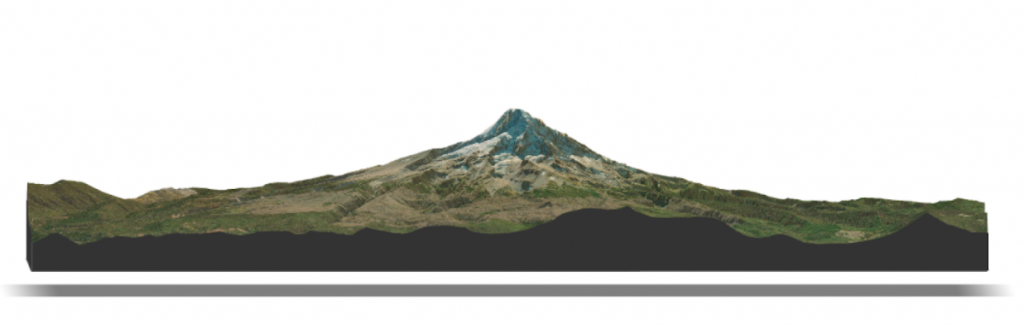
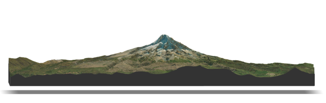
Mount Hood LiDAR and satellite rendering figure. Created by USIP Intern Nat Quinn. 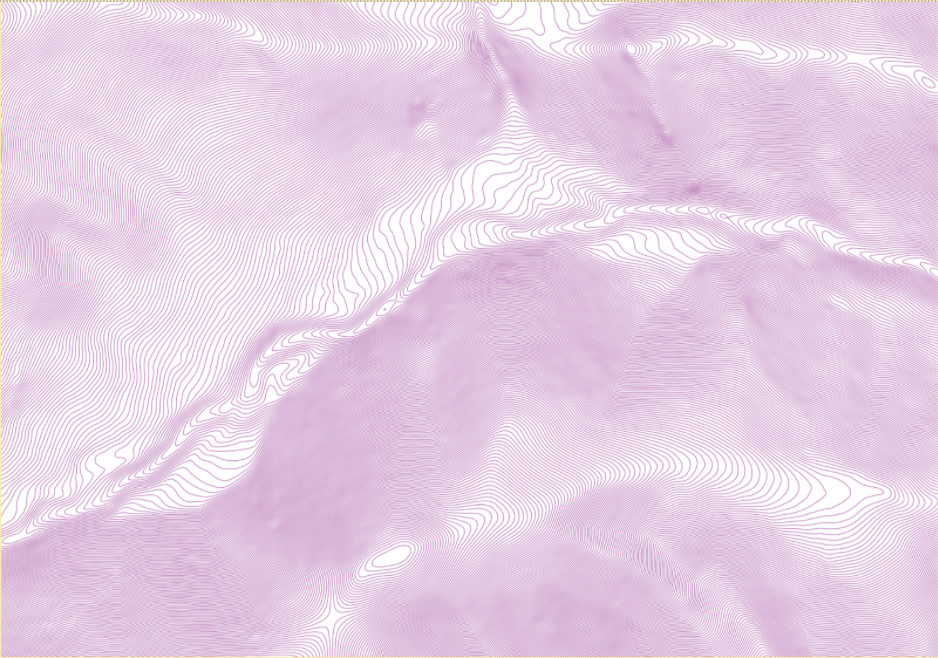
DEM generated 0.5 meter contour lines. Created by USIP Intern Nat Quinn. 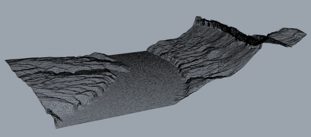
Triangulated three-dimensional mesh. Created by USIP Intern Nat Quinn. 
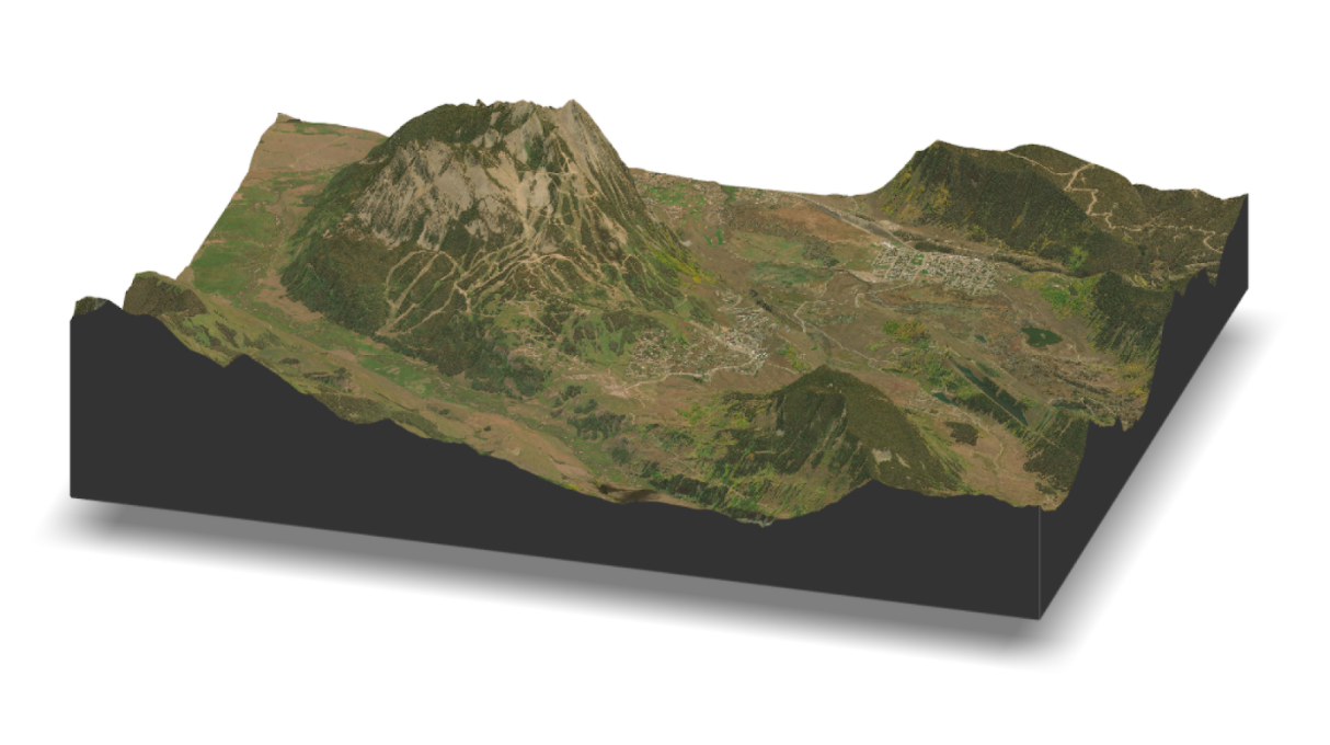
Crested Butte LiDAR and satellite rendering figure. Created by USIP Intern Nat Quinn. 
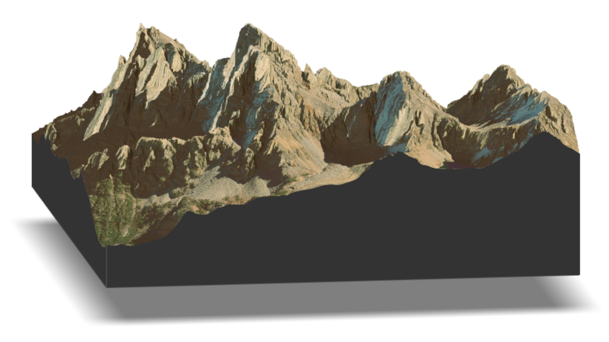
Grand Teton LiDAR and satellite rendering figure. Created by USIP Intern Nat Quinn. 
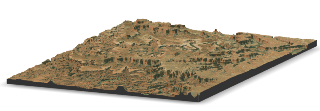
Canyonlands LiDAR and satellite rendering figure. Created by USIP Intern Nat Quinn.

This summer we’re introducing interns in the RESESS, Geo-Launchpad, and USIP programs to shine a spotlight on the projects they are completing throughout these 11-week internships and on their interests in geoscience.
Nathaniel (Nat) Quinn recently graduated with a master’s degree in Data Analysis and Visualization from the Pratt Institute. For his master’s program, his capstone project examined the Clean Water Rule of the Clean Water Act and the changes that had occurred under the Trump Administration. Nat created a series of maps depicting the exact streams that were impacted by a repeal of the Clean Water Rule in 2019, which has since been reinstated. At Colorado College, Nat obtained his bachelor’s degree in environmental science and studio art. His internship this summer with OpenTopography through UNAVCO combines his interests in urban and ecological planning with mapping and landscape rendering. Nat applied to the USIP program in order to obtain experience with LiDAR data and its three-dimensional visualization possibilities, as he had previously been working primarily with two-dimensional visualizations.
Throughout this summer, Nat is working on three different projects, supervised by UNAVCO’s Matt Beckley and Chris Crosby. Firstly, he is creating a tool for OpenTopography that produces elevation contour lines from LiDAR data, which is currently in beta and being tested. He is also making a notebook to visualize LiDAR data, projecting satellite imagery to form a three-dimensional model and rendering of anywhere within the continental United States. The final project is to build three dimensional meshes from LiDAR data so that the information could be opened in any three-dimensional modeling software. As someone who believes that everyone who works with data should understand the amount of energy and skills required to produce and maintain accessible data, Nat welcomes the opportunity to gain this background knowledge and experience.
Q&A
- What has been your favorite part of the USIP program so far?
I really like Chris [Crosby] and Matt [Beckley], who I work with. I work with them every day; I get on a call with them for half an hour every day and check in. I’ve gotten a ton of questions answered and I feel like they’ve been extremely amenable to both the learning process, as well as trying to recognize that when I hit a wall, they can kind of get me through that. Also, just trusting me. I feel like they’ve recognized that obviously the skill sets are being learned and grown as we go but they are also giving me the freedom and are there when I need help.
- Do you feel like you have developed mentorships with Matt Beckley and Chris Crosby? What have you gained from these mentorships?
I would definitely call it a mentorship. I think that it’s interesting watching because they both have slightly different roles within the OpenTopography silo… I think it’s interesting looking at Matt, [who] has just a specialized skill set in a particular geographic world and is very good at that. I appreciate that approach. He’s always able to solve all the issues that come out… Chris just clearly has his fingers in so many different parts of UNAVCO… He certainly understands all of the parts of what’s happening, and is excellent at directing from the leadership, managerial position. I feel like I’ve been able to have a front seat to both of these positions within OpenTopography.
- How does this internship fit into your future goals or help you achieve them?
I mean mine’s been pretty pointed in LiDAR data, that’s all I’ve been working with. I certainly plan to continue to use LiDAR data and this was a pretty great way of getting a basic understanding of a very complex subject, so I think that it certainly helped in a lot of ways getting over… a hump. It’s like you can’t even learn and understand what people are writing about until you get over a certain hump, but I feel like this experience has pushed it in that direction.
Although Nat took a break from landscape architecture to earn his master’s degree, he hopes to return to and pursue a career in landscape architecture and ecological planning. He also aims to improve and expand his skills in building physical models from digital models with the benefit of LiDAR datasets. This summer, Nat is enjoying spending his weekends exploring and camping around the Northeast.
Written by:
- Lucia Bellino, USIP Intern
- Posted: 2 August 2021
- Last updated: 2 August 2021
- Tags: internships, LiDAR, software development
-

