
This summer we’re introducing interns in the RESESS, Geo-Launchpad, and USIP programs to shine a spotlight on the research projects they are completing throughout these 11-week internships and on their interests in geoscience.
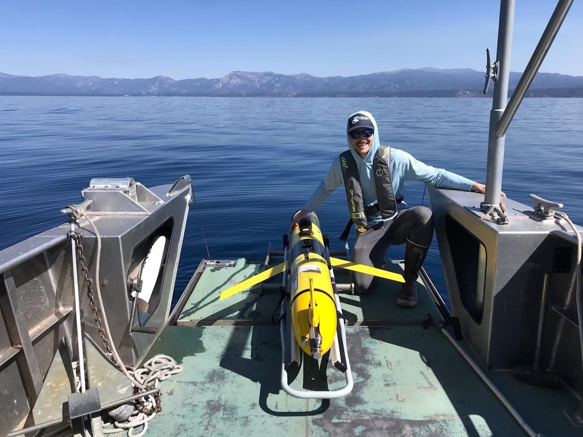
Kenny Larrieu is a PhD student at the University of California, Davis, where he uses autonomous underwater vehicles to study the dynamics of mixing in lakes and their ecological consequences. Kenny grew up in California with an awareness of water scarcity and how critical effective water management is to society. He received his BS in physics, which served as a technical foundation for his graduate studies in hydrologic sciences. For his master’s degree, Kenny modeled the hydrodynamics of rivers applied toward assessment and design of river restoration projects. During one project where he modeled ephemeral rivers, Kenny discovered OpenTopography as a useful source of high-resolution topographic data he could apply to his work. He appreciated that the platform provides open access data and open source tools, and was excited to intern at UNAVCO to learn more about the management and processing of high-resolution topographic data.
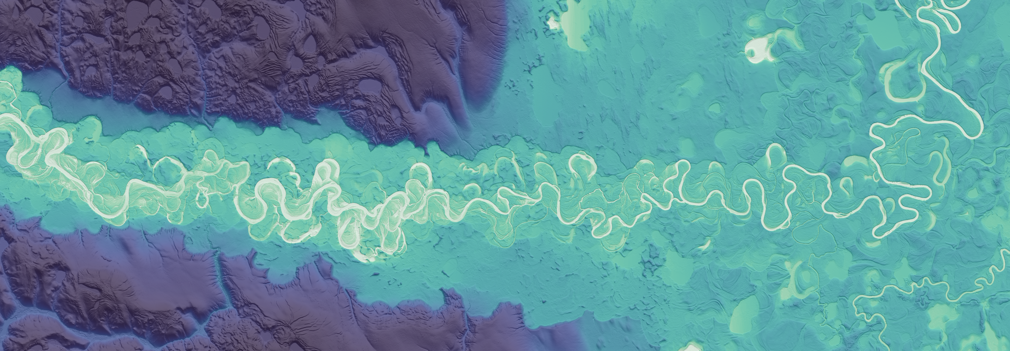
Matt Beckley and Chris Crosby of OpenTopography are mentoring Kenny this summer. Kenny is writing code that processes raster data to create derivative products visualizations. Light detection and ranging (lidar) uses the amount of time it takes for light, in the form of a laser, to return to a sensor in order to obtain information about the surface of the Earth. Lidar records the time and intensity of light reflected, in addition to the location of the data. These data are stored as point clouds, which are very large and therefore unwieldy. Instead, lidar point cloud data can be converted into raster data. Rasters are grids of pixels, with each pixel coinciding with an area of the planet’s surface, and are much more manageable. In addition to overhauling more basic raster visualization routines, Kenny created a Python package that creates river relative elevation models (REMs), which show topographic variations relative to the river locally. REMs can be useful for data analyses studying processes that govern river topography.
Q&A:
- What has been your favorite part of the USIP program so far?
I’ve really enjoyed the team that I’ve been working with and also I think it’s really cool how the code that I’ve been working on and developing has been applied to such large swaths of data. It’s pretty incredible the amount of data that OpenTopography now manages and serves—including the USGS 3DEP data, they now have over 40 trillion lidar points, which is just an insane amount of data. It’s a pretty unique experience. I also really like how my project managers were very receptive to ideas. It’s cool knowing how these tools are going to facilitate that mission of making this data more accessible and usable.
- What have you gained from your mentorship with Matt Beckley and Chris Crosby?
Definitely a lot. I think I’ve learned a ton in terms of technical skills with geospatial data management alone. I’ve also learned more about full stack infrastructure. It’s been really cool to see how code I developed for the backend is brought together with the frontend and how all of these different processes are pieced together to form this one coherent platform that is able to serve up all of this data in a useful way.
- Have you learned about any new topics/research techniques that have really piqued your interest?
It’s made me want to learn more about the variety of different applications of high-resolution geospatial data, in terms of things like machine learning models. Hearing about the variety of different ways people use this data has broadened my horizons regarding the different applications of this data outside of hydrology, where I’m most knowledgeable. There’s just an incredible richness of different ways that the data can be used for all sorts of different disciplines.
After finishing his PhD, Kenny plans to continue combining software development, physics-based modeling, and environmental monitoring in order to better understand natural water bodies. This summer, Kenny is excited to deploy an autonomous underwater vehicle in Lake Tahoe to obtain more data for his PhD research!
Written by:
- Lucia Bellino, USIP Intern
- Posted: 31 August 2022
- Last updated: 5 August 2022
- Tags: coding, internships, LiDAR, OpenTopography, USIP
-

