
Event Response to the October 19, 2020 M 7.6 Sand Point, Alaska Earthquake
A magnitude 7.6 earthquake occurred on October 19, 2020 southeast of Sand Point, Alaska. This is within the footprint of the Network of the Americas (NOTA) GNSS network operated by UNAVCO. The earthquake prompted tsunami warnings in communities across coastal Alaska and caused damage in and around Sand Point.
A magnitude 7.6 earthquake occurred at 20:54:39 UTC (12:54:39 AKDT) on October 19, 2020, 91 km SE of Sand Point, Alaska. For more information, see the USGS Earthquake Hazards Program event page or the Alaska Earthquake Center event page.
The event occured within the Network of the Americas (NOTA) footprint. NOTA is a core component of the NSF Geodetic Facility for the Advancement of Geoscience (GAGE), operated by UNAVCO.
Figures and findings are preliminary and subject to revision.
Acknowledgements
These data are provided by the GAGE Facility, operated by UNAVCO, Inc., with support from the National Science Foundation and the National Aeronautics and Space Administration under NSF Cooperative Agreement EAR-1724794. The Network of the Americas (NOTA) is a core component of the NSF GAGE Facility. To acknowledge use of these data please follow the acknowledgment guidelines.
Did you feel it?
The USGS collects information from people who felt an earthquake and creates maps that show what people experienced and the extent of the damage
Submit a responseHOME
Written by:
- Shelley Olds, Kelsey Russo-Nixon & Kathleen Hodgkinson
- Posted: 19 October 2020
- Last updated: 28 December 2020
-


Did you feel it?
The USGS collects information from people who felt an earthquake and creates maps that show what people experienced and the extent of the damage
Submit a responseOn this page:
RESPONSE DATA
Please contact archive-gps@unavco.org for information on data availability. To request access to these and other RT-GPS stations operated by UNAVCO please send an email request to rtgps@unavco.org.
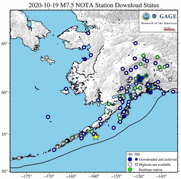
NOTA GPS/GNSS Real Time Data Solutions
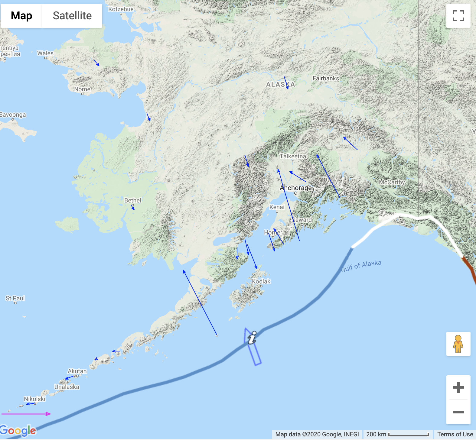
At the time of the earthquake, 25 real-time stations were operating within 1300 km of the epicenter, the approximate radius where dynamic displacements were expected to be greater than 2 cm given the magnitude and death of the earthquake. UNAVCO operates a network of real-time station in the region as part of NOTA. Real-time stations continuously stream high rate (1-sps / 1 Hz) data to the GAGE data center. Typical latencies for real-time stations, the time difference between and observation being recorded on the receiver and it arriving in Boulder, Colorado are less than 1 second.
NOTA GPS/GNSS High-Rate Data for Post Processing
UNAVCO is downloading 1- and 5-sps (1 and 5 Hz) data from all NOTA GPS/GNSS stations within 1300 km of the epicenter where it is available. These data will be available in RINEX format from the UNAVCO high-rate data ftp site.
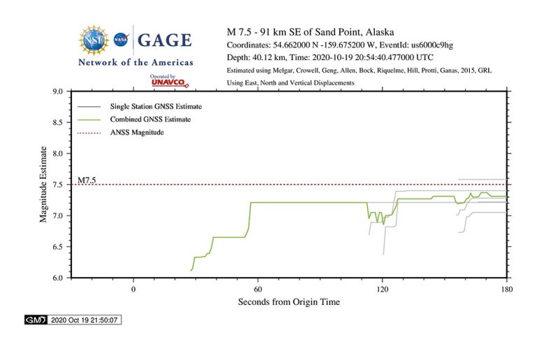
GAGE GPS/GNSS Displacement Estimates
The GAGE AC (MIT) inspects the NOTA GPS/GNSS daily positions for significant offsets when they have two to three days of post-event data. Any detected offsets will be posted to UNAVCO’s event directory when they become available.
NOTA Borehole Strainmeter Data
UNAVCO will produce a fully processed 1-sps borehole strainmeter (BSM) dataset for this event. This dataset can be downloaded from the UNAVCO Geophysical Event Data page when it becomes available.
Educational Materials
GPS Velocity Viewer
Discover plate motions, recent earthquake locations, plate boundary locations and volcanic centers.
More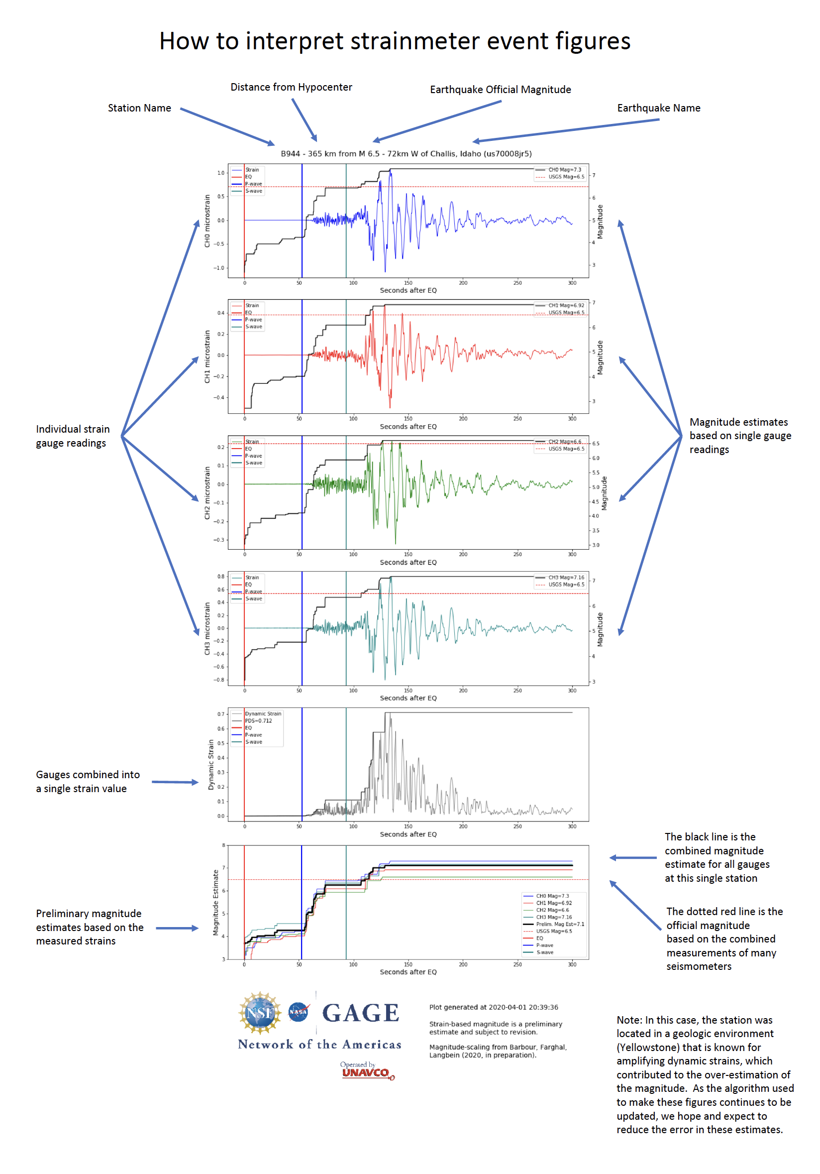
Geophysical Event Response Data Explainer: Dynamic Strain
Learn about strainmeter instruments and what strainmeter data tell us about a particular earthquake.
More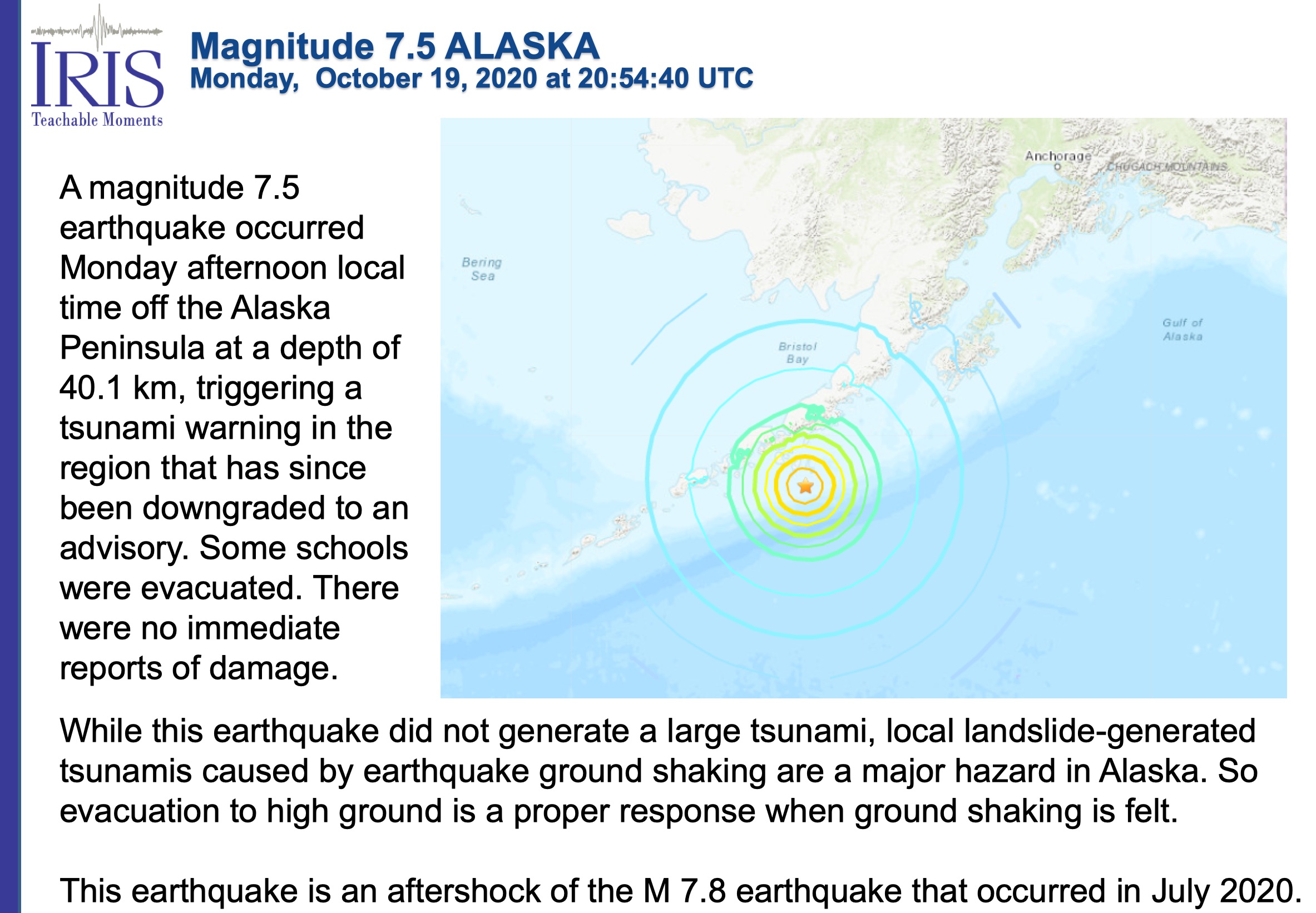
Teachable Moment Classroom Presentation
Summary for educators of the Sand Point, Alaska earthquake
More