April 2021 eruption of Soufrière St. Vincent
Event response pages are a service to help coordinate community science after an earthquake or other notable geophysical event by collecting relevant data. Findings and figures are preliminary and subject to revision.
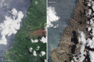
Following several months of elevated activity—including the appearance and growth of a new lava dome—Soufrière St. Vincent (also known as La Soufrière) started an explosive phase of eruptions on April 9. The Saint Lucia National Emergency Management Organisation reported that 12,775 people had been displaced as of April 19, with no casualties. According to the Smithsonian Institution’s Global Volcanism Program, Soufrière St. Vincent is an andesite-basalt stratovolcano on St. Vincent Island with recorded eruptions going back to 1718. During the April 9 eruption, ash reached an altitude of 8 kilometers. Additional explosive eruptions have followed, including pyroclastic flows and lahars.
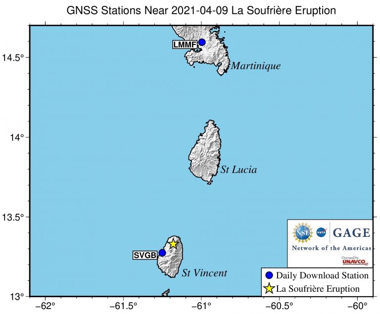
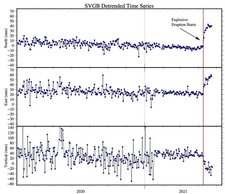
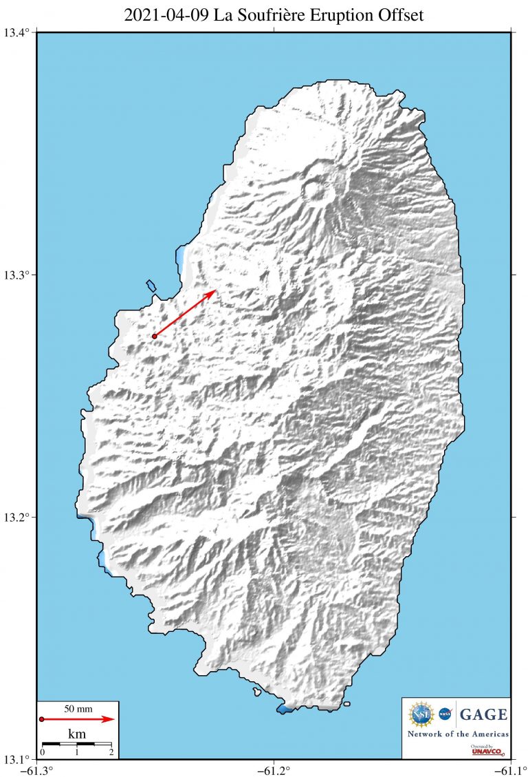
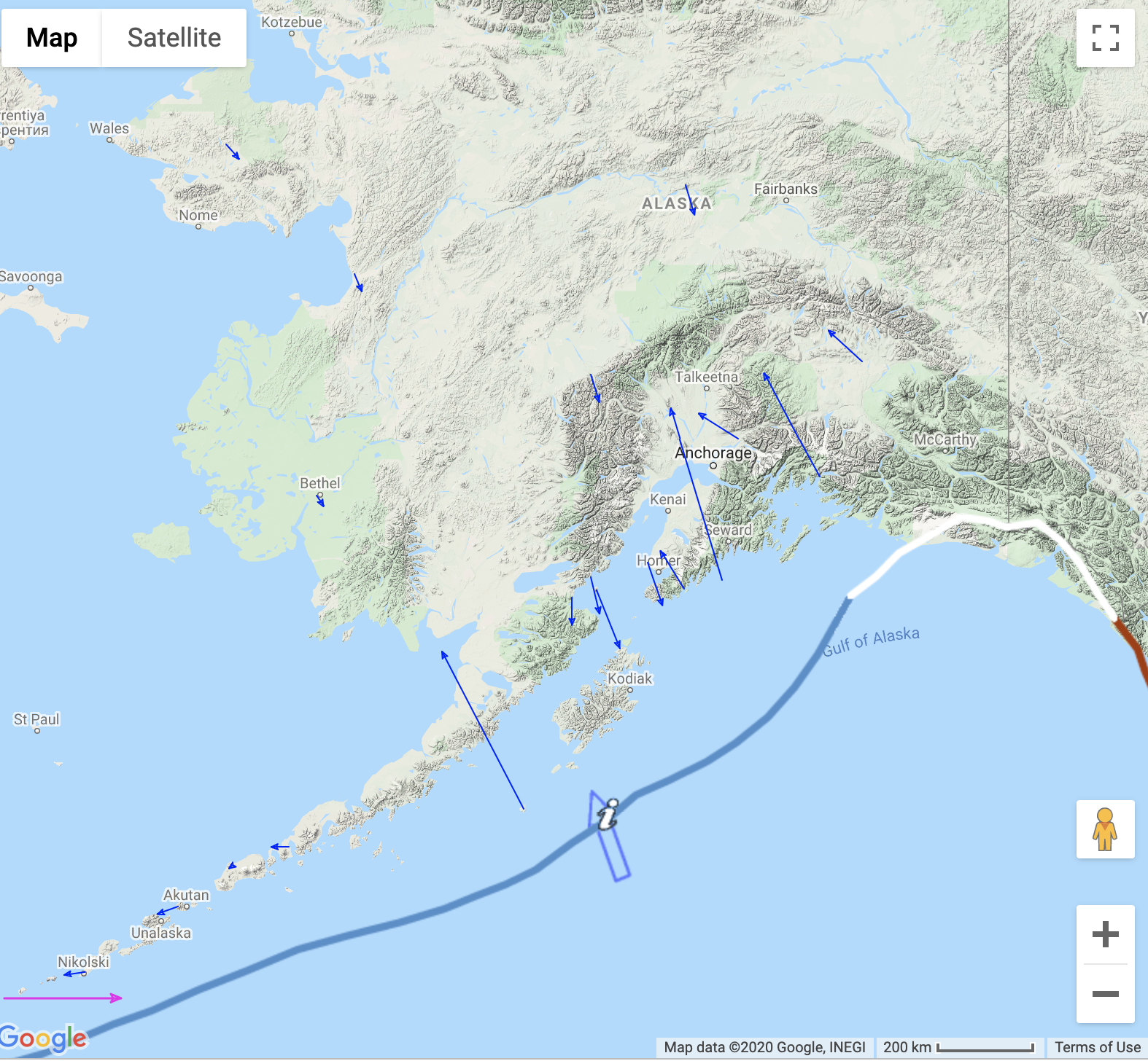
GPS station SVGB—which contributes data to the Network of the Americas—is located on St. Vincent Island as part of a continuous network operated by the University of the West Indies Seismic Research Center. Their analysis of the full network notes: “Since the initial depressurization noted immediately following the April 9 explosive phase, the continuous GPS network has recorded a decrease in the overall rates of horizontal and vertical movement.” A detrended daily time series for SVGB is plotted below, including data through April 24.
These data are provided by the Geodetic Facility for the Advancement of Geoscience (GAGE) Facility, operated by UNAVCO, Inc. with support from the National Science Foundation and the National Aeronautics and Space Administration under NSF Cooperative Agreement EAR-1724794. To acknowledge use of these data please follow the acknowledgment guidelines.
Did you feel it?
The USGS collects information from people who felt an earthquake and creates maps that show what people experienced and the extent of the damage
Submit a responseHOME
Written by:
- Scott K. Johnson
- Posted: 28 April 2021
- Last updated: 7 November 2022
-


Did you feel it?
The USGS collects information from people who felt an earthquake and creates maps that show what people experienced and the extent of the damage
Submit a responseOn this page:
Response Data
Please contact archive-gps@unavco.org for information on data availability.
GPS/GNSS Data
GNSS data access tools can be found here.
Educational Materials
GPS Velocity Viewer
Discover plate motions, recent earthquake locations, plate boundary locations, and volcanic centers.
More