)
2007 Short Courses Archive
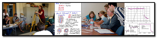
In response to community requests and interest, UNAVCO provides an annual series of short courses focussed on UNAVCO tools and data streams. These courses are for current researchers who want to refresh their skills or explore the use of new tools, and for early career scientists such as post doctoral fellows, graduate students, and upper level undergraduates who want to learn the latest geodetic techniques.
Short Course Materials
Course Materials from previous short courses.
2007
Processing and Analysis of GeoEarthscope and Other Community LiDAR Topography Datasets
October 27, 2007
Geological Society of America Annual Meeting & Exposition: Denver, CO
Ramon Arrowsmith, Arizona State University; Chris Crosby, Arizona State University; David Phillips, UNAVCO
LiDAR—Light, Distance, and Ranging (also Airborne Laser Swath Mapping-ALSM) topographic data are of broad interest to earth scientists. Many datasets are or will be available freely to the scientific community, especially for fault systems in the western United States via the GeoEarthscope project. These data have exciting and powerful applications in geomorphology, active tectonics, and geoscience education. Participants in this course will learn about LiDAR technology, access to publicly available datasets, software and hardware considerations for working with the data, data processing (raw or classified point clouds, digital elevation models, other derived products), and approaches for analyzing the data to answer their research questions.
Teacher (Grades 6 - 12) Development Courses:
-
Explore Plate Tectonics Using GPS Data
March 2, 2007
Coalition for Earth System Education Meeting "Earth System Science for All Ages"
Boulder, Colorado
Poster Session (middle and high school teachers)
-
Using EarthScope data in the classroom
March 27, 2007: 3-7 pm
EarthScope National Meeting
Monterey, California
Workshop (Middle and high school teachers): This 1/2 day professional development session will focus on the use of EarthScope data in the classroom for middle and high school teachers. The session will include the presentation of EarthScope science content and modeling of classroom activities by UNAVCO and IRIS staff and consortium members.
-
Bringing EarthScope Research into the Undergraduate Classroom
March 29, 2007: 10:30 am - 12:30 pm
EarthScope National Meeting
Monterey, California
Poster session (Undergraduate faculty): This session will allow participants to share their experiences—ranging from tried-and-true exercises to fresh, untested new ideas—on the use of EarthScope-related data and results into the undergraduate science classroom. We invite participants to contribute a poster focused on educational applications of EarthScope science, and to bring along a lab exercise, homework problem, or new idea for using EarthScope data in the classroom. Computer-based and internet exercises are particularly welcome.
-
Exploring Plate Tectonics Using the Global Positioning System (GPS)
March 31, 2007: 5-6 pm
National Science Teachers Association National Conference
St. Louis, Missouri
Short course for secondary education teachers: A variety of Earth processes—earthquakes, volcanic eruptions, and mountain building—occur at tectonic plate boundaries, and each causes Earth’s crust to deform. Come learn how earth scientists use Global Positioning System (GPS) to measure this deformation.
-
Exploring Plate Tectonics Using GPS Data
June 19-22, 2007
21st Annual Technology in Education (TIE) Conference
Copper Mountain, Colorado
Workshop for secondary education teachers: Through computer-based, hands-on, and kinesthetic exercises, join us in exploring how to make plate tectonics come alive for students. Using real high-precision GPS data and data exploration tools such as EarthsScope Voyager and Jules Vern Voyager Jr., learn some of the techniques that scientists utilize to study the movement of tectonic plates, how the plates deform during and after earthquakes, and other motions such as volcanic deformation and glacial movement. We’ll provide activities you can use in your classrooms to supplement your plate tectonic curriculum so that students can describe spatial relationship between earthquakes, volcanoes, and plate boundaries.
-
Using GPS Data to Learn about Tectonic Plate Movement, Earthquakes, Volcanoes, and other Applications: A Workshop for Educators in Secondary Education*
October 28, 2007: 1-5 pm
Geological Society of America Annual Meeting & Exposition: Denver, CO
Susan C. Eriksson, UNAVCO; Shelley E. Olds, UNAVCO
This course is geared toward educators in middle and high schools who teach earth science or a science course in which plate tectonics is a topic. Educators will be introduced to place-based, data-rich educational materials about global positioning system (GPS) and plate tectonics to use in their classrooms, receive an introduction to high-precision GPS, and have the opportunity to discuss pedagogical strategies for classroom implementation. Anticipated topics include faulting along the San Andreas fault, monitoring volcano deformation, and recent advances in researching slow earthquakes in Cascadia. Although individuals with GPS experience are welcome, knowledge of GPS is not required. Participants are encouraged but not required to bring a laptop computer.
Limit: 20. Fee: US$41; includes course materials and refreshments. CEU: 0.4
Short Course (Middle and high school teachers)
-
Explore Plate Tectonics Using GPS Data
November 9, 2007: 5–6 pm
National Science Teachers Association 2007 Western Area Conference: Denver, CO
Susan Eriksson, UNAVCO; Shelley E. Olds, UNAVCO
Explore current techniques to study plate tectonics and plate movement and discuss strategies for integrating modern research into your teaching. Classroom materials provided.
GRADE LEVEL: Middle Level-High School
-
Using EarthScope Data in the Classroom
November 15, 2007: 8-11 am
Conference for the Advancement of Science Teaching: Austin, TX
Susan Eriksson, UNAVCO; Shelley Olds, UNAVCO; John Taber, IRIS
Come learn how your students can access GPS and seismic data over the Internet from the largest ever Earth science experiment. The data can be used in the classroom to discover the processes underlying tectonic plate motions and to understand Earth structure.
Geoscience Educators’ Social Reception – Everyone is Welcome!
GSA Annual Meeting 2007
October 27, 2007: 5-7 pm
Colorado Convention Center, Hall F Prefunction
Co-hosted by: The Geological Society of America Education Committee, National Association of Geoscience Teachers, and the GSA Division of Geoscience Education.
Sponsored by: IRIS Consortium, Digital Library for Earth System Education, Cutting Edge, EarthScope, UNAVCO, American Geological Institute, and National Earth Science Teachers Association.
Coordinated by: The GSA Education and Outreach Department.
Last modified: 2019-12-24 01:25:56 America/Denver