
August 14, 2021 M 7.2 Haiti Earthquake
Event response pages are a service to help coordinate community science after an earthquake or other notable geophysical event by collecting relevant data. Findings and figures are preliminary and subject to revision.
The UNAVCO team sends our sympathy to the people of Haiti. We’re driven in our mission to measure and study the Earth by the hope that our work will ultimately lead to communities that are more resilient to geologic hazards.
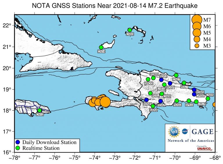
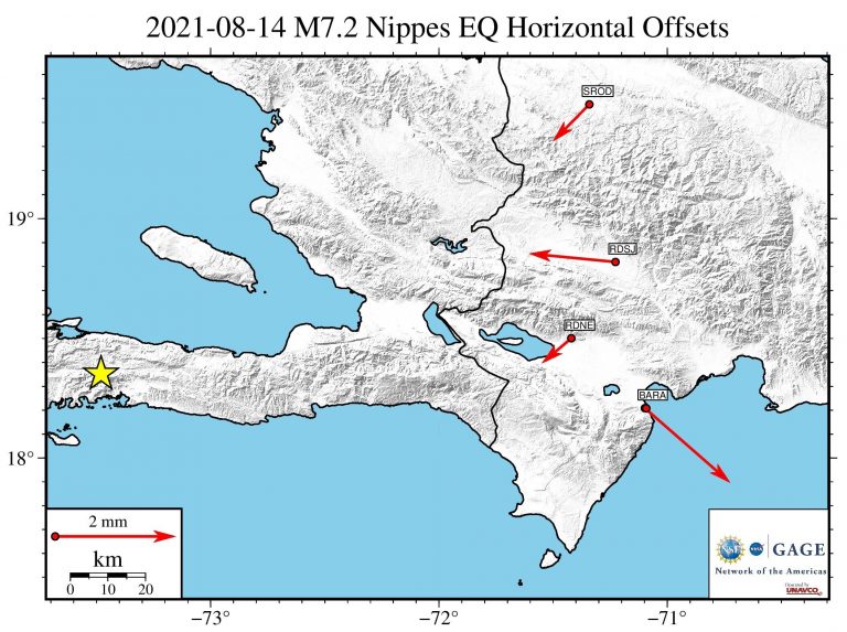
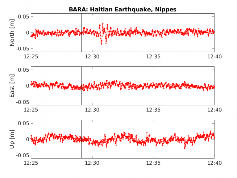
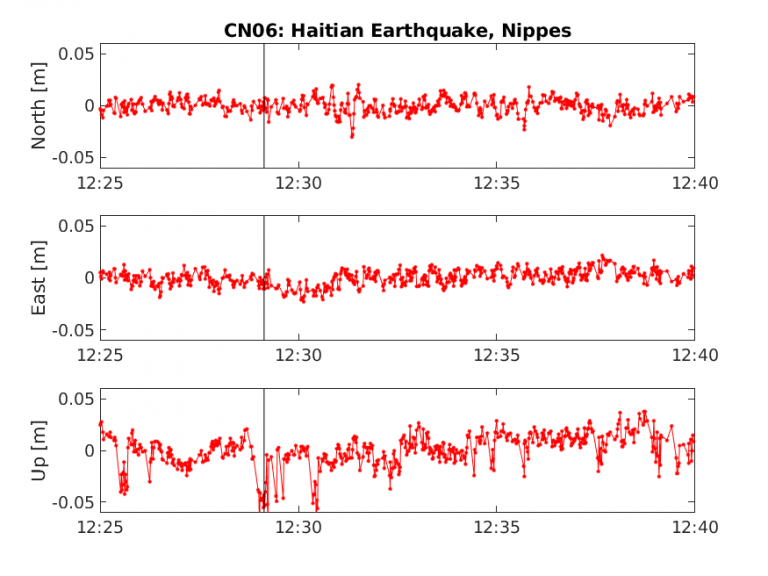
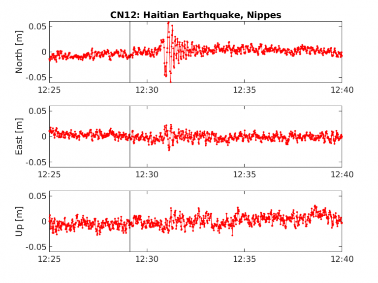
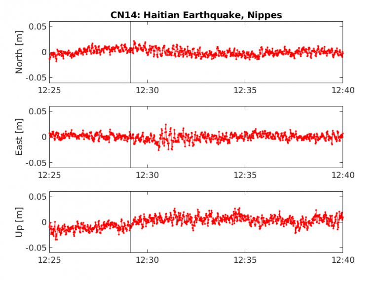
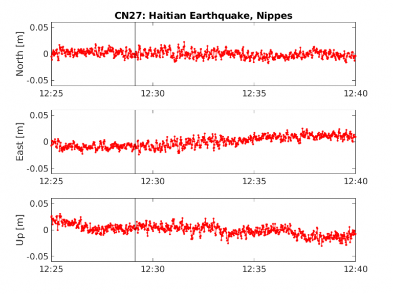
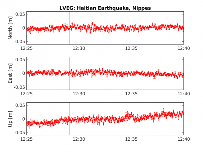
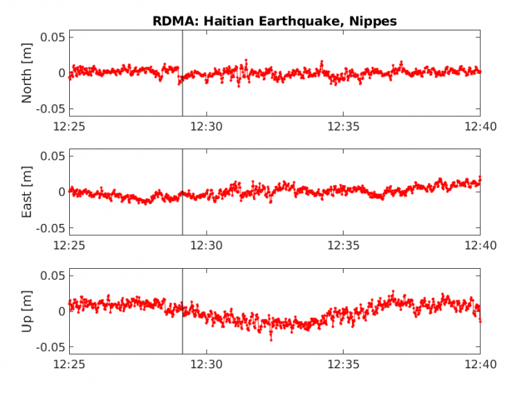
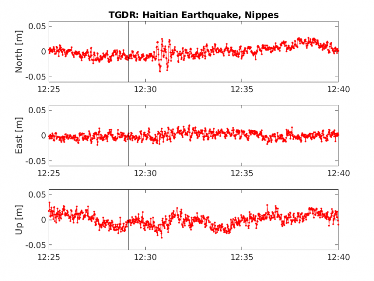
At 12:29:09 (UTC) on August 14, a shallow magnitude 7.2 earthquake occurred 12 kilometers northeast of Saint-Louis du Sud in Haiti, with oblique reverse motion on the fault. The event occurred within the footprint of the Network of the Americas (NOTA), a network of continuous GPS/GNSS stations and borehole instruments operated by UNAVCO that monitors plate motion and transient deformation, in addition to other applications. For more information about the earthquake, see the USGS Earthquake Hazards Program event page.
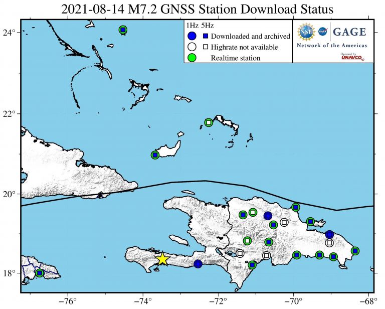
Stations Downloaded
This list of stations will be updated as high-rate data is downloaded and archived.
| Station | Distance km) | 1 Hz | 5 Hz |
|---|---|---|---|
| JME2 | 101 | X | X |
| RDNE | 218 | ||
| RDSJ | 243 | X | |
| BARA | 253 | X | X |
| SROD | 258 | ||
| RDMA | 285 | no | no |
| CN14 | 291 | X | X |
| RDAZ | 292 | ||
| CN06 | 302 | X | X |
| RDF2 | 319 | X | X |
| LVEG | 326 | X | X |
| CN12 | 348 | X | X |
| RDSF | 356 | no | no |
| RDSD | 377 | X | X |
| CN27 | 400 | X | X |
| CN53 | 401 | ||
| RDLT | 428 | X | X |
| SPED | 441 | X | X |
| CRSE | 471 | ||
| RDMS | 473 | X | X |
| CRLR | 480 | X | X |
| CN05 | 542 | X | X |
| CN13 | 642 | X | X |
Last updated 9/30/2021
Did you feel it?
The USGS collects information from people who felt an earthquake and creates maps that show what people experienced and the extent of the damage
Submit a responseHOME
Written by:
- Scott K. Johnson
- Posted: 14 August 2021
- Last updated: 7 November 2022
-


Did you feel it?
The USGS collects information from people who felt an earthquake and creates maps that show what people experienced and the extent of the damage
Submit a responseOn this page:
Response Data
Please contact archive-gps@unavco.org for information on data availability. To request access to these and other RT-GPS stations operated by UNAVCO please send an email request to rtgps@unavco.org.
NOTA GPS/GNSS Data
GNSS data access tools can be found here. The Event Data Access notebook can be used to locate stations nearest this event.
Borehole Strain Data
High-rate data from borehole strainmeters can be accessed here.
Educational Materials
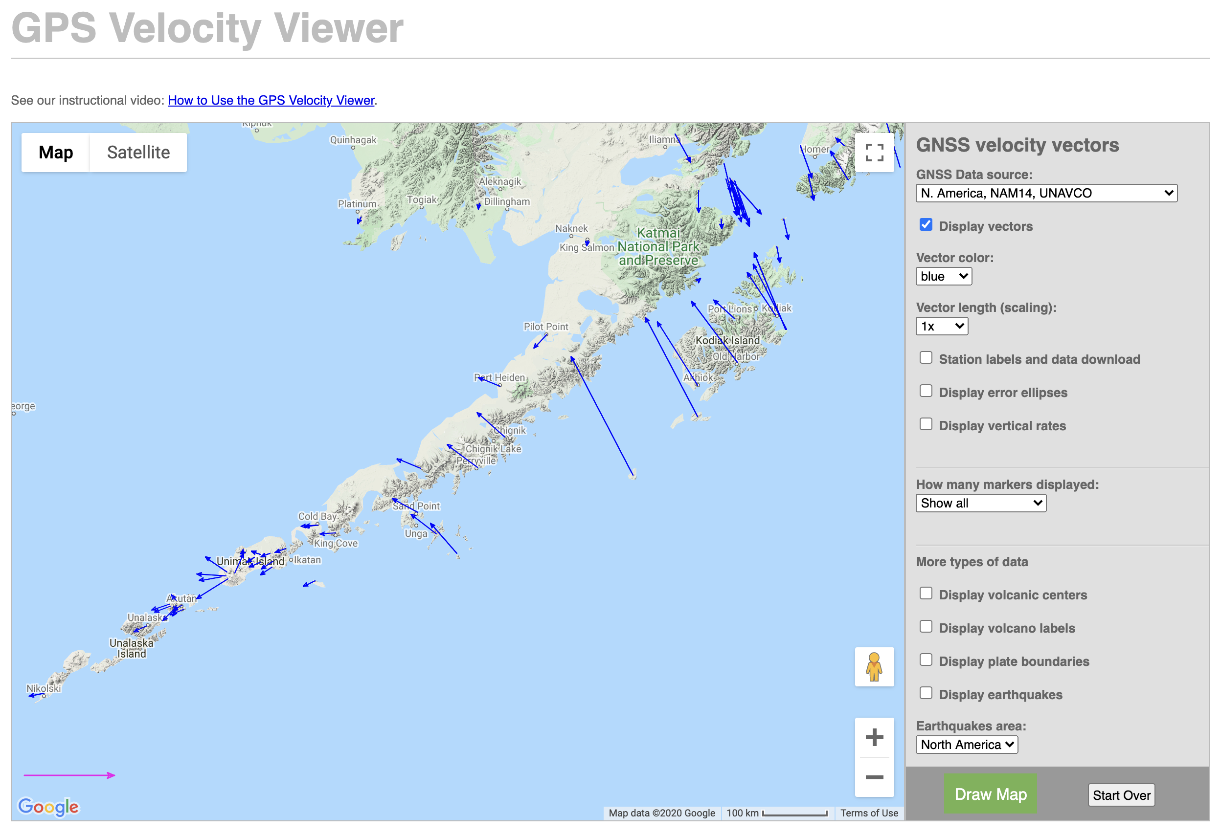
GPS Velocity Viewer
Discover plate motions, recent earthquake locations, plate boundary locations, and volcanic centers.
More