
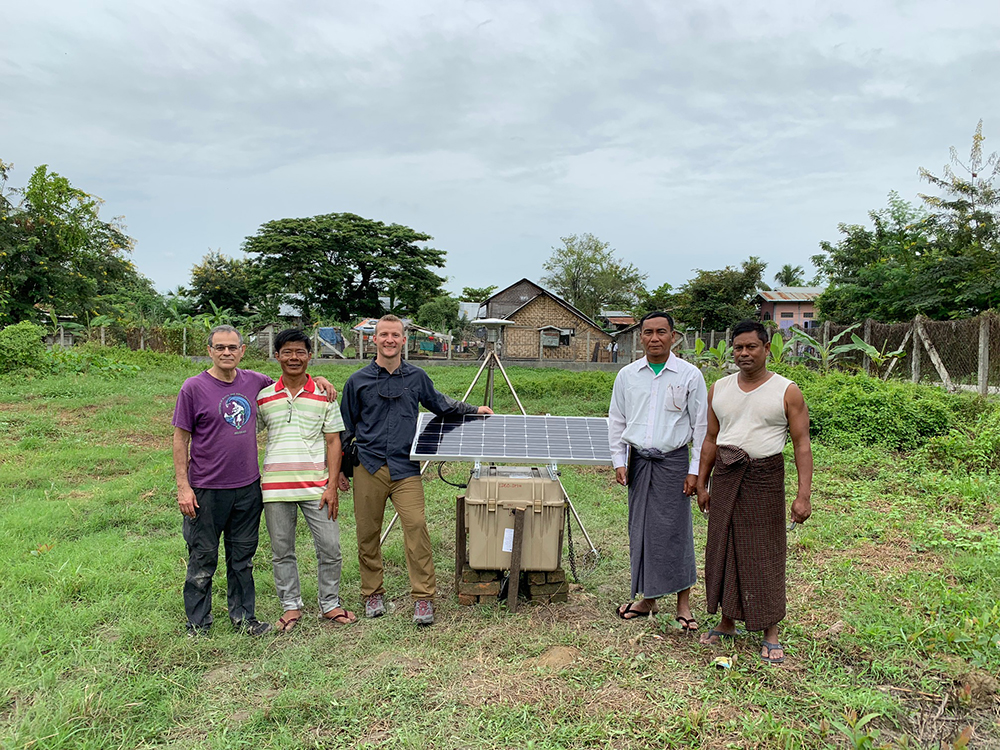
The first cGPS site (KALY) located at the Kalay DMH office. (Photo/Keith Williams, UNAVCO) 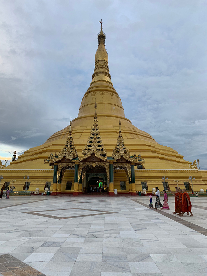
The Uppātasanti Pagoda in Naypyidaw, the capital of Myanmar. (Photo/Keith Williams, UNAVCO) 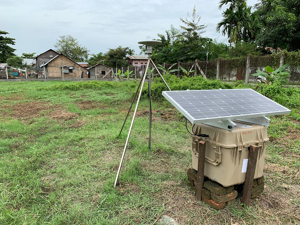
The enclosure for KALY was placed on a raised platform as this area is prone to shallow flooding during the monsoon season. (Photo/Keith Williams, UNAVCO) 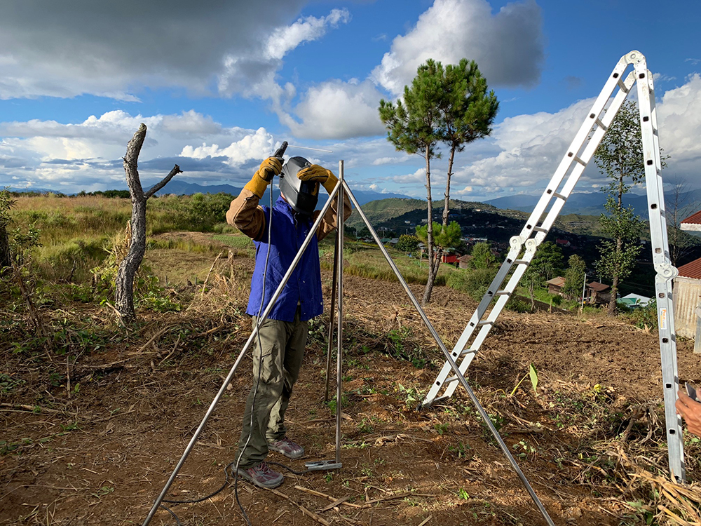
Keith Williams welding the rods into a stable platform to mount the cGPS antenna. (Photo/Michael Steckler, LDEO) 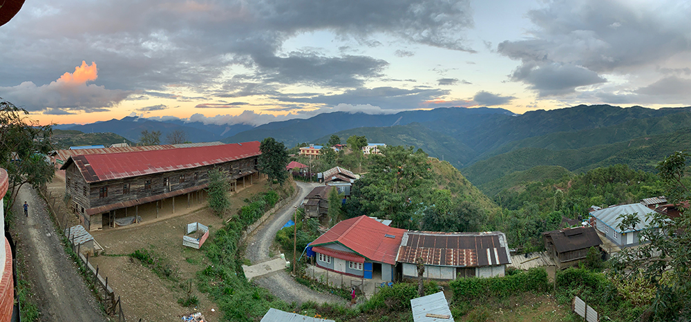
Views from the hotel balcony in Tedim made up for the lack of hot water. (Photo/Keith Williams, UNAVCO) 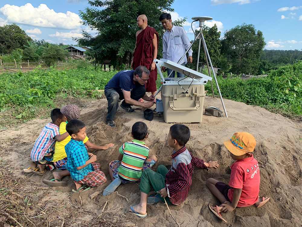
Mike Steckler builds the connector on the end of the antenna cable as observers watch. (Photo/Keith Williams, UNAVCO) 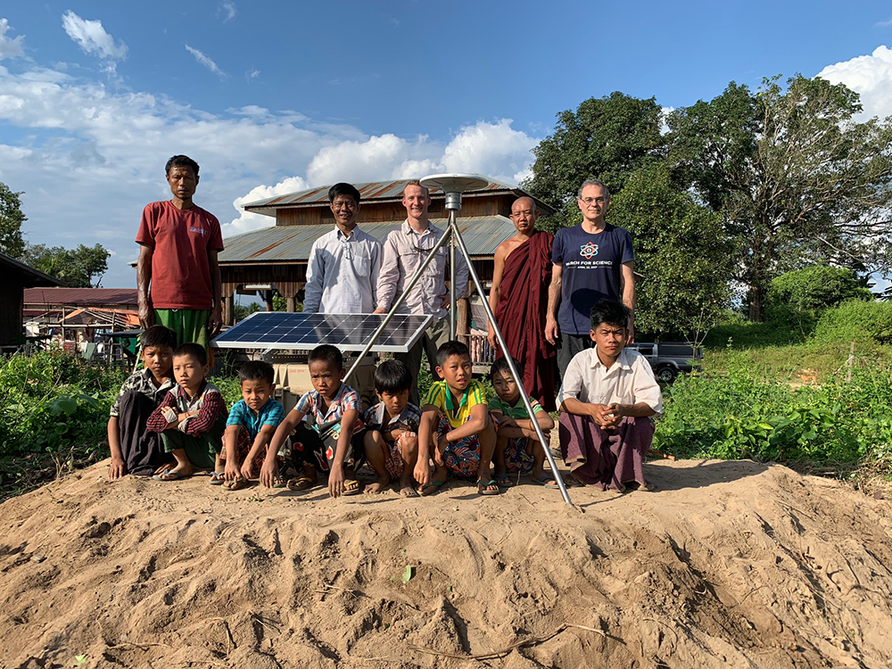
THKG cGPS site installed at a Buddhist monastery in Thickegyin. (Photo/contributed by project team) 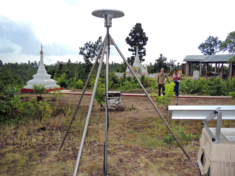
New cGPS station THKK. (Photo/Michael Steckler, LDEO) 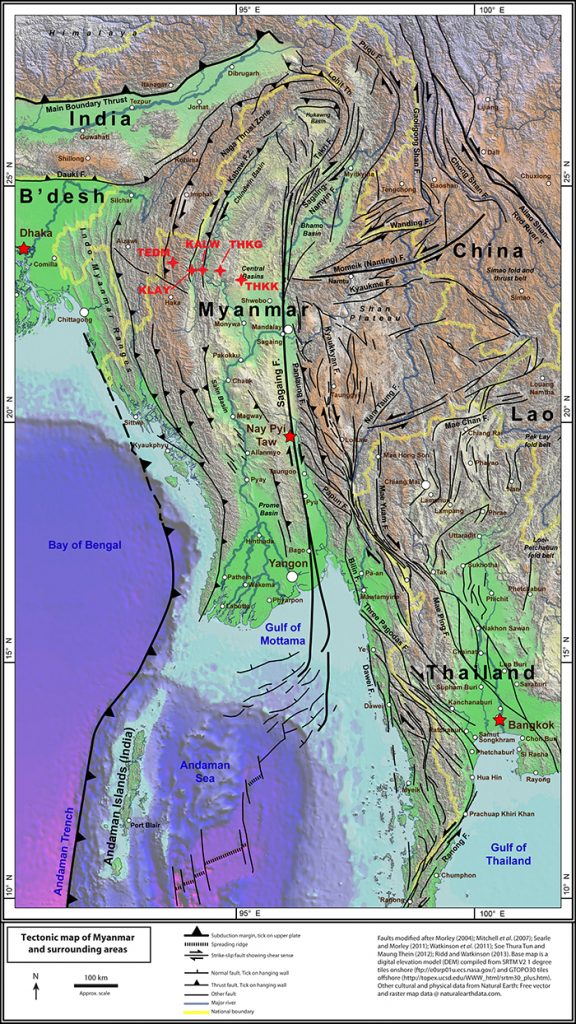
Regional tectonic setting, modified to show the five new cGPS stations installed on this trip. For the full-resolution map and full references, Related Links.
Summary of Work
Continuing previous work in Bangladesh, Michael Steckler (LDEO) and Keith Williams (UNAVCO) arrived back in Myanmar in late October of 2018 to begin the installation of five additional cGPS sites with collaborators. The larger project entails installation of a transect of cGPS stations and seismometers spanning Bangladesh, India, and Myanmar (see previous Tripartite Highlight). The five stations were installed successfully over 11 days. New stations include KALW, KLAY, TEDM, THKG, and THKK. Each station is comprised of a Trimble NetR9 receiver and Trimble Zephyr Geodetic 3 antenna, on a pounded shallow braced monument. Data will be available via the UNAVCO Data Archive after a two-year exclusivity period for project investigators.
On the Ground
The Benefits of Being Flexible
The team’s arrival was on the last day of the Thadingyut Festival, which is a public holiday; the Department of Meteorology and Hydrology (DMH) offices, where project collaborators are based and project equipment was stored, were closed. This allowed Keith and Mike a little rest after the long flights to Myanmar, the opportunity to acquire hardware for installs from shops that remained open, and a visit to the 325 ft tall Uppātasanti Pagoda in Naypyidaw that was finished in March of 2009 (Figure 2).
An Ambitious and Changeable Plan
The following day the work began. Most of the equipment (12-ft stainless steel rods, batteries, and generator) were sent by bus to Kalay to the local DMH office, which was to be the central hub for the station installs. Kalay was also the location of the first site, which went in with no troubles (Figures 1 and 3). After that install, however, weather modified the group’s plans and they traveled east to Kalewa to avoid rain while traveling up the steep mountain road in the west.
Kalewa proved to be the most troublesome site. Five people took turns pounding the stainless steel rods for the GNSS monument into hard ground, with each blow only gaining about 1-2mm of penetration. The Kalewa install was finished just after sunset, and the team drove the 1.5 hours back to Kalay that night to restock for the trip west.
The next site, Tedim, was a 3.5-hour drive through the Chin Hills climbing to over 2000 m elevation. Work began on an install at the local DMH office after the group found a hotel and some lunch. The sun set with about an hour of work remaining, so the crew finished quickly the next morning before driving back to Kalay to again restock, for the last two sites.
After a three-hour drive east to a monastery in Thickegyin, the team sat down with the head monk to obtain permission to install the site. Thickegyin was the antedote to the challenging and tiring install at Kalewa; the substrate in around the area was of a beach sand consistency. The stainless steel monument rods were able to be pushed into the ground by hand, with only a foot or two’s worth of light pounding to get them to the height desired for the monument.
With the Thickegyin station installed, the team continued further east over poor roads, finally arriving in Taze where they spent the night. The last site was at a monastery overlooking the Irrawaddy Valley; after coffee, tea, and snacks with the monks they installed the site and began the two-day drive back to Naypyidaw, having completed the five installs.
Project Future
This trip completes the multi-year, multi-country GPS transect project installation.
Project Information
- Principal Investigator(s): Michael Steckler, James Gaherty, Leonardo Seeber, Yue Cai and W. Roger Buck, Lamont-Doherty Earth Observatory, Columbia University; Eric Sandvol, University of Missouri; Patricia Persaud, LSU; James Ni, NMSU; and Doug Prose, Earth Images Foundation
- UNAVCO Staff: Keith Williams
- Dates: October 22 – November 9, 2018
- Location: Western Myanmar (map)
- Funding Source: NSF-EAR: Integrated Earth Systems, Award No. 1714892
Related Links
Previous Highlight:
Project Page:
Mike Steckler’s State of the Planet blog posts:
- Installing GPS in Myanmar to study earthquakes (Oct 27)
- To Kale for the First GPS Station (Oct 30)
- Our Next Sets of GPS in Kalewa and Tedim (Nov 3)
- Finishing the GPS Scouting (Feb 14th)
- From Catholic Churches to Buddhist Monasteries, the Work Continued (Nov 6)
- I Switch to Installing Seismometers (Nov 10)
- End of Our Fieldwork and Mandalay Hill (Nov 12)
Reference Publications:
Other:
Written by:
- Keith Williams
- Posted: 12 April 2019
- Last updated: 4 June 2021
- Tags: GPS/GNSS, project highlights
-

