
Subduction Below Extreme Sedimentation: Multidisciplinary Transect from the Ganges-Brahmaputra Delta to the IndoBurma Backarc

Dhaka University student Sanju working so diligently that a tea break was carried to the roof. (Photo/Keith Williams, UNAVCO) 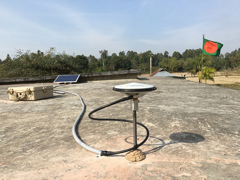
View looking north of site SSPS. (Photo/Keith Williams, UNAVCO) 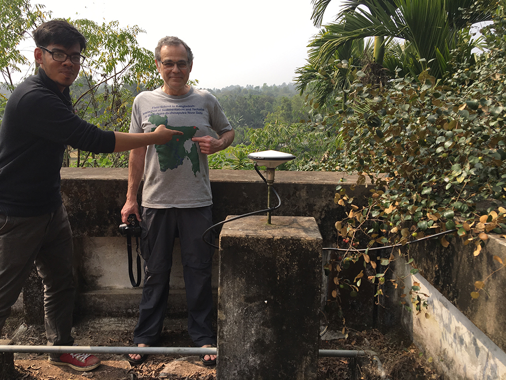
Dhaka University student Sanju pointing to where we are at on PI Michael Stekler’s shirt. (Photo/Keith Williams, UNAVCO) 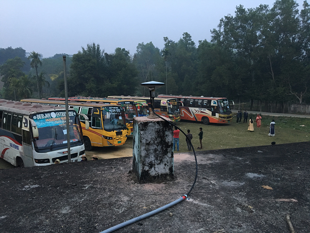
Buses parked at DCPS cGPS site for a ceremony. (Photo/Keith Williams, UNAVCO) 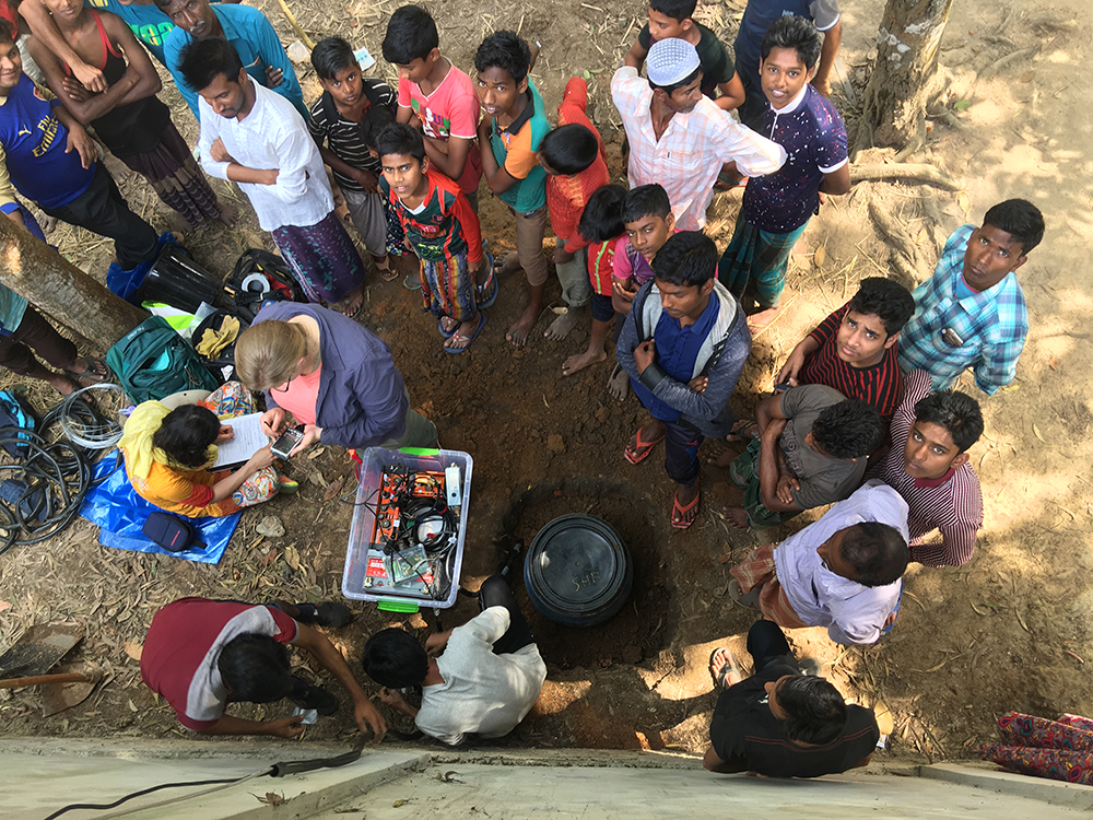
Seismometer install with a group of onlookers. (Photo/Leonardo Seeber)
Overview
UNAVCO has been supporting NSF-funded GPS observations in the Ganges-Brahmaputa Delta of Bangladesh since 2003. GPS position estimates collected from the deployed instruments have provided evidence that there is 13-17 mm shortening across this region per year. Initially, it was proposed that the GPS-constrained surface strain could be resolved on a horizontal, strike-slip fault, but additional analysis suggests that this the strain is more likely related to locking along a plate interface or mega thrust fault (Steckler et al., 2016).
To gain a better understanding of the underlying fault system and the entire IndoBurman subduction zone, researchers are installing a large broadband seismic array across Bangladesh, India, and into Myanmar. In addition, cGPS has been installed within the array to better determine the surface deformation across the entire system. In Bangladesh the seismometers were spaced at 5-10km to image shallow as well as deep crustal features, and six continuous GPS (cGPS) station were installed along a 100km portion of this array.
Significance
Bangladesh is a very densely populated region with much of the population residing on soft delta sediments. Recent studies have shown that this area, with a population of 160 million, could be at risk of at least a Mw8.2 earthquake. The delta is depressing the underlying crust with 16-20km of sediment; this sediment will likely amplify low frequency ground shaking, which can lead to liquefaction and strong surface shaking that can destroy buildings. A better understanding of this earthquake potential should help to guide policy on building construction to minimize the damage caused to new construction.
Research is ongoing to understand the growth and development of the IndoBurman subduction zone, which is the only subduction zone that is entirely on land due to its extreme amount of sediments. There is evidence of a moderate Mw7 or a large Mw8.5 that caused a 20km shift of the Meghna River to the west, constrained by dating of the river sediments deposited before the shift to within the last 3600-3800 years.
Challenges
Proposed locations for the six cGPS sites had been selected during the early planning stages of the project using satellite imagery and seismic maps of the region. cGPS site locations were established along the seismometer array to provide the best constraints on the geological structure. They were positioned to lie on different structural settings on the train of anticlines and synclines in the IndoBurman ranges composed of folded sediments of the delta. These poject goals constrained station locations to within a range of several kilometers. Due to very dense vegetation in the area, and intermittent cellular service to transmit data back to UNAVCO, a good deal of scouting was done for each site. We were very fortunate to find that the Bangladesh primary schools were well constructed reinforced concrete buildings, and typically had soccer fields around them that kept vegetation at bay. One of the sites, JURI, had been installed in early 2007; this site was placed on a three story building that had all vegetation around it cleared in the construction of the building. Returning just over ten years later, we found that a number of trees had grown up over the top of the building and the old antenna location was entirely covered. We were able to have all of the trees removed to be able to reoccupy this site, and the building owner will continue to keep the vegetation trimmed back.
Project Information
- Principal Investigator(s): Michael Steckler, James Gaherty, Leonardo Seeber, Yue Cai and W. Roger Buck, Lamont-Doherty Earth Observatory, Columbia University; Eric Sandvol, University of Missouri; Patricia Persaud, LSU; James Ni, NMSU; and Doug Prose, Earth Images Foundation
- UNAVCO Engineer(s): Keith Williams
- Dates: February 1-16, 2018
- Location(s): Near Sreemangal, Bangladesh (map)
- Funding Source: NSF-EAR: Integrated Earth Systems
Related Links
Project Page:
Mike Steckler’s State of the Planet blog posts:
- Fellowship of the Seismometers (Feb 8th)
- Installing the First Two GPS Sites (Feb 9th)
- Primary Schools to the Rescue (Feb 11th)
- Finishing the GPS Scouting (Feb 14th)
- Transition to Seismology Scouting (Feb 18th)
- Installing the seismometer array (Feb 22)
- Finishing Up in Bangladesh (Feb 24)
Reference Publications:
Written by:
- Keith Williams
- Posted: 21 December 2018
- Last updated: 4 June 2021
- Tags: GPS/GNSS, project highlights
-

