
The GAGE Facility provides Terrestrial Laser Scanning (TLS) support to Earth science researchers in the community. We maintain a pool of TLS scanners, as well as supporting field equipment (e.g., GPS systems, tripods), software, and staff trained in best practices for operation of these systems. The pool of TLS instruments provides a suite of capabilities in terms of instrument range (10cm to 2km), size and portability, scan speed, field of view, and multi-return and full waveform data capture. This diversity of instruments allows the GAGE Facility to support a wide range of Earth science applications.
Researchers and field course educators interested in utilizing GAGE Facility TLS resources are encouraged to contact EarthScope Consortium for additional information. We support TLS project planning, proposal preparation (including budgets and letters of support), instrumentation and field data collection, data processing, and online archiving of data.
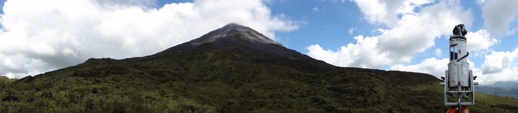
TLS, also known as ground-based lidar, is a versatile geodetic imaging technology in the Earth sciences. It offers unprecedented sub-centimeter-resolution of topographic and other surfaces, including 3-dimensional imagery of topography, rock or ice outcrops, caves, trees and vegetation, and cultural objects. TLS instruments are extremely precise, reasonably portable, relatively easy to operate, and have been used successfully in a variety of environments to support a wide range of geoscience investigations including detailed mapping of fault scarps, geologic outcrops, fault-surface roughness, frost polygons, volcanoes, lava lakes, dikes, fissures, glaciers, columnar joints, hillslopes, and drainage morphology.
Moreover, repeat TLS surveys allow the imaging and measurement of surface changes through time, arising, for example, from fluvial erosion or landslides, volcanic deformation, ice flow, beach morphology transitions, and post-seismic fault slip. TLS is applicable to problems with length scales from the 10s of meters to kilometers. Concurrent GPS measurements are used to georeference the TLS data in absolute 3D coordinates. Coincident high-resolution digital photography allows for the generation of photorealistic 3D images.
The Earth sciences have embraced the application of TLS in many facets of research and education. The GAGE Facility provides a pool of TLS instrumentation and trained staff to make TLS technology more easily accessible to the Earth science community. The GAGE Facility is also a nexus for community activities such as short courses and education and outreach efforts on multiple scales.
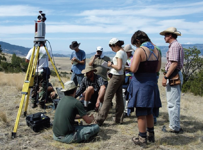
EarthScope Consortium has also pioneered the use of TLS at geologic field camps. Over the past several years, EarthScope Consortium, operator of the GAGE Facility, has developed a growing program that involves bringing TLS systems to geology field camps throughout the West. In 2013, UNAVCO (now EarthScope Consortium) supported four geology camps and one graduate seminar class with TLS instrumentation, giving nearly 100 students the opportunity to design a TLS survey, operate the instruments, process data, and make geologic analyses using the high-resolution 3D datasets. The TLS and education program has been quite successful, growing annually, and nicely compliments more traditional methods taught during field courses.
Since 2008, EarthScope Consortium, operator of the GAGE Facility, has supported more than 150 TLS field projects, community training courses, and education and outreach activities.
TLS Instrumentation
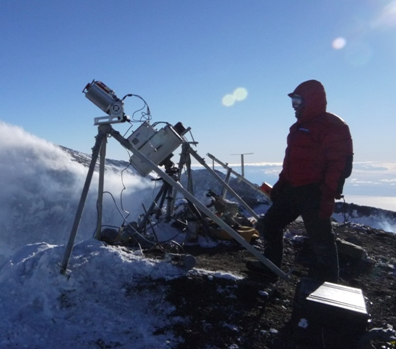
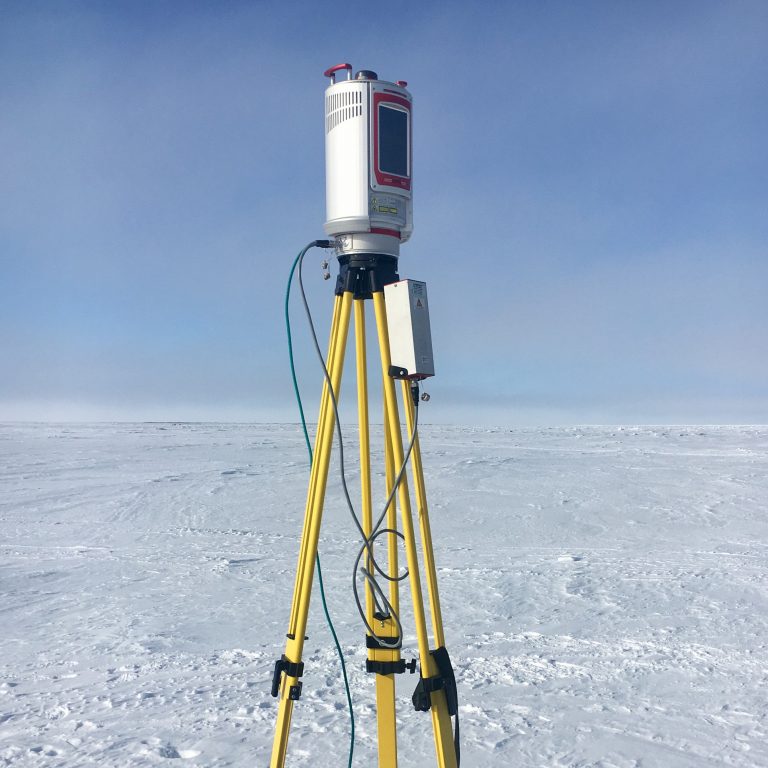
The GAGE Facility’s TLS instrument pool consists of the instruments below. Models have different attributes in terms of measurement range, sample rate, laser wavelength, laser spot size, physical size, weight, and power efficiency. All systems are time-of-flight scanners. In addition to the scanners themselves ancillary equipment deployed with the scanners include digital cameras for integrated imagery acquisition, field computers, targets for scan registration, power sources, tripods, transport cases, and dual frequency and RTK GPS receivers. The TLS systems were acquired under funding to EarthScope Consortium, operator of the GAGE Facility, from the National Science Foundation Division of Earth Sciences (EAR) and Division of Polar Programs (PLR).
| Riegl VZ-6000 | The VZ-6000 is our longest range scanner. It has a larger form factor and weight than the rest of the Riegl VZ line of instruments. |
| Riegl VZ-2000 | The VZ-2000 has a similar form factor, weight, and resolution to the VZ-400 and VZ-1000, but has an increased range of up to 2,000 m and an effective scan rate of up to 400,000 measurements per second. |
| Riegl VZ-1000 | The VZ-1000 has a similar form factor, weight, and scan rate and resolution to the VZ-400, but has an increased range of up to 1,400 m. This instrument also features full waveform data capture, enabling additional data processing and analysis possibilities. |
| Riegl VZ-400 | The VZ-400 is a versatile scanner that is well suited to a wide range of research applications. It is currently the workhorse of the TLS pool. The VZ-400 features a moderate range (up to 600 m), very fast scan rate, small size, and low weight. The VZ-400 records multiple returns through on-board waveform analysis. |
| Riegl LMS-Z620 | The Z620 is a robust, long-range scanner (up to ~2 km) with fast scan rate. Common applications are projects requiring a long range. It is larger and heavier than the VZ-400 and VZ-1000 but can still be transported by backpack. |
| Leica ScanStation C10 | The C10 is optimized for short-range (<150 m), high-speed and high-accuracy scanning. It has several unique features compared to other instruments in our pool including a green (532 nm) laser, full overhead scanning, and lightweight internal batteries. |
| Optech ILRIS-3D [retired Oct 2012] | The ILRIS is a long-range scanner (up to ~1500 m) and was the organization’s first TLS instrument. The scanner was specially outfitted for cold weather deployment and was a tried and true instrument for polar applications. It was deployed for non-polar projects as well. |
Scanner performance specifications, especially the effective scanning range, can vary significantly depending on the scanning environment. Effective range can be reduced dramatically by atmospheric contaminants such as dust, smoke and volcanic gases. Scanning is not possible in fog or rain. The effective albedo of the surface being scanned also affects range.
Please contact EarthScope Consortium for additional information regarding project planning, proposal preparation, instrumentation and engineering support, and other TLS services.
Home
- Geodetic Imaging
- Last updated: 22 August 2023
