
November 22, 2022 M 6.2 Las Brisas, Mexico Earthquake
Event response pages are a service to help coordinate community science after an earthquake or other notable geophysical event by collecting relevant data. Findings and figures are preliminary and subject to revision.
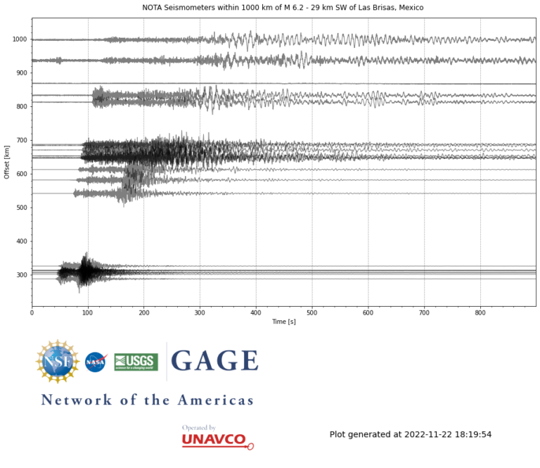
At 16:39:05 (UTC) on November 22, a magnitude 6.2 earthquake occurred 29 km southwest of Las Brisas, Mexico. For more information, see the USGS Earthquake Hazards Program event page.
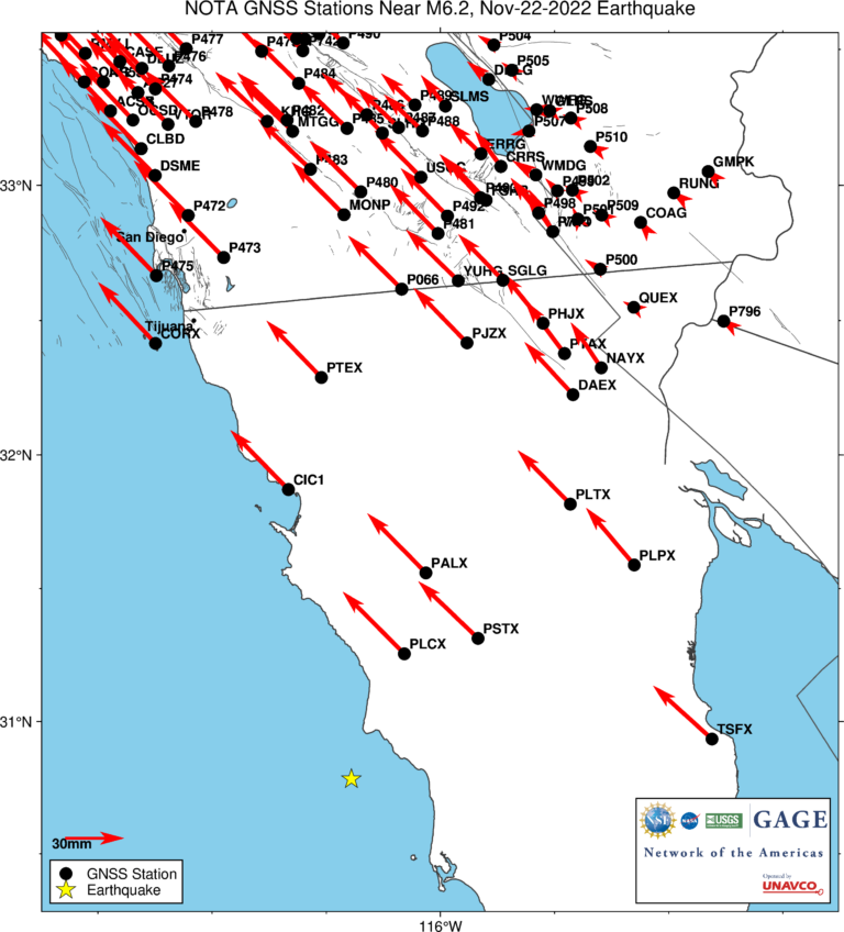
The event occurred within the footprint of the Network of the Americas (NOTA), a network of continuous GPS/GNSS stations and borehole instruments operated by UNAVCO that monitors plate motion and transient deformation, in addition to other applications. Stations near the event for which UNAVCO delivers data include a number of REGNOM/CICESE stations and one IGS station. Use of data from all stations should be acknowledged appropriately.
Did you feel it?
The USGS collects information from people who felt an earthquake and creates maps that show what people experienced and the extent of the damage
Submit a responseHOME
Written by:
- Scott K. Johnson
- Posted: 22 November 2022
- Last updated: 22 November 2022
-


Did you feel it?
The USGS collects information from people who felt an earthquake and creates maps that show what people experienced and the extent of the damage
Submit a response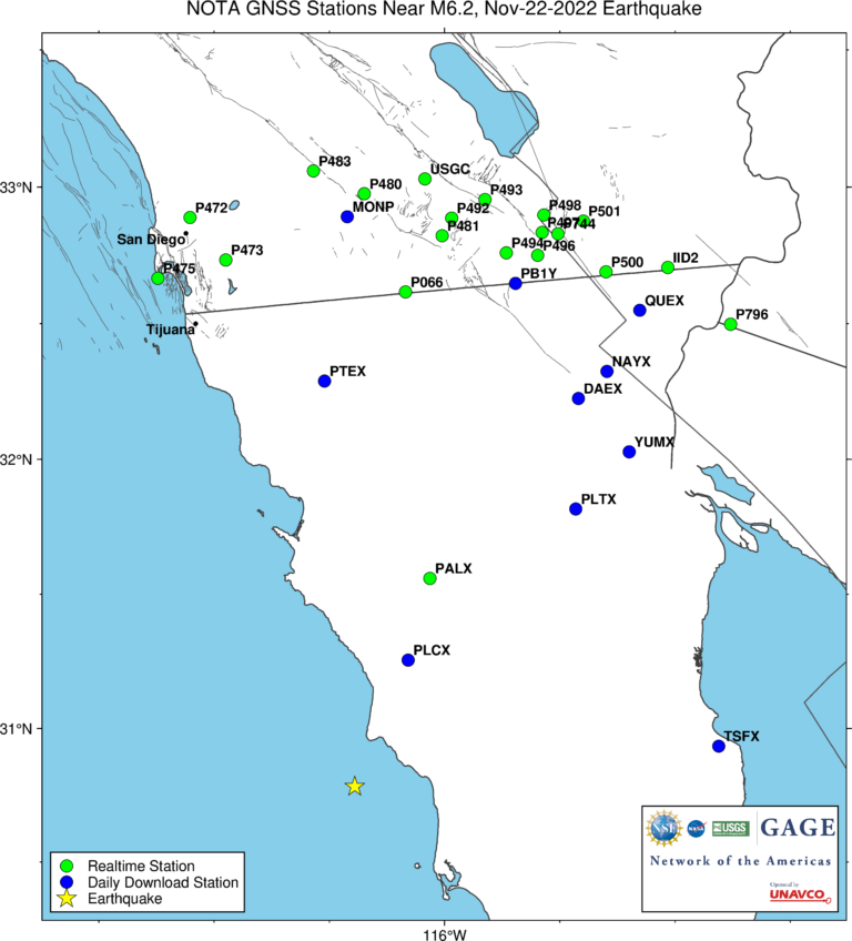
Response Data
Please contact archive-gps@unavco.org for information on data availability. To request access to these and other RT-GPS stations operated by UNAVCO please send an email request to rtgps@unavco.org.
GPS/GNSS Data
GNSS data access tools can be found here. The Event Data Access notebook can be used to locate stations nearest this event.
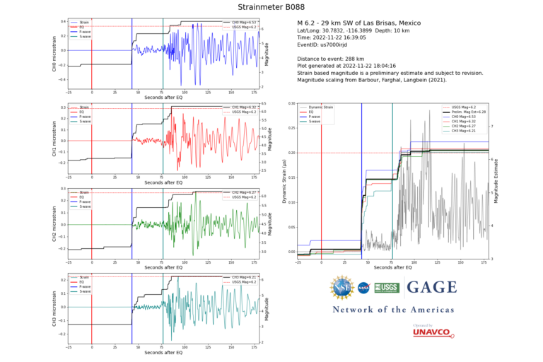
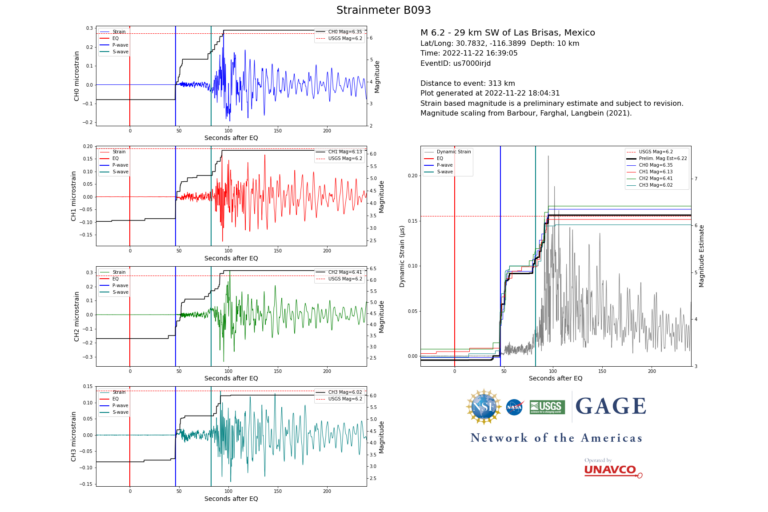
Borehole Strain Data
High-rate data from borehole strainmeters can be accessed here.