
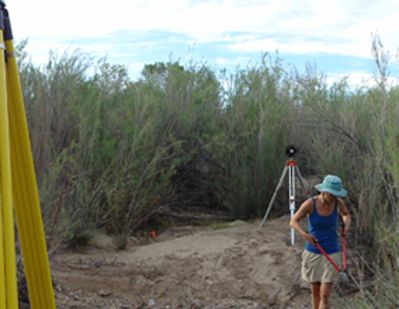
PI Sharon Bywater Reyes of the University of Montana uses pruning shears to trim back the ample vegetation in one of the field locations on the Santa Maria River. 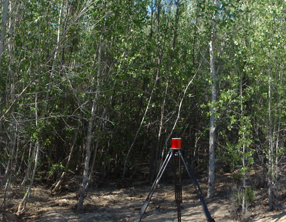
Retroreflective target nested among cottonwood trees. Larger vegetation had to be scanned early in the morning due to winds that would pick up steadily in the afternoons. Photo by Sarah Doelger
Project Overview
In April of 2013, UNAVCO supported the first half of a two-part terrestrial laser scanning (TLS) project undertaken by scientists at the University of Montana. The April survey took place on the Santa Maria River in arid northwestern Arizona. The second half will be conducted on the Bitterroot River in Montana in the summer of 2013.
The goal of the research is to better understand how rivers change due to interactions between water flow, sediment, and vegetation. The TLS instrument will provide high resolution, 3D images of riverbed topography and vegetation which scientists will use to make detailed observations about each.
Significance
Bar topography and vegetation growth are closely coupled in many rivers and are affected by water flow. Scientists believe that the feedbacks in these relationships are enhanced in rivers located in arid regions. The Santa Maria is one of these “dryland” rivers, which experienced a large flood in 2010. This flood was responsible for the creation or enhancement of the much of topography present in the river today.
Multiple high-resolution scans were taken with a Riegl VZ400 TLS instrument from three separate dry river bars along the Santa Maria. These scans captured individual plants (including tamarisk, cottonwood, and willow) and included the immediate topography around each plant.
The scientists will use specialized software to separate the plant points, or “returns,” from the ground returns. Measurements taken from these point clouds will be used in models that predict how vegetation and topography affect each other in the river environment.
Analyses of the relationships at the individual plant scale are critical to understanding dryland ecosystems on the whole and infuence decisions about aquatic habitiat, stream restoration, and resource management.
Challenges
Scanning in vegetated areas posed a significant challenge. The presence of many shrubs and trees made it difficult for the scanner to have direct line of sight to all of the retro-reflective targets needed for control in the point clouds. In addition, obtaining quality GPS measurements was a challenge due to limited skyview. These GPS measurements are taken from atop each reflective target and are crucial for georeferencing each point cloud collected.
Project Information
- Principal Investigators:
Andrew Wilcox and Sharon Bywater-Reyes, University of Montana - UNAVCO Engineer: Sarah Doelger
- Date: April 1 – 6, 2013
- Location: Santa Maria River, Arizona
- Funding Source: NSF-EAR Geomorphology and Land Use Dynamics
- Map of Santa Maria River, Arizona
Related Links
Written by:
- Sarah Doelger
- Posted: 20 November 2013
- Last updated: 2 July 2021
- Tags: project highlights, TLS
-

