
The ShakeAlert earthquake early warning system is much more than the alert message on your phone. Detecting earthquakes, characterizing them, and determining the appropriate warning area takes a tremendous amount of infrastructure. With the completion of a recent Cooperative Agreement with the USGS, UNAVCO has improved West Coast geodetic infrastructure so it can be fully integrated into ShakeAlert®.
In order to work optimally, an earthquake early warning system needs lots of sensors spread out over a region so there are several nearby when an earthquake occurs. The sooner that multiple sensors detect the event and calculate its epicenter and magnitude, the sooner an accurate warning can be sent out.
The ShakeAlert system—which is now operating in California, Oregon, and Washington—currently uses seismometers to do all this, but there are advantages to also adding GPS stations that can measure shifting ground movements during earthquakes. There is an upper limit to the magnitude that seismometers can recognize in the initial moments of an earthquake. But while nearby seismometer measurements can max out, a GPS station simply moves a greater distance, providing valuable data that enables an alert system to calculate an accurate magnitude much faster.
To build out the physical infrastructure to do this, the USGS funded work by UNAVCO to upgrade existing stations and add a few new stations to fill in gaps along the Oregon coast.
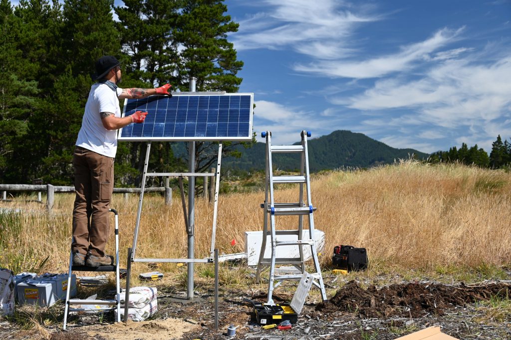
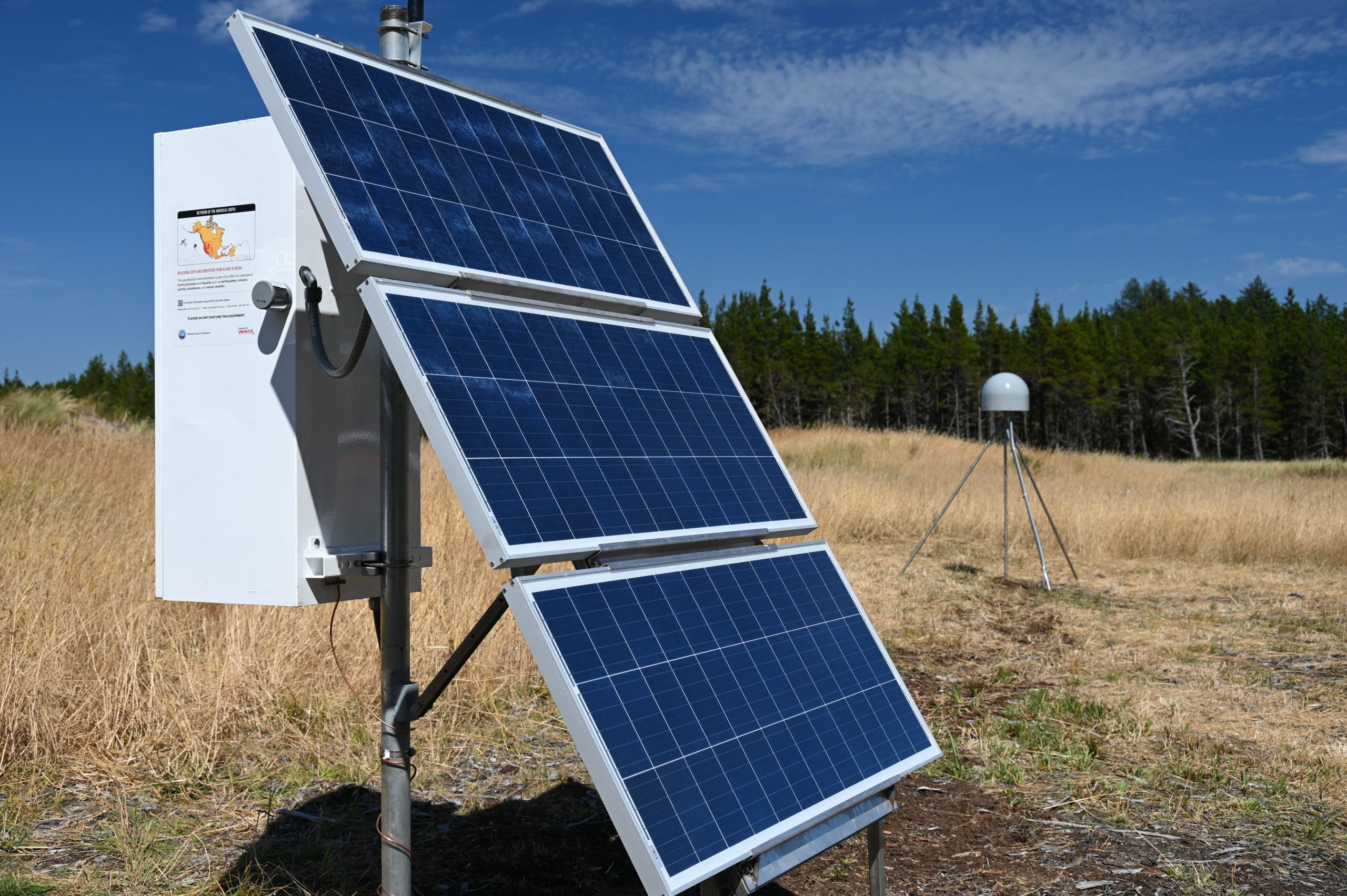
Chad Pyatt setting up solar panels for the enclosure box. (Photo by Scott Johnson/UNAVCO) 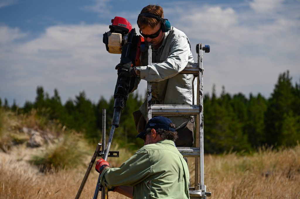
Adam Woolace and Glen Mattioli set the legs for the antenna monument. (Photo by Scott Johnson/UNAVCO) 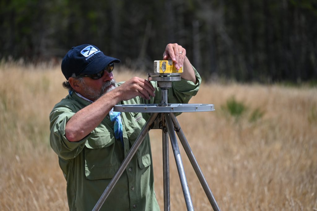
Glen Mattioli checks that the antenna monument is perfectly level. (Photo by Scott Johnson/UNAVCO) 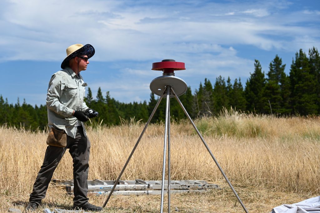
Adam Woolace installing the GNSS antenna. (Photo by Scott Johnson/UNAVCO) 
Say hello to station MZNT. (Photo by Scott Johnson/UNAVCO)


UNAVCO operates the Network of the Americas (NOTA)—roughly 1,300 permanent stations from the Aleutian Islands to the Caribbean that measure ground motion. This USGS project funded upgrades at 82 NOTA stations, including some new cell modems, and new Global Navigation Satellite System (GNSS) equipment that can record signals from more than just the United States’ GPS satellites. Because they can see more satellites at once, GNSS-capable stations can accurately calculate the station’s position more quickly—which is important when it moves suddenly during an earthquake.
Those stations and about 100 others were also upgraded with onboard Precise Point Positioning service, which applies corrections in real time for things like the precise position of each satellite’s orbit. That further reduces the uncertainty of the position data. These corrections are generally made after the data are transmitted to UNAVCO’s data system, but enabling a real-time correction in the receiver itself ensures the fastest possible connection to ShakeAlert.
In addition, five new stations were built along the Oregon coast where analysis showed coverage should be improved. Each station consists of an antenna mounted on steel legs that are driven into the ground and a connected enclosure that houses the receiver, cellular modem, and batteries for the solar panels that keep it all running.
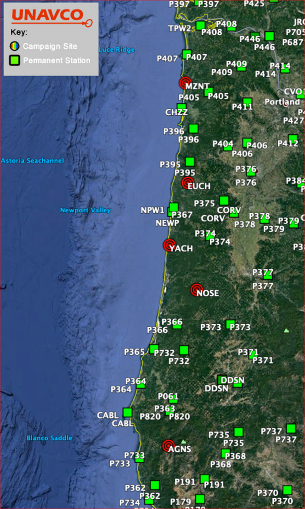
These locations near the coast—from Manzanita to the Rogue River—will serve to ensure that offshore subduction zone earthquakes can be detected quickly. Given that large earthquakes there could generate dangerous tsunamis, fast and accurate warnings are critical.
Alongside this work, the Pacific Northwest Seismic Network (PNSN) installed seismometers at two of these new sites in Oregon, following up on an earlier effort that added seismometers to more than 50 existing GPS stations in the Network of the Americas. In addition to reducing costs, sharing a site can also be useful because both types of measurements come from exactly the same location.
GPS stations can measure incredibly slow tectonic plate movements of just millimeters per year. But they can also measure incredibly fast movements, and quickly enough to contribute to life-saving earthquake warnings. That’s the goal this project is working toward.
Written by:
- Scott K. Johnson
- Posted: 16 September 2021
- Last updated: 25 October 2021
- Tags: GPS/GNSS, ShakeAlert
-

