
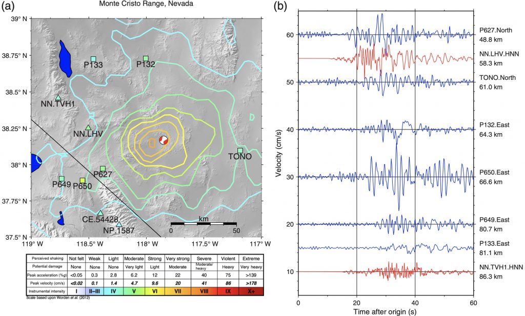
Several earthquakes jolted the western US last year, including magnitude 6.5 events near Challis, Idaho and the Monte Cristo Range in Nevada, as well as a magnitude 5.7 near Salt Lake City and a 5.8 in Owens Valley, California. Damage was thankfully minor, but the quakes served as reminders that these are seismically active places.
The California and Utah earthquakes occurred in areas where many seismometers are located, capturing the events in detail. But in places without as much local seismometer coverage, it turns out GPS stations can pinch hit admirably. In a paper recently published in Seismological Research Letters, University of Washington Research Scientist Brendan Crowell processed data from permanent GPS stations to recover measurements of shaking for each of these earthquakes.
These GPS stations, many of which are part of the Network of the Americas, are used to precisely measure changes in position over time, including the shifts along faults associated with an earthquake. But measuring small-scale, rapid motion like shaking is a different challenge. The uncertainty in position for each individual data point can be larger than the amplitude of the shaking—particularly when the sensor is getting jostled around.
There’s another way to approach this, illustrated by Crowell’s study. Instead of using the position of the instrument at each data point, Crowell used the tiny differences in satellite signal between each time step to calculate the station’s velocity in that moment. Typically, things like atmospheric conditions add noise to the location measurement that must be corrected for. But since many of these stations are making five measurements per second, the time step is so short that those conditions don’t really change, and they can be ignored when calculating the station’s velocity.
Credit: Crowell/Seismological Research Letters
Following this method, Crowell calculated velocity-based records of shaking at each GPS station near these earthquakes. To evaluate the accuracy of these data, each record was compared to the shaking estimates from the United States Geological Survey’s ShakeMap, which is based on all the available data. The match there was pretty good, showing that the GPS velocity calculation can recover a reliable record of shaking.
And that means that lots of existing GPS stations have the potential to contribute data, which is particularly handy where seismometer coverage is thin—as it was in Idaho and Nevada last year.
UNAVCO operates the Network of the Americas (NOTA) with the support of the National Science Foundation. It includes instruments at over a thousand sites in the US, Mexico, and Caribbean. Read more on the NOTA project page.
Written by:
- Scott K. Johnson
- Posted: 8 February 2021
- Last updated: 30 April 2021
- Tags: earthquakes, GPS/GNSS
-

