
Event Response to the July 2019 Ridgecrest Earthquake Sequence
The July 2019 Ridgecrest earthquakes occurred in southern California not far from the city of Ridgecrest. Approximately 30 million people felt the mainshock. The GAGE facility has instrumentation in the footprint of the earthquake series and curated data to be used for scientific investigation.
Acknowledgments
These data are provided by the GAGE Facility, operated by UNAVCO, Inc., with support from the National Science Foundation and the National Aeronautics and Space Administration under NSF Cooperative Agreement EAR-1724794. The Network of the Americas (NOTA) is a core component of the NSF GAGE Facility. To acknowledge use of these data please follow the acknowledgment guidelines.
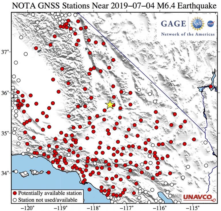
This earthquake event response covers two related earthquake events: July 4, 2019 M 6.4 and July 6, 2019 M 7.1. Signals from this event were recorded by 12 GPS/GNSS stations within 71 km of the epicenter operated by UNAVCO that were streaming high rate (1-sps / 1 Hz) data in real time. These data allowed peak ground displacements (PGD) to be calculated automatically from the displacement traces within seconds of the earthquake.
Acknowledgments
These data are provided by the GAGE Facility, operated by UNAVCO, Inc., with support from the National Science Foundation and the National Aeronautics and Space Administration under NSF Cooperative Agreement EAR-1724794. The Network of the Americas (NOTA) is a core component of the NSF GAGE Facility. To acknowledge use of these data please follow the acknowledgment guidelines.
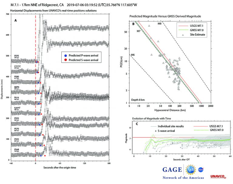
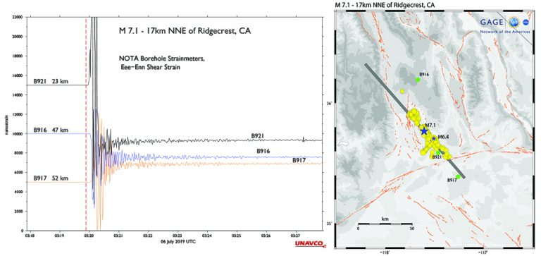
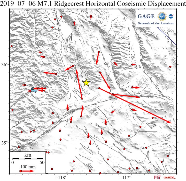
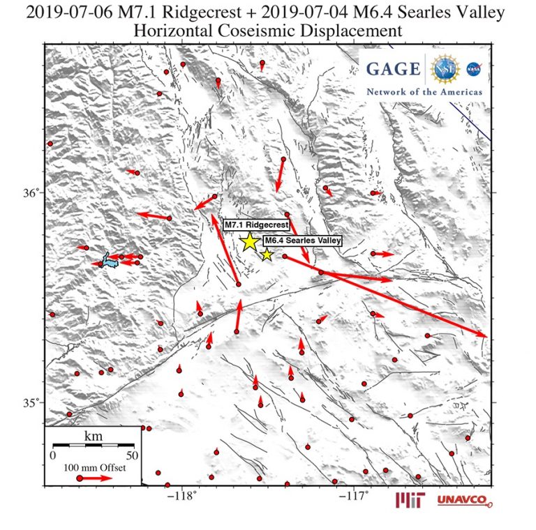
2019-07-06 03:19:53 (UTC) 35.770°N 117.599°W 8.0 km depth
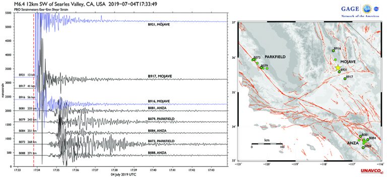
2019-07-04 17:33:49 (UTC) 35.705°N 117.506°W 10.7 km depth
Did you feel it?
The USGS collects information from people who felt an earthquake and creates maps that show what people experienced and the extent of the damage
Submit a responseHOME
Written by:
- David Phillips and Beth Bartel
- Posted: 5 July 2019
- Last updated: 4 December 2020
-


Did you feel it?
The USGS collects information from people who felt an earthquake and creates maps that show what people experienced and the extent of the damage
Submit a response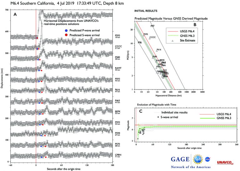
RESPONSE DATA
Please contact archive-gps@unavco.org for information on data availability. To request access to these and other RT-GPS stations operated by UNAVCO please send an email request to rtgps@unavco.org.
NOTA GPS/GNSS Real Time Data Solutions
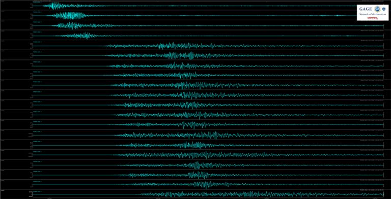
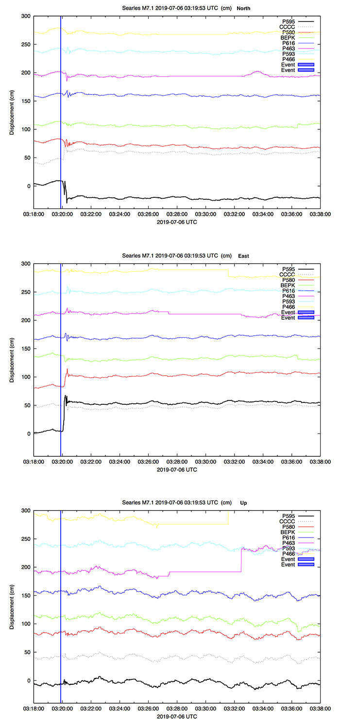
Dynamic displacement signals from these earthquakes were recorded by NOTA GNSS stations streaming high-rate (1-sps / 1 Hz) data in real time. These data allowed peak ground displacements (PGDs) to be calculated automatically from the displacement traces within seconds of the earthquake, as the surface waves propagated away from the epicenter.
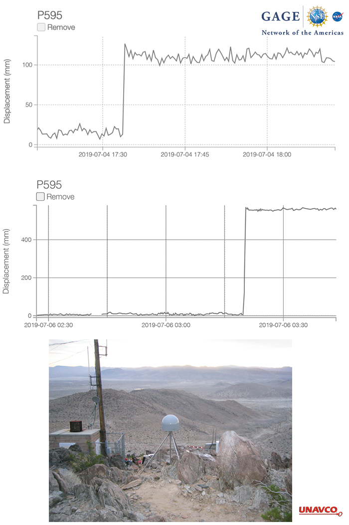
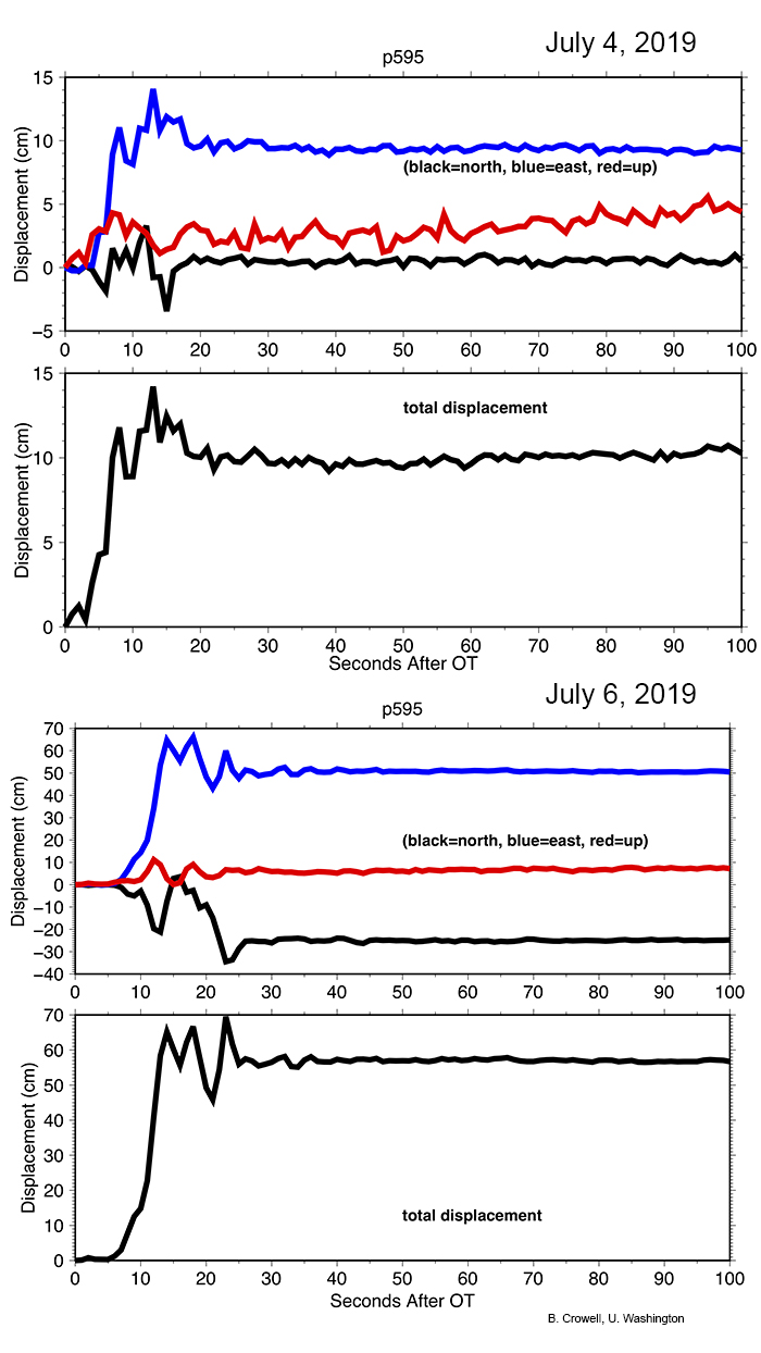
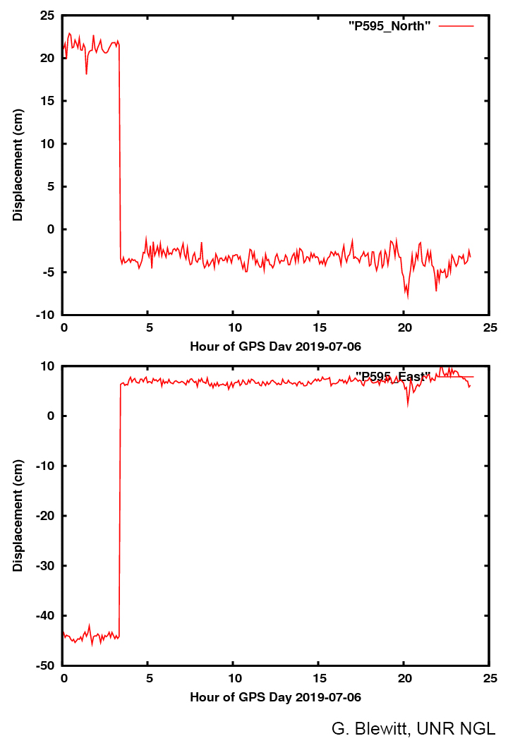
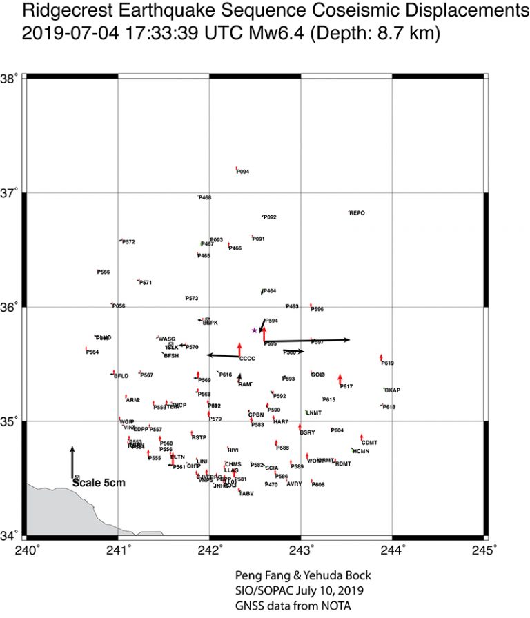
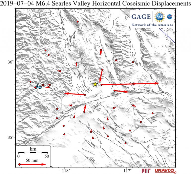
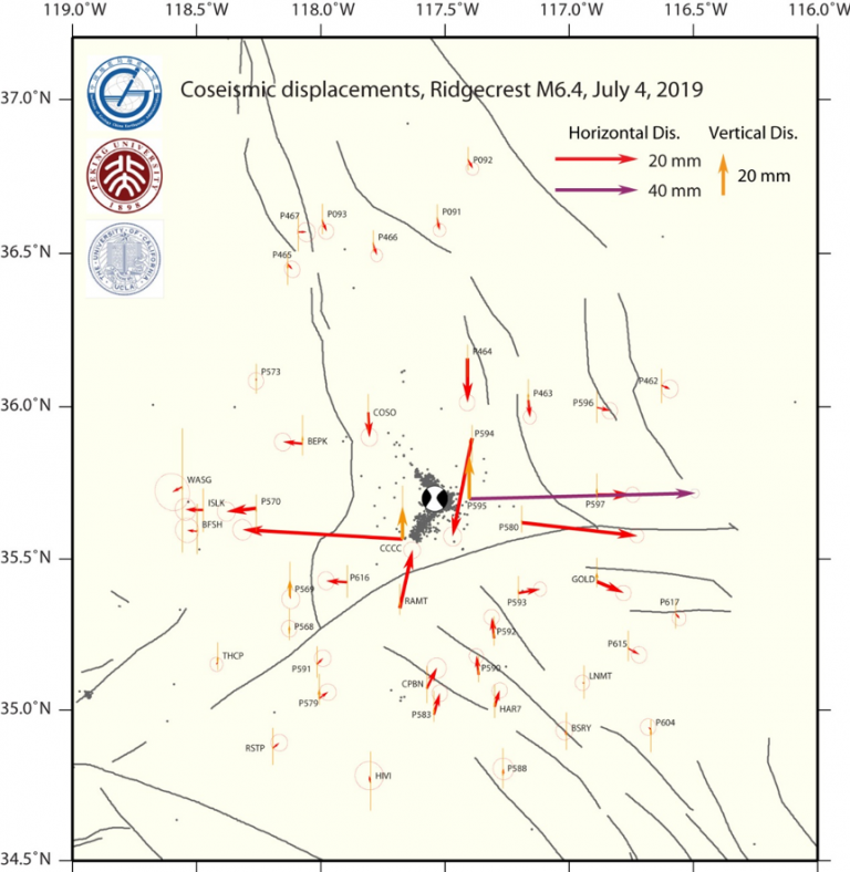
For the M6.4 2019-07-04 event, the nearest station (P595) recorded a PGD of 113 mm. Using inversions from stations out to 100 km of the epicenter, a “geodetic” magnitude of M6.3 was estimated within 30 seconds of the earthquake occurring. This GNSS-only magnitude only slightly underestimated the final known magnitude.
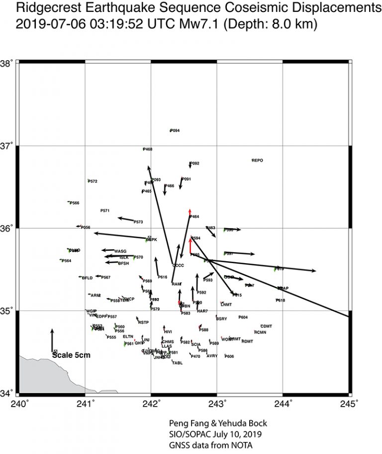
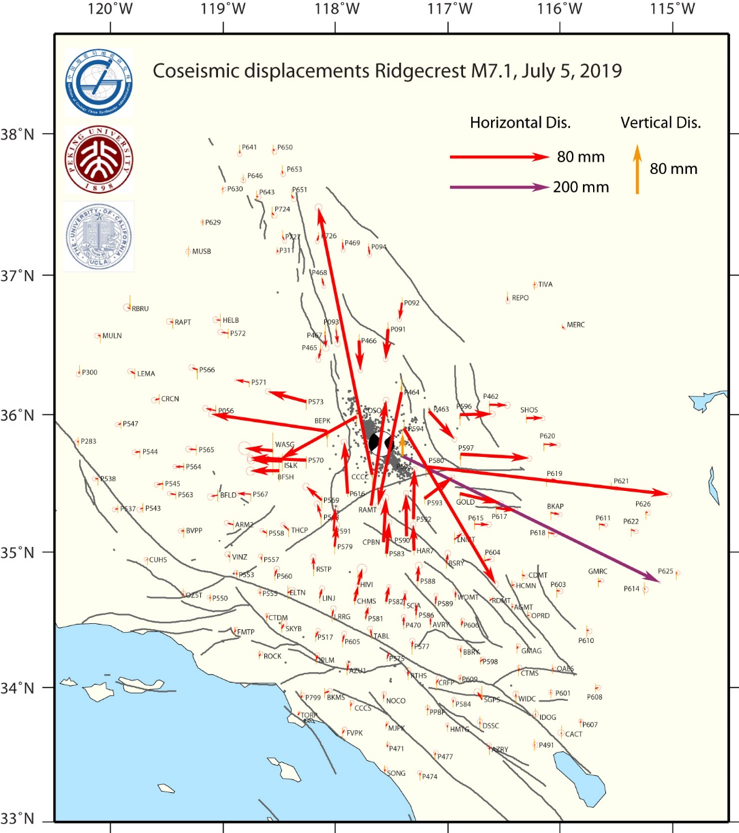
For the M7.1 2019-07-06 event, the nearest station (P595) recorded a PGD of 697 mm, much larger than the projected value of ~410 mm. The next closest site (CCCC) recorded a PGD of 354 mm, similar to the projected value of 360mm. Using inversions from stations out to 200 km of the epicenter, a “geodetic” magnitude of M 6.9 was estimated within 30 seconds of the earthquake occurring. This GNSS data-only magnitude underestimated the final known magnitude, but was more accurate than the preliminary seismic data-only estimate of M6.2 at 30 seconds after origin time.
Note: Figures and findings are preliminary and subject to revision.
NOTA GPS/GNSS High Rate Data for Post Processing
For the M6.4 2019-07-04 event, high-rate 5-sps (5 Hz) data are being downloaded from 200+ NOTA stations within ~250 km of the epicenter for a 3-hour time window around the event (± 1.5 hours), as well as 1-sps (1 Hz) data for a 3-day time window (± 1.5 days).
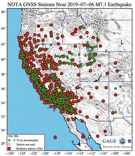
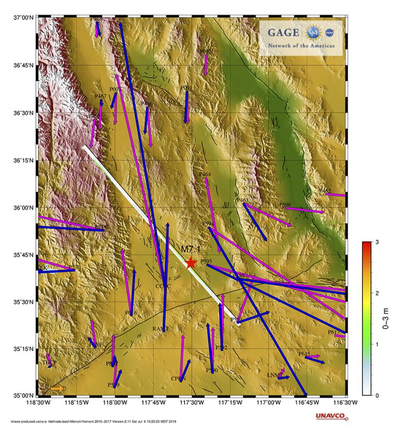
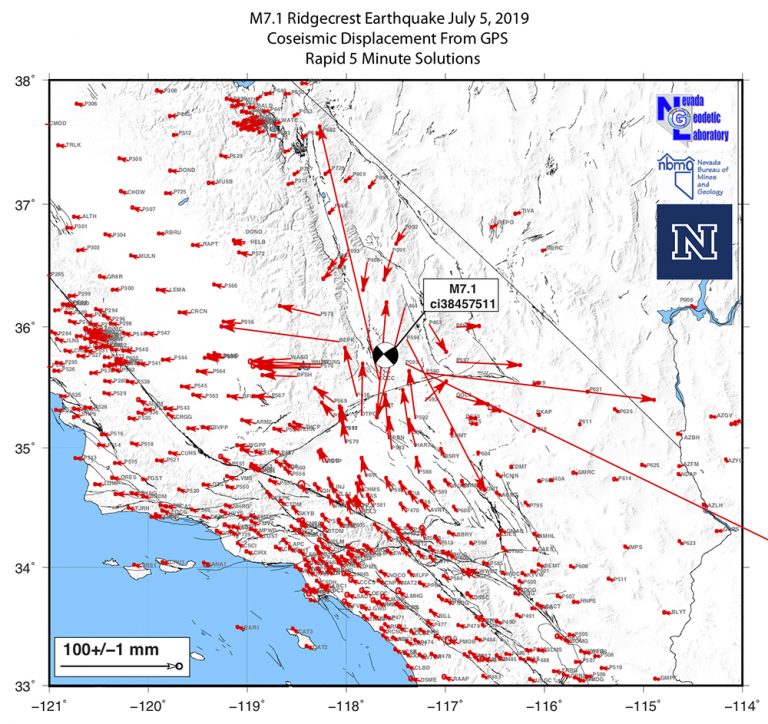
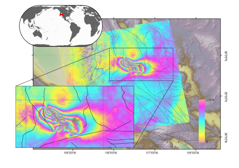
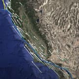
For the M7.1 2019-07-06 event, high-rate 5-sps (5 Hz) data are being downloaded from 700+ NOTA stations within 1,000 km of the epiecenter for a 3-hour time window around the event (± 1.5 hours), as well as 1-sps (1 Hz) data for a 1-day time window (continuing from the 3-day window from the M6.4 download). A map of downloaded stations is provided in Figure 4.
These data will soon be available in RINEX format from the UNAVCO high rate data ftp site.
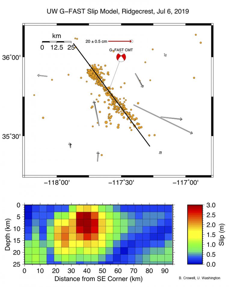
GAGE GPS/GNSS Displacement Estimates
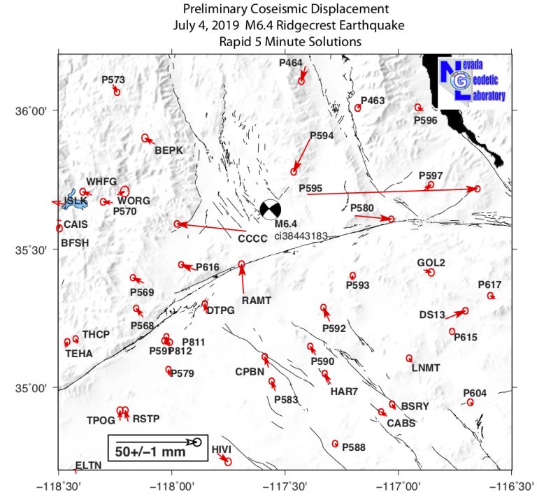
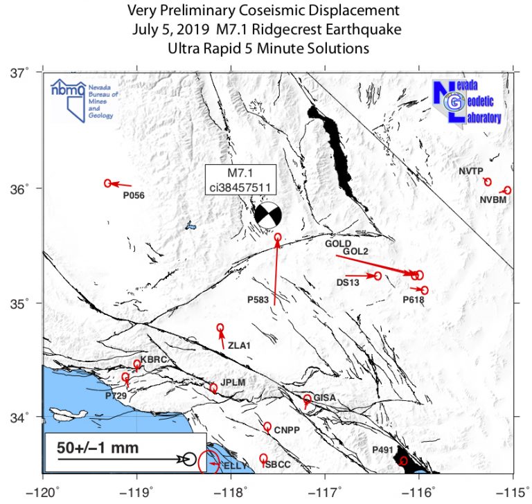
Coseismic offsets from this event have been estimated by the GAGE GNSS Analysis Centers (Figure 20). Preliminary “rapid” offsets have been tabulated and published in an event (*.EVT) file available from the UNAVCO event data products ftp site. As more data and final orbits become available, the ACC will also produce a “final” offset solution, as well as offsets estimated from Kalman filter time series analyses. The final event file will be added to the event data products ftp site. The Kalman filter offset solution will be included in the master offset file.
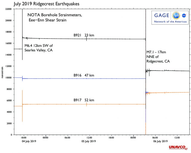
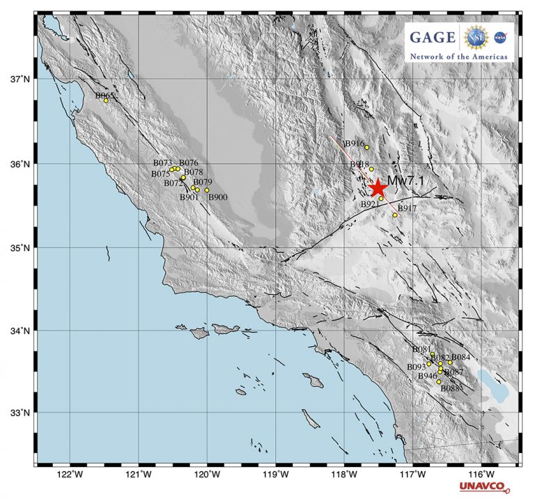
NOTA Borehole Strainmeter Data
Fully processed 1-sps borehole strainmeter (BSM) datasets for both of these events have been produced. These datasets can be downloaded from the UNAVCO borehole strainmeter event response page. See figures for examples of signals recorded by the BSM network.
FIELD RESOURCES
In response to a geophysics event, community members are welcome to request GAGE support for campaign instrumentation and/or engineering support through our project support request form.
GAGE provided eight campaign GPS/GNSS sets to the U.S. Geological Survey for post-seismic campaign data collection and ground control for a lidar survey scheduled for 27 July – 1 August 2019.
Educational Materials
Measuring Plate Tectonics with GPS
This animation shows how high-precision GPS networks help us understand plate tectonic motions and earthquake hazards around the world, with a focus on the Western United States.
More
Exploring Tectonic Motions using GPS Velocity Maps
Students use their observational and pattern recognition skills to discover the tectonic motions by exploring tectonic motions posters.
More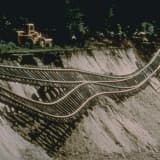
Imaging Active Tectonics with InSAR and Lidar
Students use lidar and InSAR data to understand the earthquake cycle and related hazards.
MorePartner Resources
Digital Surface Model of Ridgecrest, CA: Pre-July 2019 Earthquake, OpenTopography
Southern California M 6.4 earthquake stressed by two large historic ruptures (Temblor)
M 7.1 SoCal earthquake triggers aftershocks up to 100 mi away: What’s next? (Temblor)
Scripps Orbit and Permanent Array Center / California Spatial Reference Center