
Polar Services - Antarctic - Geodetic Benchmarks - USGS Benchmark VABM-7
| USGS Benchmark VABM-7 | ||||
 |
||||
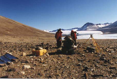
| Site Description: | Mark is in a boulder on the west side of Victoria Upper Lake, 2.7 km from Upper Victoria Glacier and about 20 meters from lake shore. It is marked with a rock cairn. | |||
|
View Larger Map |
||||
| Coordinates: | 77° 18' 47.7613" S
161° 33' 21.741" E 347.89 (~401.09 m MSL) ITRF-94 |
|||
| Source: | Baseline tie to MCM4. | |||
| Raw Data: | UNAVCO: Data Archive Interface | |||
Last modified: 2019-12-24 02:12:44 America/Denver