)
Major Projects
The NSF GAGE Facility (formerly UNAVCO and hereafter referred to simply as GAGE) collaborates with other institutions on a variety of projects. Some of the projects fund staff at the GAGE Facility and have their own Web pages within the GAGE Web site. Others are mainly external to the GAGE Web site and are only referenced here.
EarthCube
EarthCube is an initiative to create a community-driven data and knowledge management system for data sharing across the geosciences.
- GeoSCIFramework: Scalable Real-time Streaming Analytics and Machine Learning for Geoscience and Hazards Research
GEodesy Tools for Societal Issues (GETSI)
GEodesy Tools for Societal Issues (GETSI) develops teaching resources for engaging undergraduate students in addressing societally important Earth science questions through the use of geodetic data.
NASA Support
NASA Support — GAGE helps support NASA's Global GPS Network (GGN) and activities of the International GNSS Services (IGS) Central Bureau.
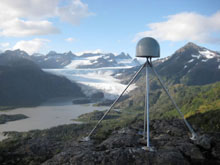
Network of the Americas
Network of the Americas (NOTA) — is an international geoscience community project that precisely measures Earth deformation resulting from the constant motion of the tectonic plates in the western hemisphere.
POLENET - Polar Observations
POLENET - Polar Observations — is a network that improves geophysical observations across the Earth's polar regions and provides a legacy of observational infrastructure to enable new insights into the interaction between the atmosphere, oceans, polar ice sheets and the Earth's crust and mantle.
RESESS - Student Interns
RESESS - Student Interns — (Research Experiences in Solid Earth Science for Students) is an established and successful program for multi-year summer research internships for Earth science undergraduates from populations underrepresented in science.
ShakeAlert - Earthquake Early Warning
ShakeAlert - Earthquake Early Warning — ShakeAlert is an earthquake early warning system for the West Coast of the United States and the Pacific Northwest sponsored by the United States Geological Survey. The system uses sensors to detect P waves, compressional primary waves created by earthquakes and traveling faster than the damaging S waves.
Last modified: 2026-03-09 18:06:37 America/Denver