
Polar Services - Antarctic - Geodetic Benchmarks - USGS mark FISHER
| USGS mark FISHER | ||||
 |
||||
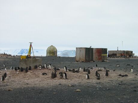
| Site Description: | Station is located at Cape Hallett Station, Antarctica, in an adelie penguin rookery. Station is 230.3 feet SE of the center of SE side of radio dome, 384.8 feet SW of station No 14 Hallett Astro, 77.8 feet of SE corner of southernmost hut. Station is a standard USGS Antarctic brass tablet stamped "FISHER 1989-1990" and is set flush on the top of a large concrete block, 6.3 feet by 2.4 feet, and is 3.2 feet above the ground level. | |||
|
View Larger Map |
||||
| Coordinates: | 72° 19' 06.7521" S
170° 12' 39.916" E -53.82m (~2.15 m MSL) ITRF-93 |
|||
| Source: | Baseline tie to McMurdo MCM4. | |||
| Raw Data: | UNAVCO: Data Archive Interface | |||
Last modified: 2019-12-24 02:12:43 America/Denver