
Polar Services - Antarctic - Geodetic Benchmarks - BOB1
| USGS Benchmark BOB (BOB1) | ||||
 |
||||
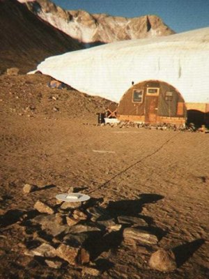
| Site Description: | **As of 2010, BOB1 is underwater because of rising lake levels in Taylor Valley. The benchmark can no longer be occupied and is included here for historical purposes only.** Mark is a circular placque with dimple. From the Jamesway, 20.89 m west of the northwest corner and 21.07 m west of the southwest corner. |
|||
|
View Larger Map |
||||
| Coordinates: | 77° 37' 24.7959" S
162° 54' 17.579" E 20.12 m (~75.36 m MSL) ITRF-94 |
|||
| Source: | Baseline tie to McMurdo Station. | |||
| Raw Data: | UNAVCO: Data Archive Interface | |||
Last modified: 2019-12-24 02:12:43 America/Denver