
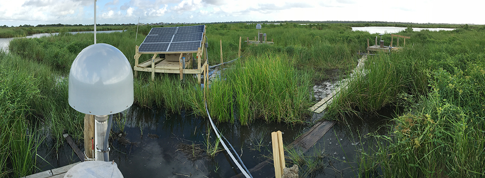
‘Superstation’ Myrtle Grove as seen from the MGW3 platform. (Photo/Keith Williams, UNAVCO) 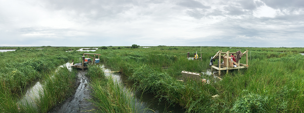
‘Superstation’ Myrtle Grove seen from MGW2, the medium-depth well. (Photo/Keith Williams, UNAVCO) 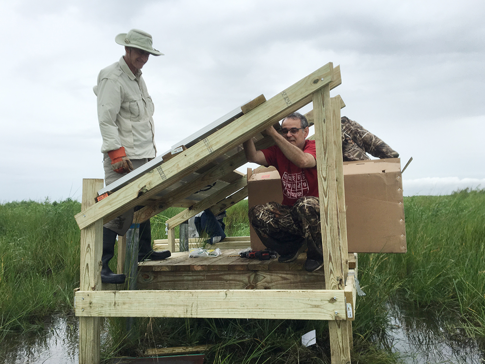
Tim Dixon and Mike Steckler install solar power to run supersaturation. (Photo/Keith Williams, UNAVCO) 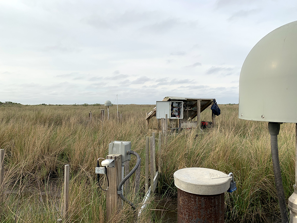
By 2019, the damage done to the marsh grass by the marsh buggy that was used to drill the wells was nearly restored. (Photo/Keith Williams, UNAVCO) 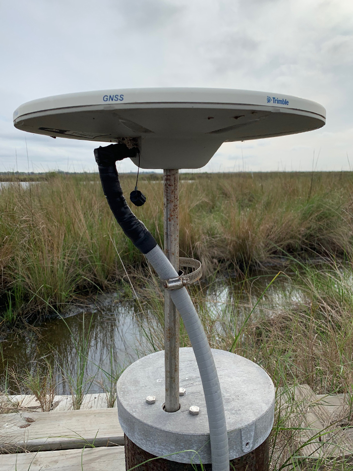
The deepest monument, at MGW1, is anchored to the Pleistocene basement approximately 40m below the surface. (Photo/Keith Williams, UNAVCO) 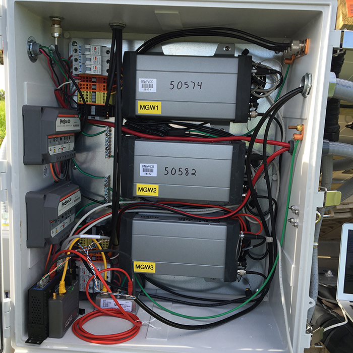
The equipment enclosure houses two independent power systems: One for three Trimble NetR9 GPS receivers, and the other for three strainmeters, cellular modem, and a network switch. (Photo/Keith Williams, UNAVCO)
Delta Sites
How do you install a GPS station in a marsh? How about three all in the same place?
Installation of the Myrtle Grove subsidence superstation began in August 2016, but planning began well beforehand. The array of three co-located stations in Myrtle Grove, Louisiana, posed particular challenges, as the instruments were installed in a coastal marsh—in which the installation team would sink up to their hips in mud and water. The site now consists of three sets of GPS and strain instruments, as part of an experiment to determine present-day subsidence of the Mississippi River Delta due to both sediment compaction and tectonic loading.
An Unusual Installation
While most UNAVCO-supported projects using GNSS observations are designed to measure the motion of the crust or glaciers flowing on top of it, this project uses instruments coupled at various levels into soft sediment to measure differential vertical motion of the sediments themselves. At a single site, three boreholes within ~60 feet of each other house strainmeters at various levels: one near the surface (MGW3, 10 m), one about halfway to the underlying, consolidated sediment (MGW2, 25 m), and one in the consolidated sediment, at the base of the unconsolidated sediments (MGW1, 40 m). Each strainmeter is accompanied by a GPS system. At the shallower two strainmeters, the GPS antenna is mounted to the borehole casings. At the deep strainmeter, the GPS antenna is mounted on a rod within the well casing drilled into the consolidated sediment. The rod is stabilized at the surface by a slip coupler to restrict horizontal movement while allowing vertical movement free of the sediments to which the casing is coupled (Figure 5). The systems are designed to measure motion related to compaction within the sediments (all three, relative to each other) as well as larger-scale, tectonic motion of the underlying consolidated sediment (the deeper installation). Both processes contribute to changing shorelines.
Above Waterline
The marsh environment posed particular challenges for installing station power, which was managed by UNAVCO in addition to the GPS component of the site. Designing the power system platform entailed research on deck construction, local tides, and storm surge to determine the appropriate platform height and stability.
One particular challenge to overcome was how to install the pilings supporting the power platform into the water and mud. The posts were set by using a sump pump converted to a water jet to flush out mud and clay from under each 12-ft piling until it reached the desired depth.
Instrumentation and Power
Each station is equipped with a borehole strainmeter designed and installed by Scripps, and a GPS system with a Trimble NetR9 receiver and Zephyr Geodetic antenna. The GPS system is powered by three 100 W solar panels and two 100 Ah batteries, while the strainmeters, cellular modem, and network switch are powered by three 100 W solar panels and four 100 Ah batteries. All station data are telemetered to UNAVCO. The GPS data are available free and open access through the UNAVCO Data Archive, while the strainmeter data are archived and processed at Scripps.
Project Information
- Principal Investigator(s): Mead Allison & Torbjörn Törnqvist, Tulane University; Timothy Dixon, University of South Florida; Michael Steckler, Columbia University; Mark Zumberge, University of California, San Diego
- UNAVCO Staff: Keith Williams
- Dates: Aug 12-16, 2016; May 24, 2017; March 12, 2019
- Location: Myrtle Grove, Louisiana (map)
- Funding Source: U.S. Army Corps of Engineers
Related Links
Mike Steckler’s State of the Planet blog posts:
Reference Publications:
Related Media Stories:
Written by:
- Beth Bartel and Keith Williams
- Posted: 28 May 2019
- Last updated: 4 June 2021
- Tags: GPS/GNSS, project highlights, strainmeters
-

