
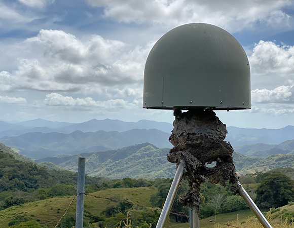
Site hazards: An old bees\’ nest on the GPS monument at station EPZA. (Photo/Nicolas Bayou, UNAVCO) 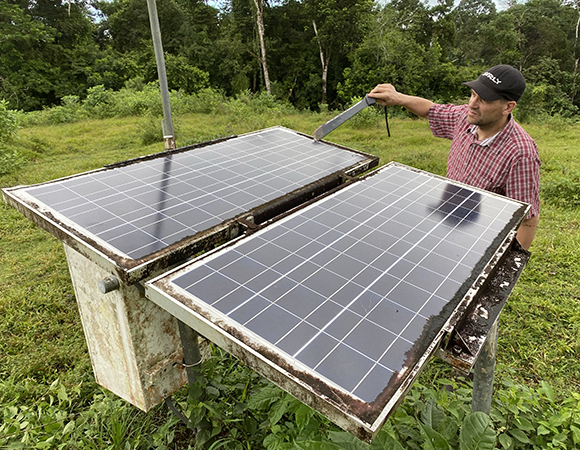
UNAVCO project manager Jim Normandeau cleans solar panels at station VERA. (Photo/Nicolas Bayou, UNAVCO) 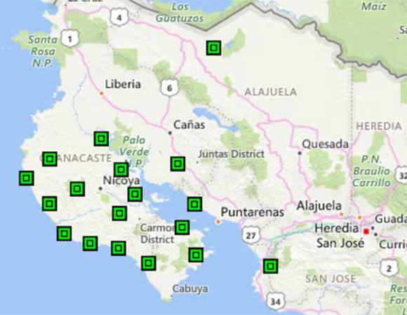
The Costa Rica Network, including the four NOTA-designated stations. Not pictured: station ISCO on Cocos Island. 
UNAVCO project manager Jim Normandeau cleans the metpack at station VERA. (Photo/Nicolas Bayou, UNAVCO) 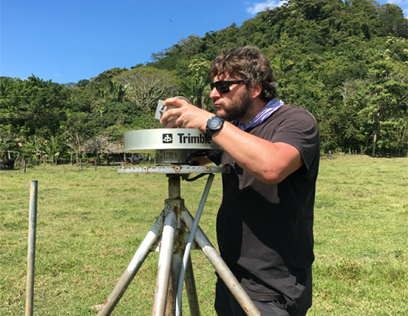
UNAVCO engineer Nicolas Bayou upgrades station QSEC’s Trimble Chokering LNA to enable GNSS tracking with the Trimble NetR9 receiver installed at the station. (Photo/Jim Normandeau, UNAVCO) 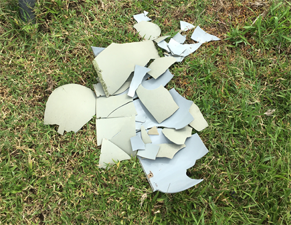
Long exposure to sunlight, high temperatures, and humidity have made most of the SCIGN domes very brittle. The plan is to proactively replace all the domes in the network. (Photo/Jim Normandeau, UNAVCO) 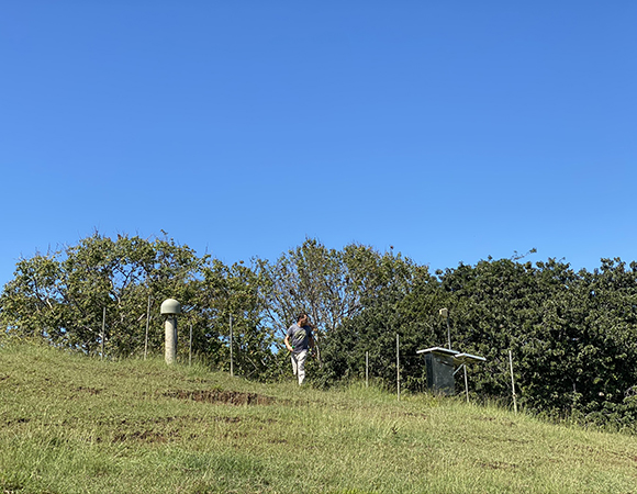
Avoiding invasive bees at station BON2. (Photo/Nicolas Bayou, UNAVCO) 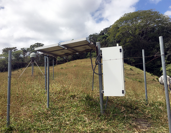
Station EPZA was in great shape and only needed to have the old Trimble NetRS receiver replaced with a Septentrio PolaRx5 GNSS receiver. (Photo/Jim Normandeau, UNAVCO) 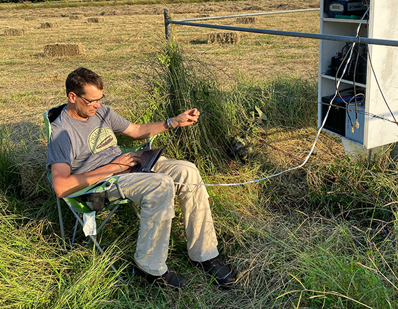
UNAVCO project manager Jim Normandeau troubleshoots communications at station LEPA. (Photo/Nicolas Bayou, UNAVCO) 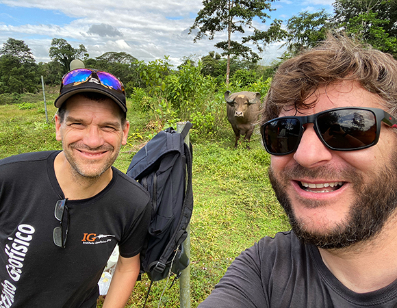
Last selfie at station VERA. (Photo/Nicolas Bayou, UNAVCO) 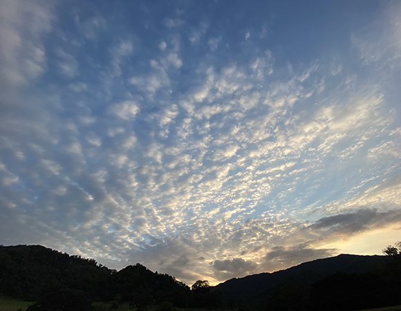
Sunset at station LEPA. (Photo/Nicolas Bayou, UNAVCO)
Project Overview
From the NSF award abstract
The great earthquakes and tsunamis of 2004 (Sumatra) and 2011 (Japan) were wake-up calls that our forecasting skill for these catastrophic events remains poor. Measurement of the slow motions of the Earth’s surface near active faults could help to forecast the location and the size of future earthquakes. This project tests the concept by operating a network of a high precision GPS/GNSS receivers in Costa Rica. This area is an active subduction zone that experiences frequent large earthquakes. The GPS/GNSS units will measure ground motion for a 3-year period with a precision of a few millimeters per day. This will continue a long history of geodetic observations here that now span both the late and early stages of the earthquake cycle. The data from this project will improve understanding of the earthquake process, and could lead to improvements in our ability to forecast these potentially deadly events. UNAVCO, the NSF-funded consortium for geodesy, will provide critical maintenance support for the network.
The existence of earthquake clusters in subduction interfaces suggests that not all accumulated strain is necessarily released in a single earthquake, and can be stored over a seismic cycle for release in a subsequent, larger than average event. With the discovery of slow slip events (SSEs: earthquake-like phenomenon within the interseismic phase that release energy slowly) it is now clear that determination of a full strain accumulation budget, and improved understanding of frictional conditions on the plate interface, also require study and understanding of these interseismic strain release mechanisms. Data from the M 7.6 September 5, 2012 Costa Rica earthquake suggests that a pre-event SSE changed Mohr Coulomb failure stress by a trivial amount, which may have pushed the fault to failure, although other failure mechanisms are also possible. SSEs are also important indicators of frictional conditions. Shallow SSEs are an important subset, and while generally difficult to observe, can be clearly seen in northern Costa Rica due to proximity to the trench. They may be critical for understanding tsunami potential in this difficult-to-observe region. More generally, SSEs may outline the region of subsequent seismic rupture; this pattern has now been documented in the active margins off Costa Rica, Ecuador and parts of Japan. This project deploys geodetic infrastructure to better observe and understand these slow slip events in the Nicoya Peninsula.
UNAVCO Support
Observatorio Vulcanológico y Sismológico de Costa Rica (OVSICORI), is tasked with providing operations and maintenance for the continuously operating GPS/GNSS (cGNSS) network located on the Nicoya Peninsula and the surrounding areas. Support also includes data downloading and archiving. This currently funded project’s goal is to upgrade the existing GPS stations to GNSS and to overhaul the cGNSS station’s infrastructure where needed. There are 19 stations in total. Some of these cGPS stations have been running since 2003, with the bulk of them installed in 2006.
Several stations in Costa Rica were absorbed into the Caribbean-wide COCONet network, which allowed for continued O&M support as funding at the time for the entire Costa Rican network was uncertain. One new station, VRAI, was installed as part of COCONet. These three stations (VERA, QSEC and IND1) and VRAI are now part of the Network of the Americas (NOTA), a core component of the National Science Foundation Geodetic Facility for the Advancement of Geoscience (GAGE), operated by UNAVCO.
For this preliminary trip, UNAVCO optimized support for stations in both networks. We visited three stations that are part of NOTA and most of the other stations in the Coast Rica network. Repairs, upgrades and assessment of the infrastructure were completed. A second trip is planned in early 2020 to complete the overhaul of stations in need and to relocate the HATI station.
Free and Open Data
All station data are available free and open access through the UNAVCO Geodetic Data Archive; the PIs encourage researchers to access and use it.
Project Information
- Principal Investigator(s): Timothy Dixon, University of South Florida
- UNAVCO Staff: Nicolas Bayou, Jim Normandeau
- Dates: 15 Jul 2019 ‐ 30 Jun 2022
- Location: Nicoya Peninsula, Costa Rica
- Funding Source: NSF EAR 1835947
- Map of Nicoya, Costa Rica
Related Links
- Do slow slip events trigger large and great megathrust earthquakes? – Science Advances (2018)
- The SZ4D Initiative: Understanding the Processes that Underly Subduction Zone Hazards in 4D (report) (2017)
- Earthquake and tsunami forecasts: Relation of slow slip events to subsequent earthquake rupture – PNAS (2014)
Written by:
- Jim Normandeau
- Posted: 6 January 2020
- Last updated: 4 June 2021
- Tags: GPS/GNSS, project highlights
-

