
GAGE/SAGE 2021 Community Science Workshop
Revealing Earth Systems: Integrating Spatial and Temporal Data
Click here for the Workshop Virtual Platform Website
The virtual platform site will stay live until August 2022. All registered attendees will continue to have access to it. Some of the workshop videos and content will be migrated to this page and the UNAVCO YouTube channel and be publicly available.
This workshop stretches across disciplinary boundaries and focuses on elements that are common to the diverse disciplines and applications within geodesy and seismology. It highlights synergies between the geodetic and seismic communities in time, space, and methods for approaching datasets and changes in the Earth System. It provides an opportunity to learn about cutting edge research, engage with other members of the community, and expand technical skills.
The workshop was virtual. The main workshop days were Tuesday-Thursday August 17-19, 2021. Short courses were August 9-13 and a few other activities were August 16 and 20.
This meeting is the equivalent of the UNAVCO and IRIS Science Workshops, which used to be held separately. The first joint workshop was held in Portland, Oregon in October 2019.
The Workshop is sponsored by the the US National Science Foundation (NSF) and National Aeronautics and Space Administration (NASA). The Geodetic Facility for the Advancement of Geoscience (GAGE) and the Seismological Facility for the Advancement of Geoscience (SAGE) are run by UNAVCO and IRIS, respectively, through cooperative agreements with NSF.
Dates
- June 1 – Registration opens
- July 1 – Early bird registration and E-lightning poster abstract deadline
- July 7 – E-lightning Poster abstract deadline (extended from original deadline of July 1)
- July 15-25 – E-lightning poster upload period
- July 25 – Last day for poster upload, refund request, caregiver stipend request (part of the registration process), and welcome packet availability
- August 1 – Full meeting website available; Short course registration deadline
- August 9-13 – Short courses
- Monday August 16 – First-time attendee welcome and early career networking events; International panel on geophysics in Central & South America
- Tuesday August 17 – Thursday August 19 – Main Workshop
- Friday August 20 – International panel on geophysics in Africa & Asia
Registration Fees
- Early bird registration (June 1-July 1)
- $100 regular
- $30 student
- Full price registration (July 2 and later)
- $130 regular
- $40 student
- Short courses (latest day to sign up is August 1)
- $25 regular ($35 July 2 and later)
- $15 student ($20 July 2 and later)
- Participants currently at institutions in low and low-middle income countries may request a fee waiver when registration is opened (community@unavco.org). We will use the economic definitions given by the World Bank.
- There is no fee to attend the International Panels, but participants must still register for these free events if they are not already registered for the meeting as a whole.
- Abstract submission for an E-lightning Poster is no additional cost beyond the main meeting registration. If you register as a Regular, Student, or Staff attendee, you will receive the link for abstract submission in your registration confirmation email. Poster abstract deadline is July 7, 2021 (extended from July 1). Posters and accompanying 3-min videos will need to be uploaded during July 15-25.
Workshop Goals
- Foster community among geodetic and seismic researchers, faculty, students, and facility staff,
- Facilitate geodetic and seismic scientific research by sharing results and planning future endeavors, and
- Provide a venue for professional development in scientific and technical careers.
Plenary Sessions
Videos from Plenary Sessions will be available asynchronously so people who are unable to attend in real time are still able to see the presentations.
Behavior at and coupling across key Earth interfaces
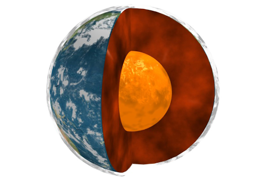
This session is aimed at understanding the structure and processes associated with interfaces and boundaries within the Earth system. Examples include the boundary between the solid Earth and its fluid envelopes, the boundary between the solid mantle and the liquid outer core, the land/ocean interface at continental margins, and Earth’s permeable near-surface boundary layer known as the critical zone. It will include contributions that highlight new data sets and observation strategies that target these interfaces, those that reveal new understanding of the processes operating at them, and studies that explore the ways that different regions of the Earth interact and how different components of the Earth system are coupled across interfaces.
- Michael Thorne – Unraveling small-scale structures across the lowermost mantle with multiple seismic phases: 3D modeling and probabilistic inversion
- Heather Ford – The seismic signature of past and present tectonic and dynamic processes on the lithosphere-asthenosphere boundary
- Chris Johnson – Probing fault systems using hydro-spheric induced stress modulation
- Diego Melgar – Geodetic coupling at subduction megathrusts and tsunami hazards: An example from Cascadia
- Clara Chew – Using reflected GPS signals to monitor the terrestrial hydrologic cycle
Illuminating Transients in Earth Processes
This plenary session focuses on integrative studies of transient deformation and Earth structure. Recent advances in seismic and geodetic monitoring technologies and methods have revealed time-dependent deformation processes and changing constitutive properties in a wide variety of Earth systems. Examples include slow slip on plate-boundary faults, a range of postseismic deformation processes, seasonal and multi-year aquifer changes, and landslide dynamics. These time varying signals can be captured by various geodetic methods, continuous seismic imaging using ambient noise, receiver functions or active source experiments, and repeated electrical resistivity imaging. We seek contributions that combine multiple methods to illuminate transient deformation and changing mechanical properties in the Earth.
- Hilary Martens – Constraining Hydrologic Loading with Space Geodesy
- Noah Finnegan – Hydrological and deformational processes governing transient seasonal slip in a large, slow-moving landslide
- Kathryn Materna – Geodetic deformation transients on plate boundary faults and in geothermal settings
- Qing-Yu Wang – Crustal deformation monitoring with ambient seismic noise correlation
- David Shelly – Earthquake Swarms: Volcanic and Tectonic Lessons from the Earth’s Crust, and the Mysteries that Remain
New approaches to processing big geophysical and geospatial datasets
“Big data” is challenging our computational capabilities in terms of volume, velocity and variety (3Vs). Increases in the spatial and temporal resolution of our geophysical observations have produced dramatic increases in the amount of data for geoscientists to analyze. Each stage of the life cycle of geospatial big data can present challenges for our community: (1) data acquisition, (2) compilation and management, and (3) data analysis, visualization and distribution. This session seeks to showcase strategies that are overcoming these obstacles and providing new insights into Earth behavior. For instance, machine learning presents a host of new opportunities for our community, with increasing emphasis on technical rigor, common benchmarks, and repeatability. In addition, enhanced understanding can also be achieved via data amalgamation, high-performance computing, data mining, and dataset-integration strategies. Vast datasets also create opportunities for improved statistical characterization and improved quantification of uncertainties. We are particularly interested in highlighting techniques that are scalable and transferable to other problems.
- Michael Bianco – Machine learning in seismology and acoustics: tomography and beyond
- Lindsey Heagy – Community driven development of open source tools for geophysical inversions
- Michael Olsen – Shake, rock and roll: Analyzing and forecasting post-earthquake rockfall activity from point clouds
- Eileen Martin – Compressing the computing requirements of fiber optic seismic monitoring
- Marine Denolle – Cloud Seismology
E-lightning Posters
Anyone who registers for the full workshop (Regular, Student, UNAVCO/IRIS Staff) can submit an abstract to do an E-lighting Poster. You will receive the abstract submission link in your registration confirmation email.
Abstract submissions to give E-lighting Poster Presentations will be accepted June 1 – July 1, 2021. In early July workshop conveners will review submissions for appropriate content and group into sessions of ~6-8 posters on related topics. Abstract deadline July 7, 2021 (midnight Hawaii) (extended from original deadline of July 1).
During the July 15-25 interval, poster presenters will need to upload:
- Poster file (pdf format; there are no specific size requirements but we recommend an aspect ratio that works well on screens and a high enough resolution that viewers can zoom in effectively)
- ≤3-minute video presentation of the poster
The last day to upload posters and videos will be July 25, 2021 (midnight Hawaii).
The presenting author for each E-lightning Poster must be registered for the GAGE/SAGE 2021 Community Science Workshop.
During each E-lightning Session, presenters will show their 3-minute video followed by a 2-minute live Question & Answer period. When all presentations have been shown, the group will have time to discuss further questions and ideas.
The poster and video files will be available asynchronously so people who are unable to attend in real time are still able to see the presentations.
Short Courses
Short Courses
Short courses will be held the week before the main workshop – August 9-13, 2021. They include seismology, geodesy, and workplace climate options.
- Geodesy (11:00 am – 3:00 pm ET)
- GAMIT/GLOBK in a Day
- Monday August 9 – Tuesday August 10
- InSAR Data Interpretation and Analysis for Nonspecialists
- Thursday August 12 – Friday August 13
- GAMIT/GLOBK in a Day
- Seismology (11:00 am – 3:00 pm ET)
- Retrieving Signals from a Noisy World: How Seismometers Work
- Monday August 9
- Introduction to MsPASS: A New Data Management and Processing Framework for Seismology
- Tuesday August 10 – Wednesday August 11
- Introduction to Earthworm and AQMS
- Thursday August 12
- Distributed Acoustic Sensing: Scientific Frontiers and Community Needs
- Friday August 13
- Retrieving Signals from a Noisy World: How Seismometers Work
- Workplace Climate (4:00 – 7:00 pm ET)
- Improving Workplace Climate: Boost Your Satisfaction and Success in Graduate School (STUDENTS-ONLY)
- Tuesday August 10
- Improving Workplace Climate: Increasing Inclusionary Behaviors in Your Department (NON-STUDENTS)
- Wednesday August 11
- Improving Workplace Climate: Boost Your Satisfaction and Success in Graduate School (STUDENTS-ONLY)
Workshop Agenda
Videos from Plenary and E-lightning Poster sessions will be available asynchronously so people who are unable to attend in real time are still able to see the presentations.
Day 0 – Monday August 16
- International Panel: Sharing Effective Practices for Infrastructure, Training, and Collaboration #1 – Emphasis on the Americas (11:00 am-12:30 pm ET; 3:00-4:30 pm UTC)
- Opening (2:00-4:00 pm ET)
- First-time Attendee Welcome and Orientation
- Student Networking Event
Day 1 – Tuesday August 17
Daily schedule will be 11:00 am-7:00 pm US Eastern Time with three 2-hours blocks and 1-hour breaks between. Sessions will include:
- Community Welcome Session
- Plenary 1 – Behavior at and Coupling Across Key Earth Interfaces
- Plenary Chairs – Ved Lekic and Shimon Wdowinski
- Plenary Speakers
- Michael Thorne – Unraveling small-scale structures across the lowermost mantle with multiple seismic phases: 3D modeling and probabilistic inversion
- Heather Ford – The seismic signature of past and present tectonic and dynamic processes on the lithosphere-asthenosphere boundary
- Chris Johnson – Probing fault systems using hydro-spheric induced stress modulation
- Diego Melgar – Geodetic coupling at subduction megathrusts and tsunami hazards: An example from Cascadia
- Clara Chew – Using reflected GPS signals to monitor the terrestrial hydrologic cycle
- Special Interest Group sessions
- Common Cloud Platform: Progress Towards Cloud-based Data Services
- Progress in Justice, Equity, Diversity, Inclusion, and Access in Geoscience
- Subduction Zones in Four Dimensions: Progress in Planning for the SZ4D Initiative
- Emerging Applications for sUAS (uncrewed aerial systems)
- Community Needs for NOTA Instrumentation and Data Quality
- E-lightning Posters
Day 2 – Wednesday August 18
Daily schedule will be 11:00 am-7:00 pm US Eastern Time with three 2-hours blocks and 1-hour breaks between. Sessions will include:
- Plenary 2 – Illuminating Transients in Earth Processes
- Plenary Chair – William Frank
- Plenary Speakers
- Hilary Martens – Constraining Hydrologic Loading with Space Geodesy
- Noah Finnegan – Hydrological and deformational processes governing transient seasonal slip in a large, slow-moving landslide
- Kathryn Materna – Geodetic deformation transients on plate boundary faults and in geothermal settings
- Qing-Yu Wang – Crustal deformation monitoring with ambient seismic noise correlation
- David Shelly – Earthquake Swarms: Volcanic and Tectonic Lessons from the Earth’s Crust, and the Mysteries that Remain
- Professional Development Mini-courses
- Visual Design for Scientists
- NSF: A Peek Behind the Curtain
- IRIS & UNAVCO Data Services
- Everything You Need to Know About Proposing to Use PASSCAL Magnetotelluric Instrumentation for Your Science
- Community Session: Visions for Future Geophysics Infrastructure
- E-lightning Posters
Day 3 – Thursday August 19
Daily schedule will be 11:00 am-7:00 pm US Eastern Time with three 2-hours blocks and 1-hour breaks between. Sessions will include:
- Plenary 3 – New Approaches to Processing Big Geophysical and Geospatial Datasets
- Plenary Chair – Greg Beroza and Margaret Darrow
- Plenary Speakers
- Michael Bianco – Machine learning in seismology and acoustics: tomography and beyond
- Lindsey Heagy – Community driven development of open source tools for geophysical inversions
- Michael Olsen – Shake, rock and roll: Analyzing and forecasting post-earthquake rockfall activity from point clouds
- Eileen Martin – Compressing the computing requirements of fiber optic seismic monitoring
- Marine Denolle – Cloud Seismology
- Special Interest Group sessions
- Shaping the Design of the Rupture and Fault Zone Observatory (RuFZO)
- EarthScope Science Synthesis Volume(s)
- Collecting Geophysical Observations from the Seafloor
- Long term plans for the GNSS Data Products
- Seismic Rapid Response to Geohazards Initiative: Updates and Opportunities
- E-lightning Posters
- Community Session: Partnerships for the Future of Geophysics Panel Discussion & Workshop Closing
Friday August 20
- International Panel: Sharing Effective Practices for Infrastructure, Training, and Collaboration #2 – Emphasis on Africa & Asia (7-8:30 am ET; 11 am-12:30 pm UTC)
Workshop Leadership
Science Planning Committee:
- Mike Brudzinski, Miami University of Ohio
- Roland Bürgmann, University of California Berkeley
- Maureen Long, Yale University
- Wendy Zhou, Colorado School of Mines
UNAVCO/IRIS Planning Contacts:
- Beth Pratt-Sitaula, UNAVCO
- John Taber, IRIS
Have questions? Please contact Beth Pratt-Sitaula (prattsitaula![]() unavco.org) and John Taber (taber
unavco.org) and John Taber (taber![]() iris.edu) for more information.
iris.edu) for more information.
HOME
- EVENTS
- Workshops
Info
- Date(s): August 17-19 (short courses August 9-13)
- Location: Online
-


- CODE OF CONDUCT