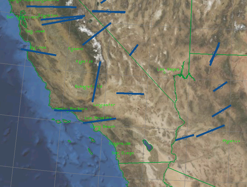
 San Diego area; click for larger image
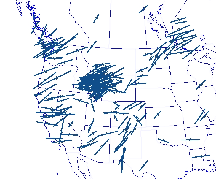 western US; click for larger image
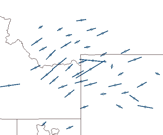 Yellowstone area; click for larger image
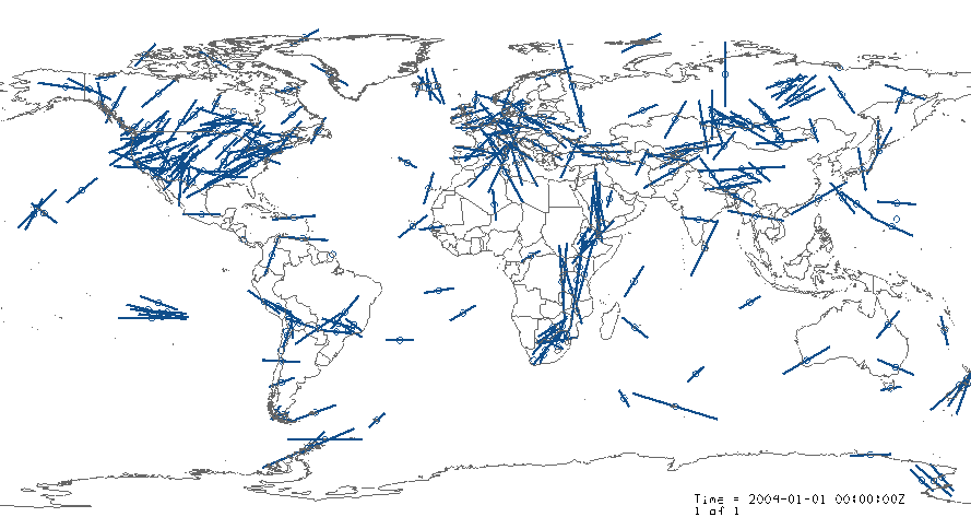 Earth, from Mathew Fouche compilation (selected stations)
The UNAVCO IDV can display seismic anisotropy or polarization derived from shear wave splitting, with the conventional symbol centered on the location in latitude, longitude, and elevation. Splitting azimuth and delay are shown at each station as bars aligned with the fast direction and bar length scaled by time delay.
The IDV has full interactive controls in true 3D including zoom, pan, and rotation, and a tools to change map projections and background maps. You can make combined displays with other geophysical and map data.
Data
Original Data Publication: Gregory P. Waite, Derek L. Schutt, Robert B. Smith, and Eugene D. Humphreys, "Models of lithospheric and asthenosphere anisotropic structure of the Yellowstone hotspot from shear wave splitting", J. Geophys. Res., 110, 2005, B11304, doi:10.1029/2004JB003501; Table 3.
Global compilation of shear wave anisotropy by Matthew Fouche (more than 1300 observations)
Original Data publication:
Upper Mantle Anisotropy Database
URLs of data files for UNAVCO IDV use, converted to NetCDF format:
Waite et al., western US
Waite et al., Yellowstone area
Matthew Fouche global compilation
(
bundle file to make a display with the Fouche data.)
Be sure to use Data Source Type of "netCDF Point Data" in the Dashboard's Data Chooser.
To format your own anisotropy data for the UNAVCO IDV, use this sample NetCDF CDL file. The "global attributes" are optional. Also see NetCDF data for the UNAVCO IDV.
Anisotropy data can also be formatted in ASCII; see UNAVCO IDV Point Data in Text Format (csv files).
Sample UNAVCO IDV Displays
San Diego area; click for larger image
western US; click for larger image
Yellowstone area; click for larger image
Earth, from Mathew Fouche compilation (selected stations)
Make a Display
After the IDV connects to the data (you added a data source) , then in the "Fields Selector" window, in the Fields panel, you should see "Point Data." (If not, the file is bad or you did not tell the IDV it was point data. ) To make a data display, in the Displays panel click on the circle by "Point Data," then on "Point Data Plot." Click on Create Display. ("Point Data List" shows a list of data values.) A display appears in the main window and a Display Controls window pops up. In the main menu bar, choose a Projections -> Set that suits your area, or make a new Projection to do so. See more about Projections in the how-to page.
In the Display Controls window, choose "Layout" to be "Seismic polarization." The symbols are located at the location and depth of the observation. Read more about Point data plot controls.