UNAVCO IDV: Topography Data Sources
UNAVCO IDV: Topography Data Sources
High quality topography data for the entire globe is available online ready to use in the IDV.
For some data you need only
enter the URL to the data, with no need to copy data files.
The IDV can display topography data (gridded elevation values) as contours, flat surfaces
colored by elevation value, and as
3D topographic relief maps which may be colored by elevation or
be drapped with imagery. The colors and vertical exaggeration are adjustable.
Surfaces may be below sea level, and displays may be in for any area and with many map projections
including polar projections. You can also make a data transect of elevation showing a graph of elevation along a line.
Any latitude-longitude grid of values, for example, gravity anomaly grids, may be displayed on a map with the parameter value
controlling the "Altitude" in a 3D relief plot.
This makes a relief map by data value, a kind of topography.
You can drape TIFF and JPEG imagery over 3D relief topography.
Online Topography Data
USGS DEMs
Sample IDV Topography Displays
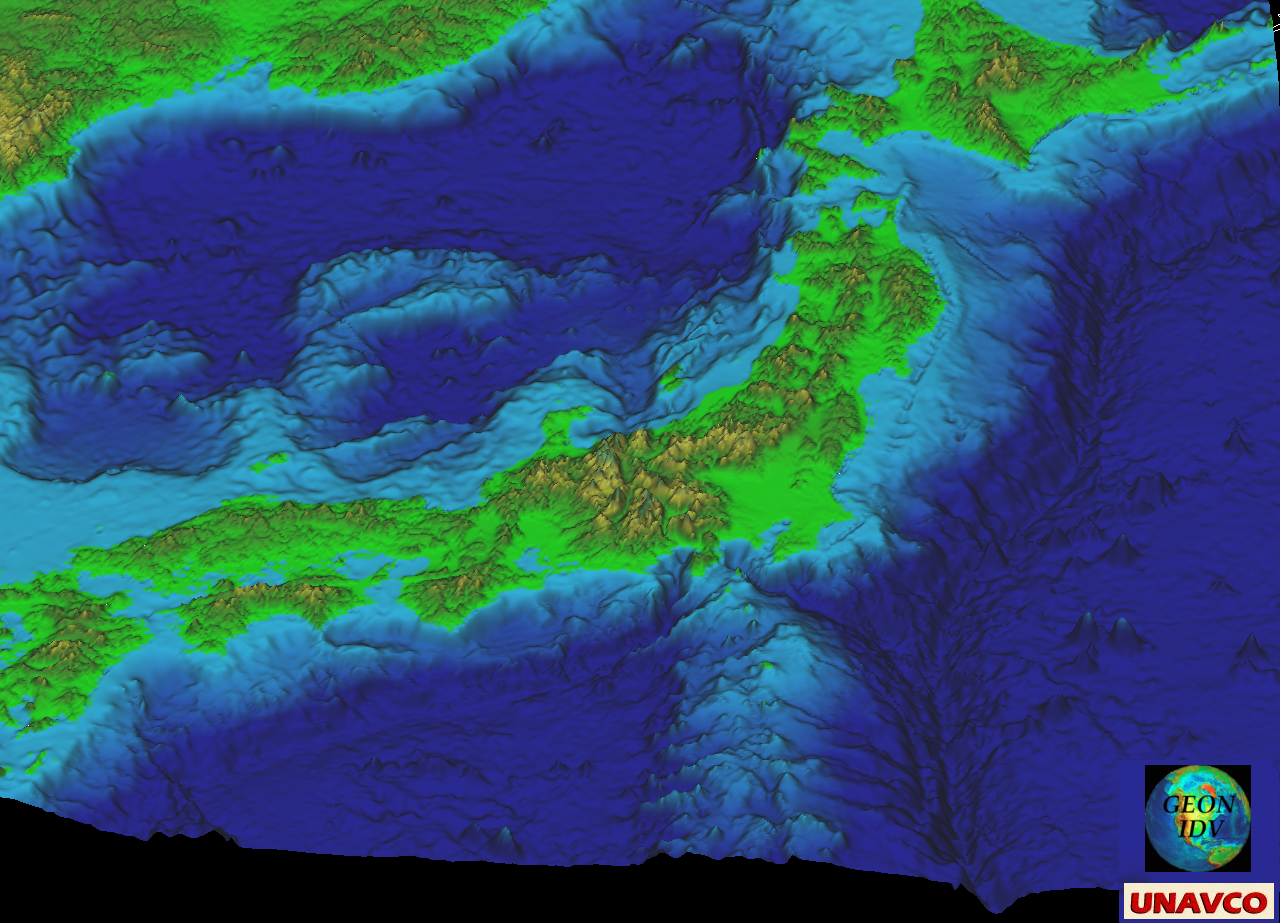
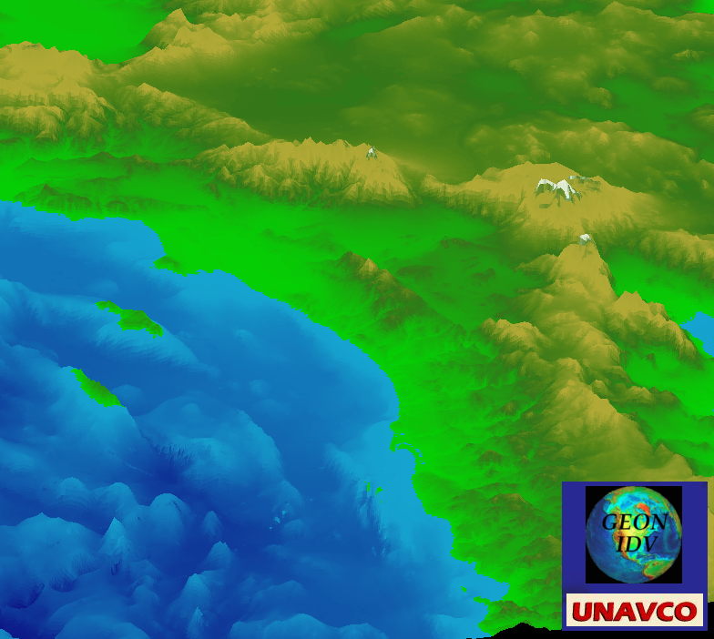
Japanese bathymetry, 3D relief surface;
oblique view, colored by elevation;
10 x vertical exaggeration; NGDC GLOBE data. Click for full size
|
|
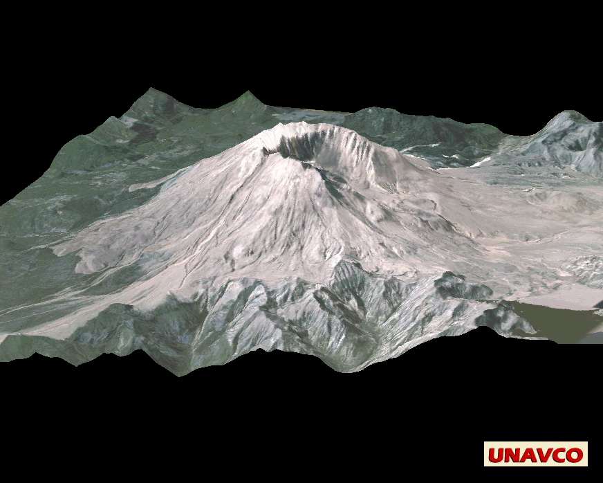
Mt St Helens (true vertical scale; elevation data is USGS hoquiam-e DEM, drapped with photography. Click for full size.
|
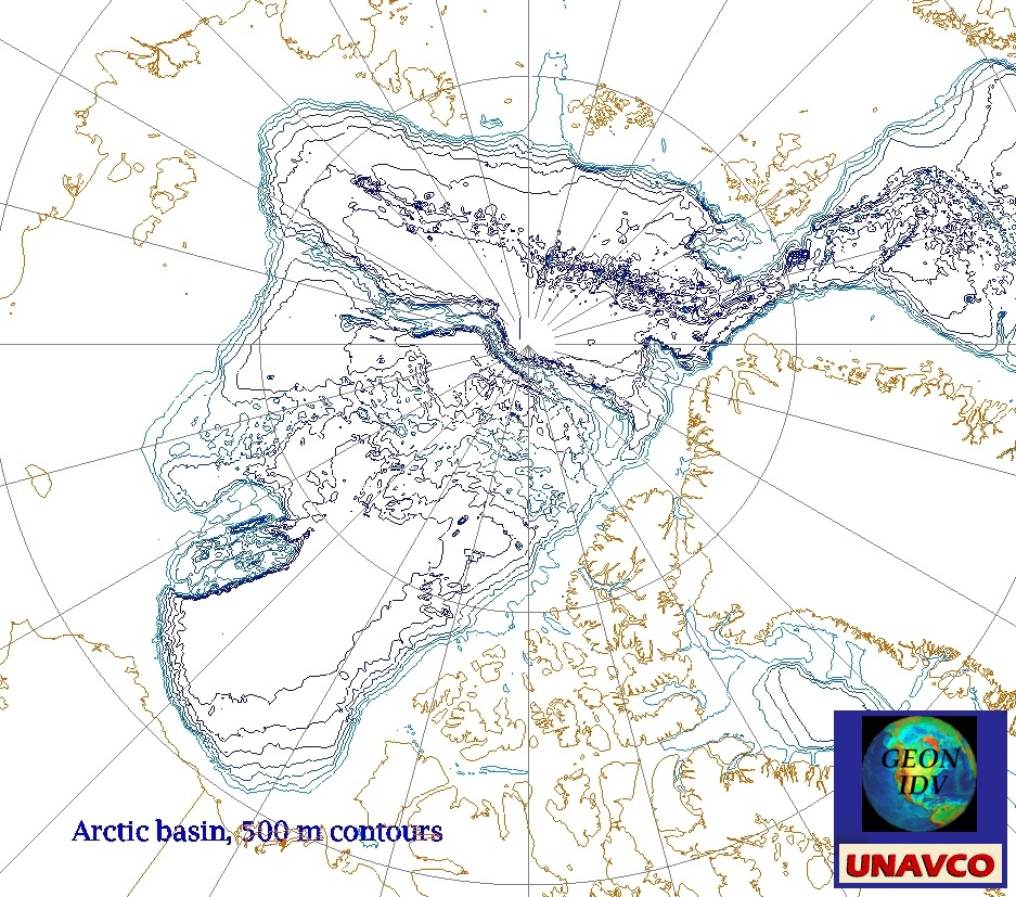
Arctic Basin Contours. Click for full size.
|
|
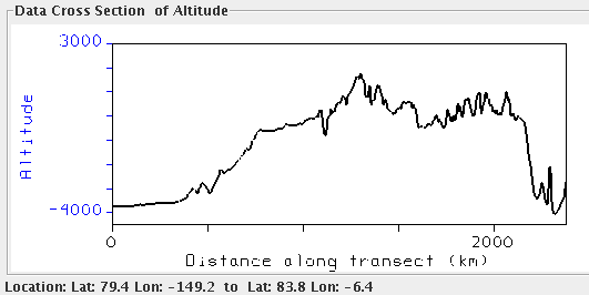
IDV topography transect (vertical cross section).
Click for full size.
|
Catalogs of Online Topography Data
You can easily load high quality global topographical data into the IDV from online sources:
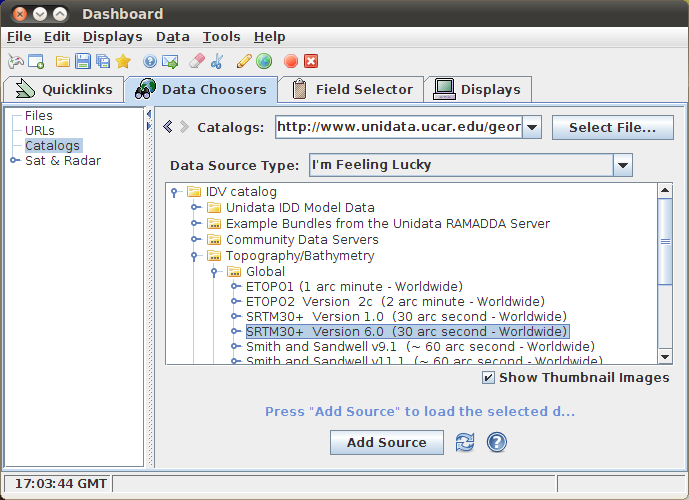
In the Dashboard window, Data Choosers tab, choose Catalogs in the left menu.
In catalogs, choose IDV Catalog -> Topography/Bathymetry. Open Global (as shown above) or one of the other regions.
In Global for example there are six data souces. The figure above shows SRTM30+ version 6.0 choosen.
2 arc minute data has a resolution a little better than 3.6 km;
1 arc minute data (60 arc second) has a resolution a little better than 1.8 km; and 30 arc seconds has 0.9 km.
Click Add Source. The Field Selector tab in the Dashboard window will appear, with the Plan Views Color image display choice
highlighted.
You may modify "stride" and "region" in the little map tool in the lower right.
This helps the IDV handle huge global data sets. Choose a region, by dragging the mouse, where you want a display, and no larger.
Click on Create Display to see a display of topo values by color. You can of course use any of many
color tables, or make or edit your own color table. Or you can choose contour lines.
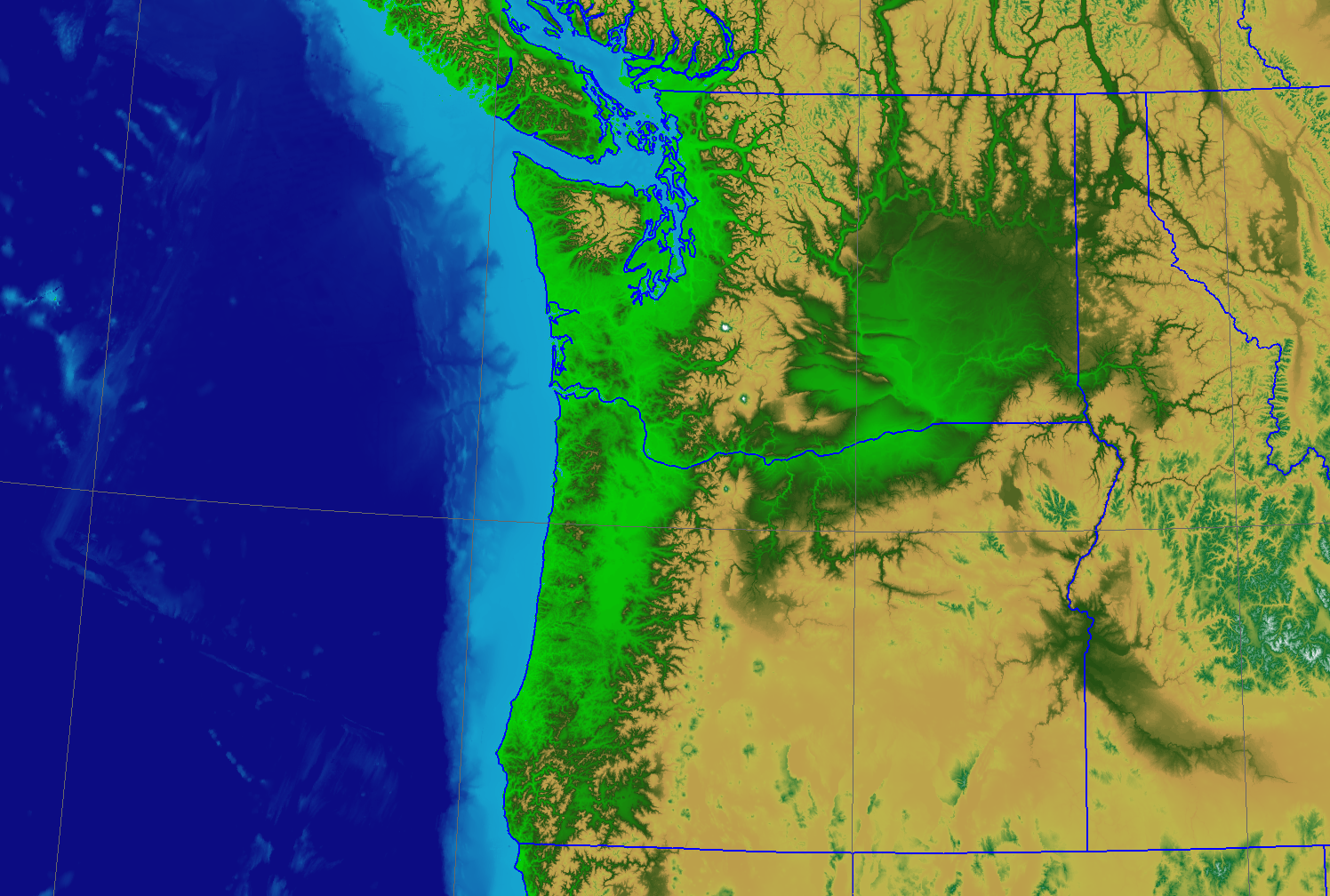
SRTM30+ v6 30 arc second data. Click for full size.

SRTM30+ v6 30 arc second data. Click for full size.
Smith and Sandwell v11.1 data. Click for full size.
DEM Files
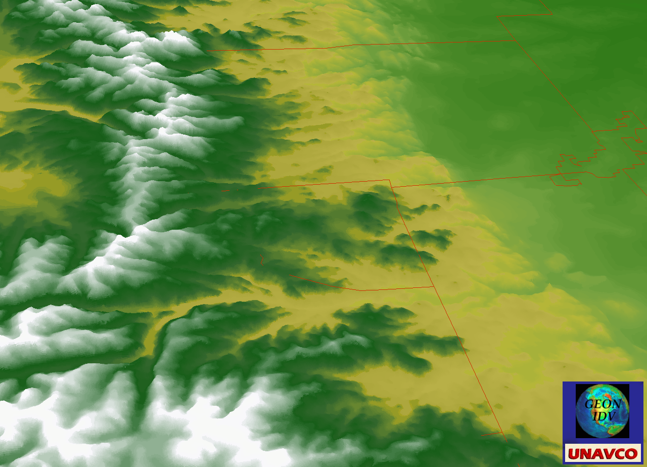
USGS DEM topography values; IDV 3D relief surface, Colorado Front Range, oblique view to North
click for larger size
The IDV can read and display DEM files. Many of these are available online; see
for example
The National Map Seamless Server.
Scales and resolutions:
USGS 1:24000 scale DEMs (resolution near 10 meters)
USGS 2 arc-second DEMs (about 62 meters resolution horizontally; the
unit of coverage is a 30- by 30-minute block, or 1 km on a side);
USGS 1:250,000-scale Digital Elevation Models
have a horizontal resolution of 3 arc-seconds: the spacing of the elevation values is 3 arc-seconds
(roughly 100 meters). The vertical resolution is the nearest integral meter at each grid location.
30 arc second or about 1 km grid point spacing (resolution).
2 arc minute or about 3 km grid point spacing.
4 arc minute or about 7 km.
5 arc minute or about 10 km.
The USGS makes DEMs on many scales; see
USGS Digital Elevation Models (DEM)
and
USGS DEMs.
See also USGS Geographic Data Download
including 1,125000 scale (3 arc seconds)
and higher resolution 1:24000 scale DEMs (resolution near 10 meters), and other topographic data.
There are also 2 arc seconds DEMs; see
2-Arc-Second Digital Elevation Models
For Alaska see Alaska DEMS.
To find a USGS 1:250,000 DEM (100 m grid spacing; 1 square geographic degree area)
for your area, first find the name of the
USGS 1:250,000 topo map for the area, for example, using the web service
USGS topo maps. Then find the USGS DEM file
of the same name in
this directory.
These DEMs cover an area 1 degree on a side. For each topo map area and name, there are an east and west
DEM. Download the file (about 1 MB); gunzip the file (to 9.83 MB).
Add the "data source" file to the IDV -- use data type "DEM file."
You can use it for any topo data display or purpose.
Sample IDV Displays of Topo Data
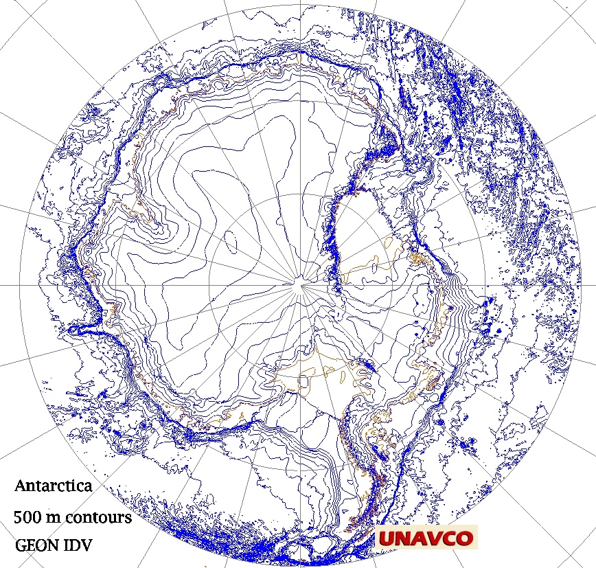
Antarctica, 500 m contours (click to see full size image)
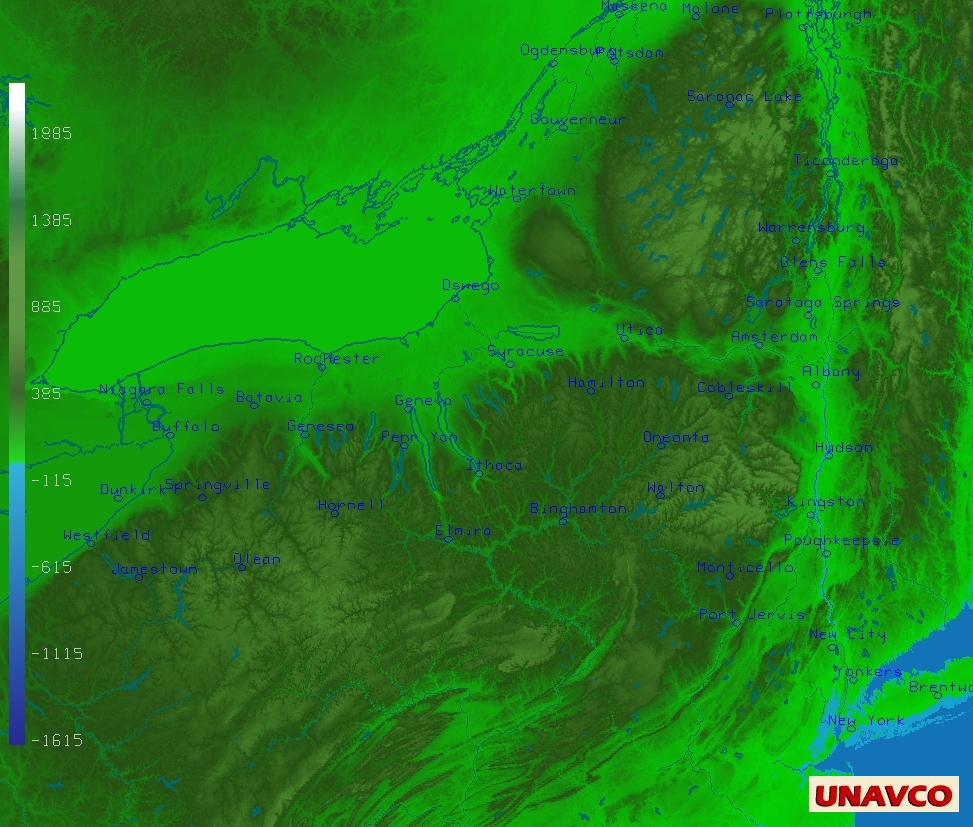
Topography of New York State colored by elevation. (NGDC 30 second "GLOBE" data).
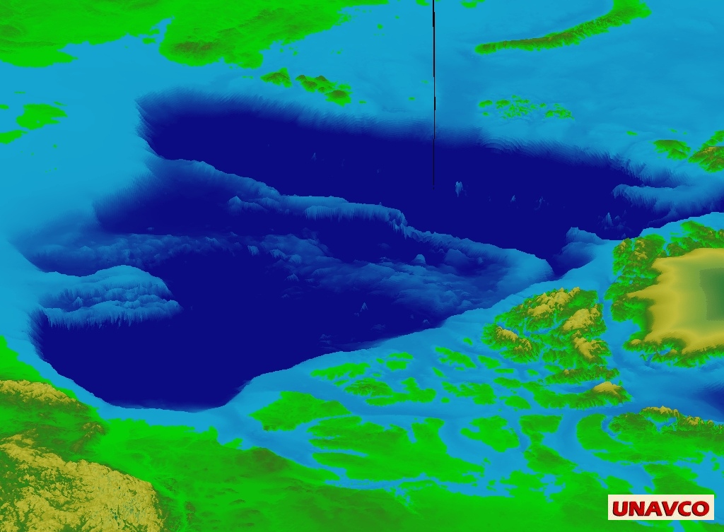
Topography of Arctic basin, oblique 3D relief, colored by elevation (NGDC ETOPO2v2 data).
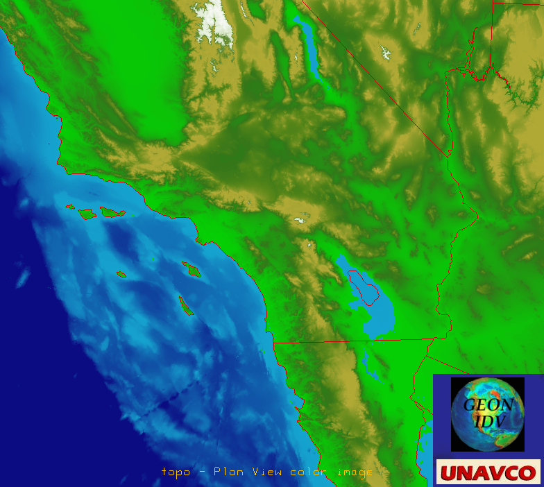
SRTM30 PLUS map colored by topography (California)
SRTM30 PLUS data, 3D relief surface, oblique view
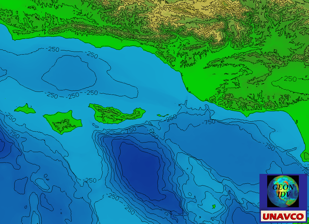
NOAA_Coastal_Relief_Model_3_arc_sec_Vol_6_Southern_Calif: contour (250 m) map, plus colored relief (stride every 2nd point)


