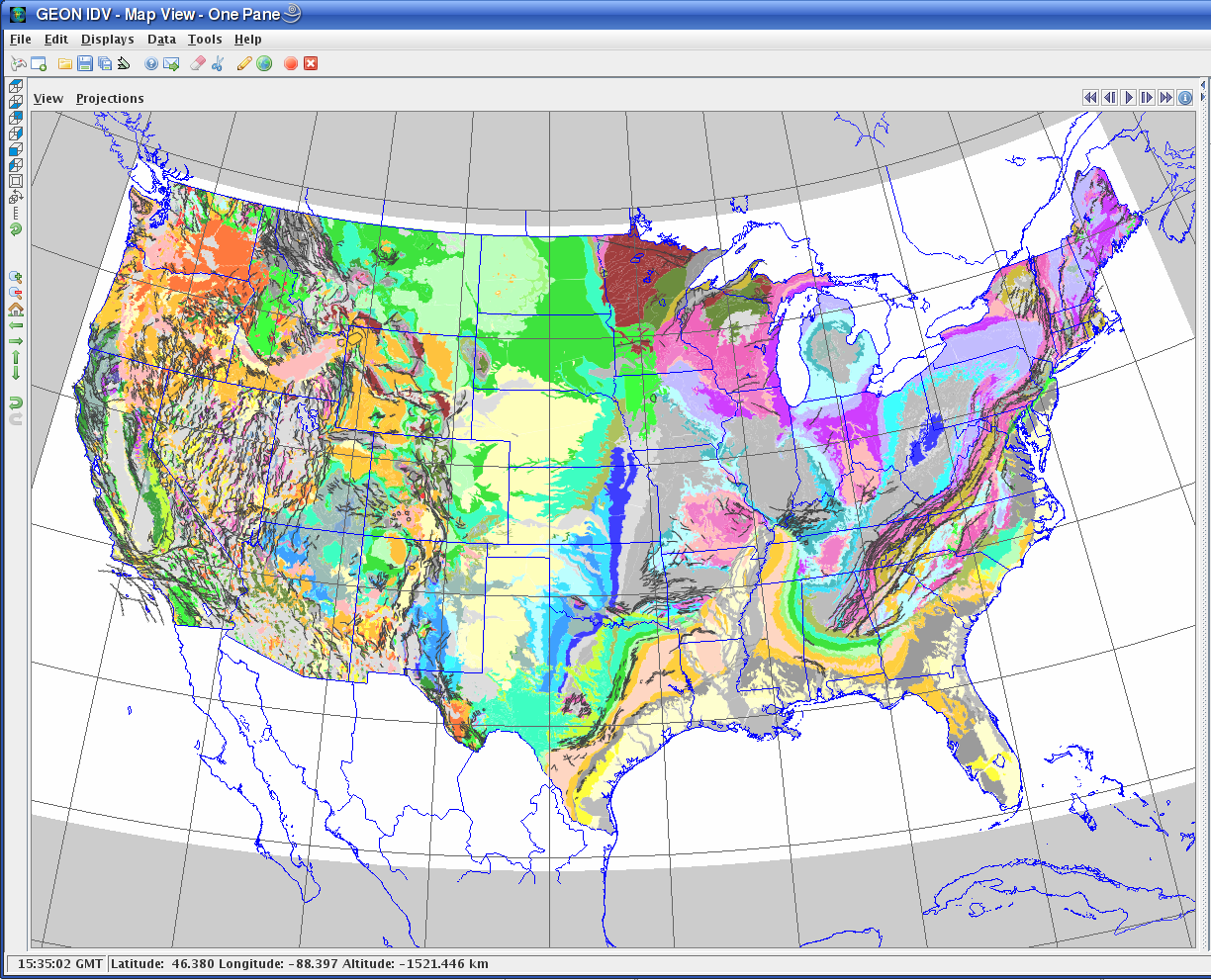
Geology of the conterminous United States:
WMS: http://mrdata.usgs.gov/cgi-bin/mapserv?map=kb.map&request=GetCapabilities&service=WMS&version=1.1.1
 Click for full size.
Geology maps from WMS servers
Geology maps from WMS servers can be included in any IDV display, with any map projection, in 2D or 3D views.
Sample USGS Data sets:
Geology of the conterminous United States:
WMS: http://mrdata.usgs.gov/cgi-bin/mapserv?map=kb.map&request=GetCapabilities&service=WMS&version=1.1.1
Click for full size.
For more online data from the USGS see
Mineral Resources On-Line Spatial Data
and USGS Geology online which includes
State Geologic Map Compilation
World geology which includes a link to OneGeology.
and
USGS Web Map Services (WMS) available
which includes gravity and magnetic anomaly maps.
OneGeology: see
OneGeology and IDV Geologic Maps from WMS Servers.
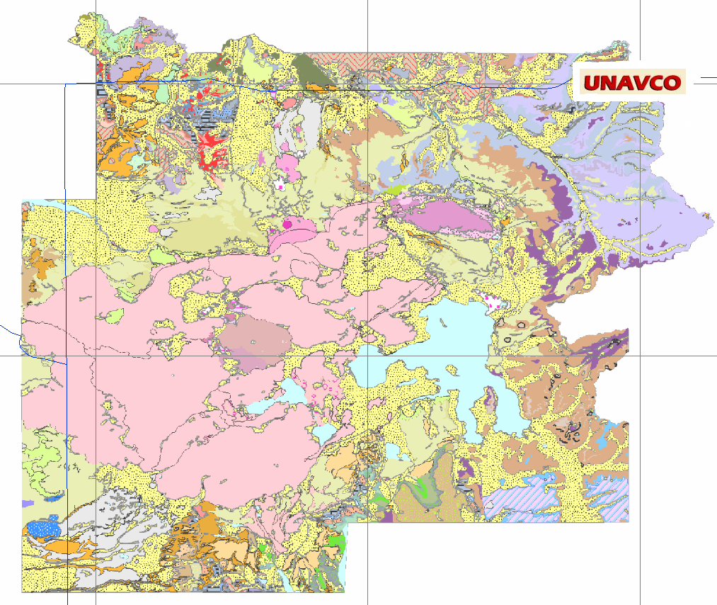
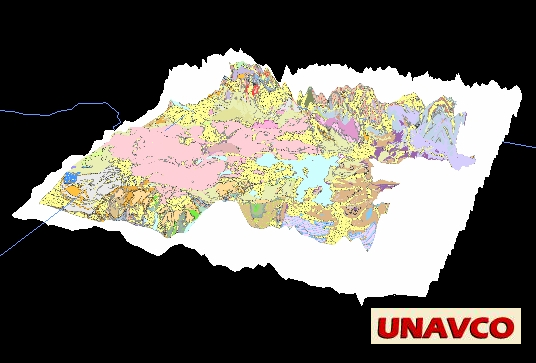
Geology maps from images
Geology maps (as images) can be included in IDV displays, and geology cross sections
can be included in 3D IDV displays, with the correct location and depth extent.
If you have an image of a geology map in a TIFF or JPEG file, with known corner locations,
in latitude/longitude,elevation, you can display it in the IDV in the correct mapped location.
See Mapping TIF imagery
You can also drape the geology map over 3D topograhic relief, if you have elevation data.
Geology map of Yellowstone National Park
Geology Cross-Sections
Learn more about TIF Images
and
TIF over Topography in 3D relief in the IDV,
and learn about
JPEG Images mapped with latitide and longitude.
Any image can be displayed in the IDV if you know the lat/long of the corners, either as a flat
image at any level, or drapped over surface (or other) elevation data.
Geological cross sections, or any can be a vertical part of IDV
displays in correct spatial and vertical location and extent. See
Display vertical images.
The
One Geology project provides
geology maps of the world, from
other geological surveys, in standard format
(GeoSciML).
The IDV can display these maps: OneGeology Maps server and the IDV.
 Click for full size
provided by:
Robert L. Christiansen. See
U.S. Geological Survey Professional Paper 729-G,
"The Quaternary and Pliocene Yellowstone Plateau Volcanic Field of
Wyoming, Idaho, and Montana," (http://pubs.usgs.gov/pp/pp729g/).
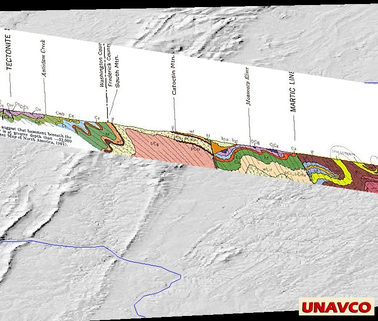
Maryland geology: The surface 3D relief has been moved down to show the cross-section.
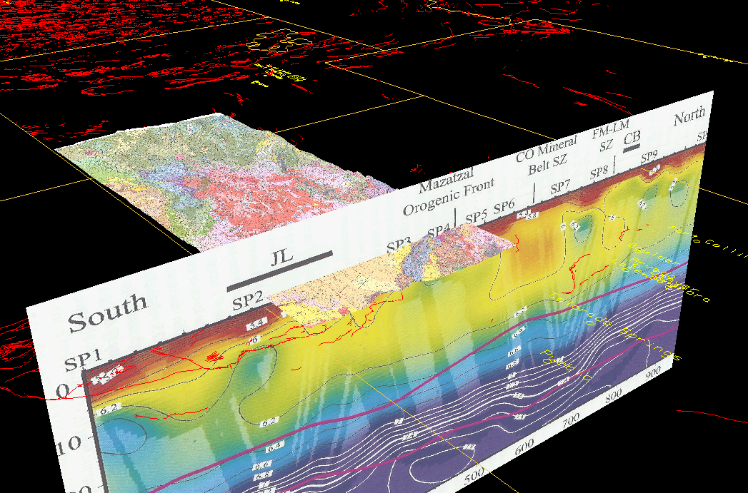
Southwestern Colorado geology map, geophysics cross section diagram, in ooblique 3D view from the southeast,
all parts in correct locations