DGRAV Summary
Data files:
"DNAG GRAVITY, 2.5 Minute:
This file [dgrav.bin] is a binary file copied from the Geophysics of North
America CD-ROM. It contains bouguer/free-air gravity anomalies
for North America on a 2.5 minute grid File dgrav.bin -
2.5 minute grid of bouguer/free-air gravity anomalies for the
U.S.A. (from GNA).
GRID LIMITS:
Longitude : 170E to 10.75W
Latitude : 5.16667N to 81.1667N
1824 Rows X 4302 Columns = 7,846,848 data 2 bytes / data point = 55,693,696 bytes
The data are stored row wise starting in the upper left corner."
file metadata.
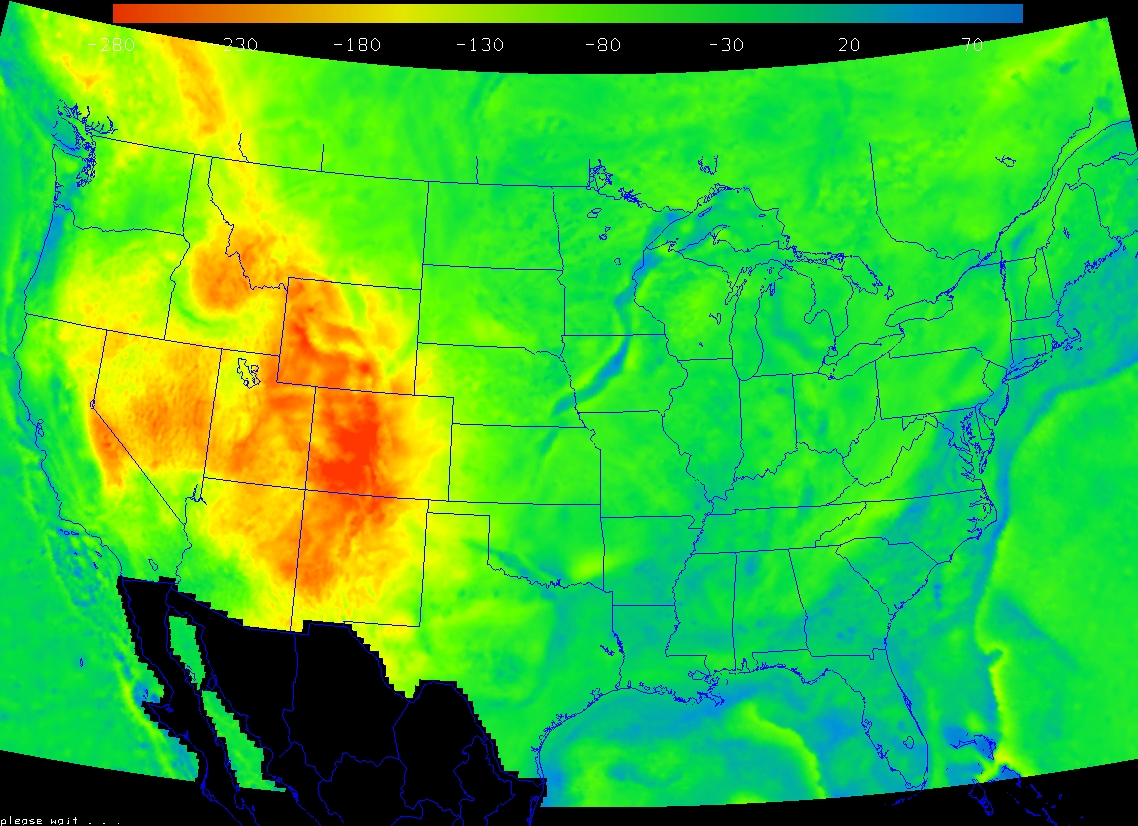
UNAVCO IDV displays of DGRAV Bouguer anomaly, U.S. Click for full size.
"... Regridding the potential field data from kilometers on a map projection into latitude and longitude introduced some gradient distortions at all latitudes. We would recommend that anyone attempting to do quantitative work with the potential field grids use the original 6-km gravity grids. DNAG GRAVITY, 2.5 Minute: dgrav.doc This file is a binary file copied from the Geophysics of North America CD-ROM."
NetCDF format binary data file of DGRAV for IDV use: DGRAV.nc (31 MB)
DNAG Gravity
DNAG Summary
NGDC Data files"Contributing Organization: Geological Society of America
Summary: The Decade of North American Geology (DNAG) gravity grid values, spaced at 6 km, were used to produce the Gravity Anomaly Map of North America (1987; scale 1:5,000,000). Considerable caution should be exercised when using these gridded data in regions of sparse coverage (for example, deep oceanic areas). The spatial distribution of the original data from which the grid was generated is shown on sheet 5 of the published map."A data grid for the IDV (converted to the NetCDF binary format), is DNAG.nc. This grid has 7.8 million grid points and can max out IDV display capabilities on some systems. Use x-y spatial subsetting when selecting files to display in the IDV if you do not need to see full resolution.
UNAVCO IDV displays of DNAG Bouguer anomaly, North America, and lower 48 states. Click for large size.
PACES
A excellent source of U.S. gravity surface field values is PACES, with data in the Gravity Database of the US.
A sample file of PACES Bouguer anomaly values (point values) made into a NetCDF grid for the IDV: Colorado Bouguer anomaly grid The grid spacing or resolution is 2.4 kilometer (about 1.3 minutes of latitude). The equivalent NetCDF CDL file (in ASCII) is here, for a sample of a good NetCDF format gravity grid file.
Gridding PACES with GMT for IDV Use
PACES data is at point locations, not gridded. You can use GMT to grid PACES gravity for the IDV, as these examples show. Here is some help to start with. Gridding is not fool-proof; you can shift feature locations slightly depending on how you do it, so take care.
The grided sample files of PACES data by UNAVCO is only for illustrating the process and NetCDF data formats. Do not rely on the accuracy of these gridded anomalies for actual field use.
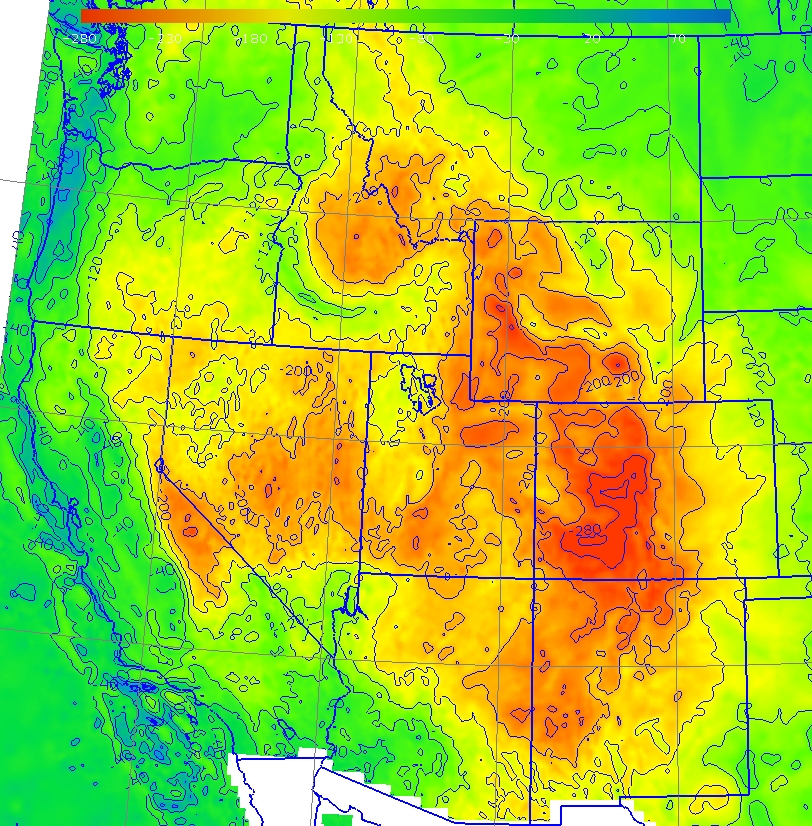
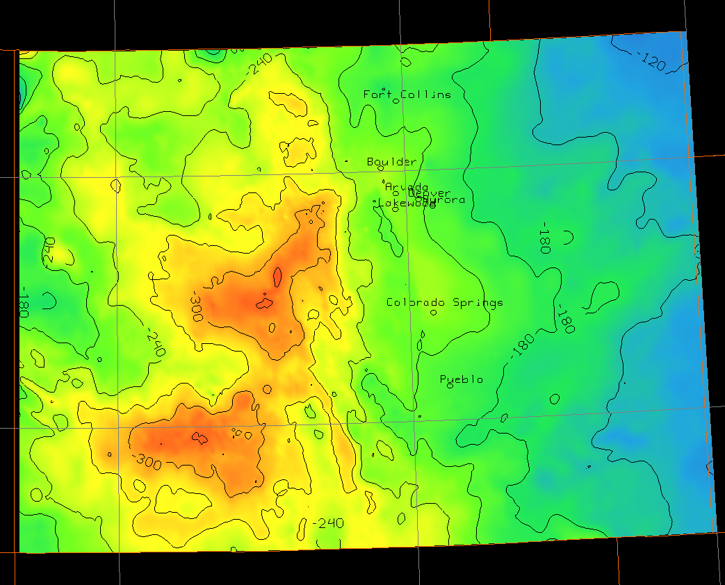
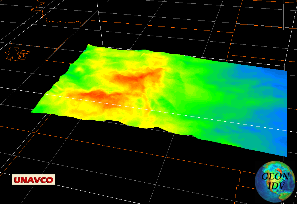
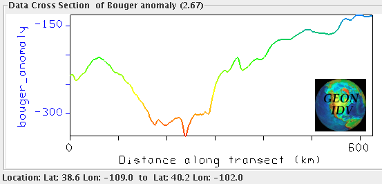
UNAVCO IDV Displays of PACES Bouguer gravity anonalies in Colorado. Click for full size:
And, CHECK OUT THESE DATA:
NOAA'S NGDC Gridded Data - Regional and Global Data Sets.