
2010 Short Courses Archive
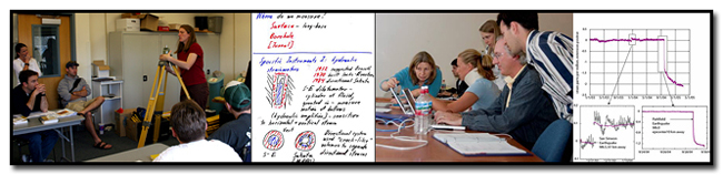
In response to community requests and interest, UNAVCO provides an annual series of short courses focussed on UNAVCO tools and data streams. These courses are for current researchers who want to refresh their skills or explore the use of new tools, and for early career scientists such as post doctoral fellows, graduate students, and upper level undergraduates who want to learn the latest geodetic techniques.
Short Course Materials
Course Materials from previous short courses.
2010 Short Courses
Faculty Development
-
Planning for the Future of Geo-cybereducation Workshop: Report from a Workshop
January 6-8, 2010
Hilton Arlington and Towers, Arlington, Virginia
Conveners: Jeffrey G. Ryan, University of South Florida
Susan Eriksson, UNAVCO Education and OutreachThe geoscience community has come together repeatedly in the last fifteen years to examine how the growing world of cyberinfrastructure tools, data archives, and information resources is impacting education and research in the field. The earth, ocean, and atmospheric sciences have been early adopters of cyber‐tools to facilitate both educational activities and research (e.g., Manduca and Mogk, 2000; Carbotte, et al 2001; Allison et al 2002; 2003).
Download full report (PDF)
-
Teaching Geodesy in the 21st Century – an ‘On the Cutting Edge’ Follow-on Workshop
Part of the 2010 UNAVCO Science Workshop
Monday, March 8, 2010
Leaders: Susan Eriksson, UNAVCO and Shimon Wdowinski, University of Miami
Cutting Edge PI mentor: Barb Tewksbury
SERC webteam mentor: John McDarisThe Follow-On Workshop Program is designed to bring Cutting Edge workshop results and resources to new audiences, while providing opportunities to develop new Cutting Edge workshop leaders. To integrate these regional workshops into the Cutting Edge program and to maximize the use of existing resources, workshop leaders with successful proposals attend a leadership workshop where they learn about Cutting Edge program goals, design principles, and website tools. The leadership workshop provides an opportunity to work with Cutting Edge PIs to design the workshop, and to work with the Cutting Edge evaluation team to design its evaluation. UNAVCO was selected as one of 4 workshops in the 2009 competition. Prior to the Science Workshop in March, faculty and E&O staff will develop an interactive website for pre-workshop and post-workshop activities. If you attended the 2008 UNAVCO Science Workshop pre-meeting workshop for faculty – this is for you. To register and learn more visit the workshop webpage.
GPS Course:
-
GPS Data Analysis and Modeling Using GAMIT/GLOBK/DEFNODE
November 16-19, 2010
University of Miami, FL
InSAR Course:
-
InSAR: An introduction to Processing and Applications for Geoscientists
August 16-18, 2010
UNAVCO: Boulder, Colorado
Laser Scanning Course:
-
TLS: Terrestrial Laser Scanning (Ground-Based LiDAR) Methods and Applications in Geologic Research and Education
October 30, 2010, 8am-5pm
Geolocial Society of America 2010 Annual Meeting, Denver, CO
Strainmeter Course:
-
Getting Started with PBO Strainmeter Data
August 25 - 27, 2010
UNAVCO: Boulder, Colorado
Teacher (Grades 6 - 12), Park Ranger & Museum Interpreter Development Courses:
-
Central Texas Earth Science Teacher Workshop (1/2 day)
GPS Geodesy as Windows on Earth: New Discoveries using GPS and other Geodetic Techniques
February 2, 2010
Waco, Texas (taught through web-ex)
-
Teachers on the Leading Edge - TOTLE 2010 Summer Workshop for Washington State Middle Level Earth Science Teachers (5-9th grade)
August 1-6, 2010, Pacific Lutheran University, Tacoma, Washington
Instructors: Robert Butler (University of Portland), Beth Pratt-Sitaula (Central Washington University), Jill Whitman (Pacific Lutheran University), Frank Granshaw (Portland Community College), Bonnie Magura (Jackson Middle School), Chris Hedeen (Oregon City High School), Roger Groom (Mt Tabor Middle School), Denise Thompson (Orting High School)
Teachers on the Leading Edge (TOTLE) is a professional development program for Earth Science teachers in the Pacific Northwest. Through a grant from EarthScope, TOTLE will offer a five-day workshop for middle-level Earth Science teachers during summer 2010 at Pacific Lutheran University in Tacoma. EarthScope is an Earth Science program funded by the National Science Foundation to explore the structure and evolution of the North American continent. EarthScope seismic stations and global positioning system (GPS) receivers are monitoring seismicity and deformation of the active continental margin to advance our understanding of the earthquake, tsunami, and volcanic hazards in the Pacific Northwest. Through a problem-solving approach to active continental margin geology, teachers will learn how geoscientists developed our current understanding of Pacific Northwest plate tectonics, earthquakes, and volcanoes and how EarthScope research is advancing frontiers of knowledge. Three days of classroom and computer-based studies of active continental margin geology and EarthScope science will be reinforced by two field days investigating Cascadia great earthquakes and tsunamis and Cascade volcanic hazards.
For more information about the TOTLE program visit https://sites.up.edu/totle/.
-
Yellowstone Interpretive Workshop
GPS Geodesy as Windows on Earth: New Discoveries using GPS and other Geodetic Techniques
September 9-12, 2010
Teton Science School, Jackson, WyomingWorkshops for park rangers and museum educators sponsored by the EarthScope National Office. Participants learned how to use EarthScope data and science results, and developed and presented interpretive programs on the evolving landscape and its connections to aspects of the natural and cultural history of the Yellowstone region.The workshop featured presentations by scientists and interpretive specialists to convey the story of how hotspot activity other geological processes result in the region's breathtaking landscape and geological hazards.
More information on EarthScope's website
Last modified: 2019-12-24 01:25:55 America/Denver