
2008 Short Courses Archive
In response to community requests and interest, UNAVCO provides an annual series of short courses focussed on UNAVCO tools and data streams. These courses are for current researchers who want to refresh their skills or explore the use of new tools, and for early career scientists such as post doctoral fellows, graduate students, and upper level undergraduates who want to learn the latest geodetic techniques.
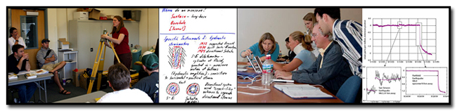
Short Course Materials
Course Materials from previous short courses.
2008 Short Courses
GPS Courses:
-
Using GPS Data to Study Crustal Deformation, Earthquakes, and Volcanism: A Workshop for College Faculty
March 18, 2008: 1:00-5:00pm
Geological Society of America Cordilleran / Rocky Mountain Section Meeting, Las Vegas, NV
-
Processing and Analysis of GPS Data with GAMIT/GLOBK/TRACK
September 23-25, 2008
UNAVCO: Boulder, Colorado
LiDAR Courses:
-
Processing and Analysis of GeoEarthscope and Other Community LiDAR Topography Datasets
April 29 - May 1, 2008
Arizona State University: Tempe, AZ
InSAR Course:
-
InSAR: An introduction to Processing and Applications for Geoscientists
June 16-18, 2008
UNAVCO, Boulder, Colorado
Strainmeter Course:
-
Working with Strainmeter and Tiltmeter Data: A Short Course for New Users
June 10-12, 2008
UNAVCO, Boulder, Colorado
Teacher (Grades 6 - 12), Park Ranger & Museum Interpreter Development Courses:
-
Explore Plate Tectonics Using GPS Data
National Science Teachers Association National Conference
March 27, 2008
Boston, MA
-
Explore Plate Tectonics Using GPS Data
TXESS Revolution workshop
April 4, 2008
Austin, TX
-
Using EarthScope GPS and Seismic Data in National Parks
EarthScope Cascadia Interpretive Workshop, Mount Rainier National Park Education Center
April 7–10, 2008
Tahoma Woods, WA
Earthquakes, volcanoes, and tsunamis reveal the power of Earth’s forces that form the spectacular landscape of the Pacific Northwest. EarthScope is a nationwide effort that applies the latest science and technology to explore the structure and evolution of the North American continent and understand processes that cause earthquakes and volcanic eruptions (www.earthscope.org). Interpretive professionals in the Pacific Northwest have the unique opportunity to engage the public on the relevance of EarthScope discoveries as they are being made. This 3-day workshop will combine presentations by EarthScope scientists with interpretive methods to convey the story of the ongoing deformation of the edge of the North American continent. Participants will learn how to use EarthScope data and science results, and will develop and present actual programs and exhibits during the workshop. The goal is to help interpreters create opportunities for the public to form their own intellectual and emotional connections to the dynamic landscape of the Pacific Northwest.
Course Materials: http://www.earthscope.org/education/interpretative_workshop
-
Explore Central Great Plains Geology and Geophysics through the EarthScope Program
June 12–13, 2008
University of Nebraska
Lincoln, NE
Through an exploration of EarthScope learning activities as they relate to the Central Great Plains geology and geophysics, participants will:
-Be able to describe why EarthScope is investigating the geophysics of the Great Plains, how understanding the past can help us understand the present and future & how present day geologic phenomena can help us understand the past.
-Improve their foundation in geophysics.
-Be able to implement selected EarthScope activities in their classrooms.
-
Teachers on the Leading Edge Workshop
July 27 - August 1, 2008
Portland, OR
-
Explore New Mexico Geology and Geophysics through the EarthScope Program
New Mexico Museum of Natural History and Science
August 5, 9am -4pm
Albequerque, NM
EarthScope is a national, decade-long geoscience program to understand the North American continent. Geophysical instruments will move across the continent, acquiring new information about continental evolution and structure; and laboratories have been set up in regions of special interest, including our own Rio Grande rift. In 2008, instruments will be fully operational throughout New Mexico, allowing us to better understand our state’s volcanoes, mountains, seismic activity, and the development of the rift. This is a great opportunity to learn about new and ongoing geological research that directly relates to New Mexico. This workshop is offered by EarthScope, IRIS, and UNAVCO and hosted by the NMMNHS. Come learn information, activities, and materials that you can use in the classroom!
Level: Limited to teachers of middle through high school Earth science and physical science.
Funding provided by the National Science Foundation. $125 teacher stipend and lunch provided; mileage and one night’s hotel available for non-local participants.
-
Introducing GPS and its Applications in Earth Science to Students and Educators of Puerto Rico
September 27, 2008
Mayagüez, Puerto Rico
Susan C. Eriksson, UNAVCO
Through an exploration of UNAVCO learning activities as they relate to the Caribbean geology and geophysics, participants will be able to:
-Describe why scientists are investigating the geophysics of Puerto Rico and surrounding area, how the geology relates to hazards of the area, and how technology of space geodesy helps us understand the Earth.
-Discuss high-precision GPS and its application to plate tectonics, volcanoes, and earthquakes.
-Interpret GPS time series plots to determine regional plate velocity.
-Access resources to support classroom implementation and be able implement selected UNAVCO activities in your classroom.
-
The Use of GPS, LiDAR, and InSAR Data to Learn about Plate Tectonics, Crustal Deformation, Isostasy, and Ice Flow: A Short Course for Faculty at Two- and Four-Year Institutions
Geological Society of America Annual Meeting
October 4, 2008, 9am - 5pm
Houston, TX
Susan C. Eriksson, UNAVCO; Shelley Olds, UNAVCO
This course is geared toward faculty at two- and four-year colleges who teach earth science or a science course in which plate tectonics is a topic. Participants will be introduced to place-based, data-rich educational materials about GPS and plate tectonics to use in their classrooms, receive an introduction to high-precision GPS, and have the opportunity to discuss pedagogical strategies for classroom implementation. Anticipated topics include slow earthquakes in Cascadia, volcano deformation, isostatic rebound, and ice flow. Applications of new technologies, such as LiDAR and InSAR, will be introduced. Knowledge of GPS is not required.
Last modified: 2019-12-24 01:25:56 America/Denver